↓
 

words and images

🇺🇦✏️✒️📚📔🌜dreamer 🌕 thinker 🌕 aspirant📱📷🚴‍♀️🏕🍄🌻

Menu
  • Home
  • Articles
  • Book Reviews
  • Letters
  • Photography
  • Poems & Stories
  • About Diane Schirf
  • Site Map

Tag Archives: Pennsylvania state park

Octave Chanute: Patron Saint of Flight

words and images Posted on February 22, 2020 by dlschirfMay 2, 2020

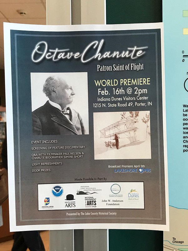
Facebook has many flaws, but it does alert me when events I might be interested in are coming up. A few weeks ago I found out about the world premiere of Octave Chanute: Patron Saint of Flight, at Indiana Dunes Visitor Center. I knew the Chanute name vaguely from the old Air Force base, but I couldn’t have told you then where the base had been located or why it was named Chanute. This sounded like a way to get in a visit to Indiana Dunes, learn something, and spend what might be otherwise a dull winter afternoon, depending on the weather.

The parking lot was unusually crowded, and when J and I walked in about a half hour early, a good-sized group was watching Shifting Sands: On the Path to Sustainability, a documentary on the history of Indiana Dunes and efforts to restore what can be restored. It’s meant to inspire, but it’s also tragic and depressing.

By the time Shifting Sands ended and Octave Chanute was scheduled to begin, the auditorium had filled up, even when extra folding chairs were brought out. Soon it was standing room only.

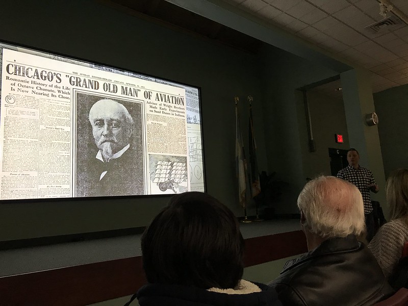
Simine Short, author of Locomotive to Aeromotive: Octave Chanute and the Transportation Revolution, and young director Paul Nelson introduced the film. I mention Nelson’s relative age because the audience was mostly 50 plus, possibly 60 plus, which disappointed me because I would like to see younger people interested in history. Of course, when I was younger none of my peers would have been interested, either.

Octave Chanute: Patron Saint of Flight film premiere at Indiana Dunes Visitor Center
That’s director Paul Nelson dimly seen in the plaid shirt

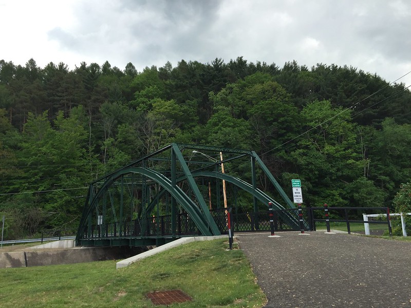
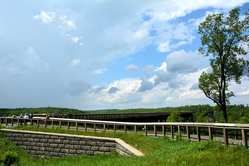
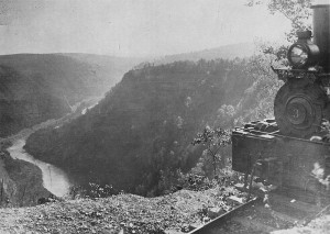
Bridge 16, or the Portage Bridge

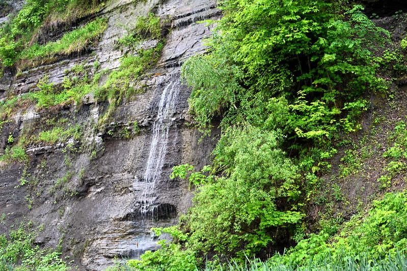
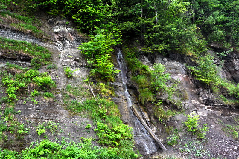
The presentation began with some technical glitches (flashbacks to every high school A/V club everywhere!), but my ears perked up at the mention of the Portage Bridge, accompanied by a photo I recognized immediately. Through this film, I found out Octave Chanute was the engineer behind the much-loved railroad bridge over the Genesee River at Letchworth State Park in New York.

Known for his bridges, Chanute was called in when the original timber trestle, the longest and tallest wooden bridge in the world when it opened in 1852, was reduced to ashes on May 6, 1875, after a train had passed over (spark?). Chanute’s iron replacement opened only 86 days after the fire. According to Short’s book, the piers were rebuilt and the uprights and girders strengthened in 1880, “making the bridge better than new.”

Pgbridge 1864
See page for author / Public domain
The original timber Bridge 16 over the Genesee River
Portage Bridge at Letchworth State Park
Chanute’s iron Portage Bridge over the Genesee River, replaced in 2017 by the Genesee Arch Bridge, at Letchworth State Park
Portage Bridge at Letchworth State Park
Another view of Chanute’s iron bridge over the Genesee River, replaced in 2017 by the Genesee Arch Bridge, at Letchworth State Park

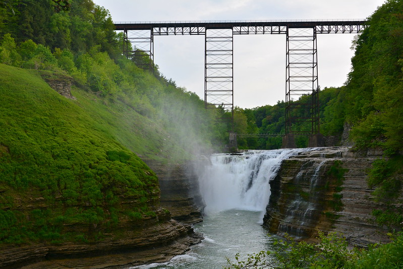
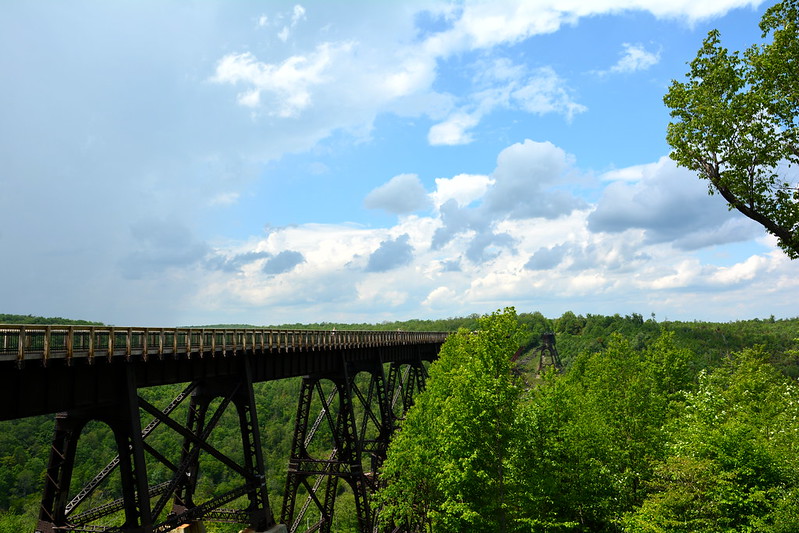
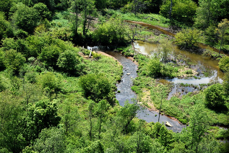
Although modern Norfolk Southern trains were restricted to 10 miles per hour over the Letchworth gorge, Chanute’s bridge lasted until 2017, when the Genesee Arch Bridge opened. The state of New York declined the offer of the 1875 bridge, the last of which was demolished on March 20, 2018. I’d been fortunate to visit the old bridge one last time in 2015. When I’d found out about the premiere of this film, I’d had no idea it would take me back to perhaps the most iconic of my childhood memories. I remember walking along those tracks with my brother during one of his visits.

But wait! There’s more!
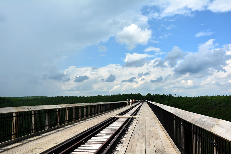
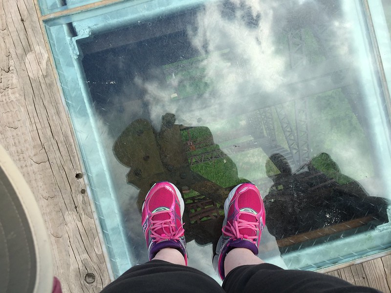
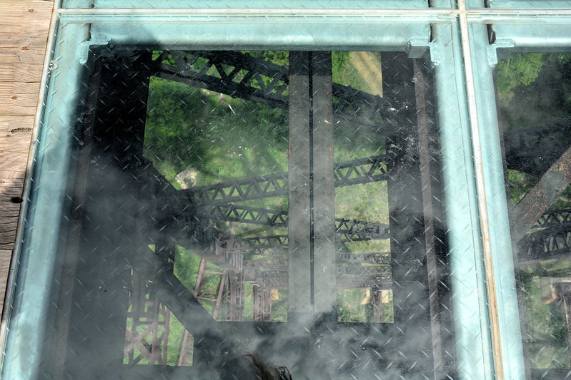
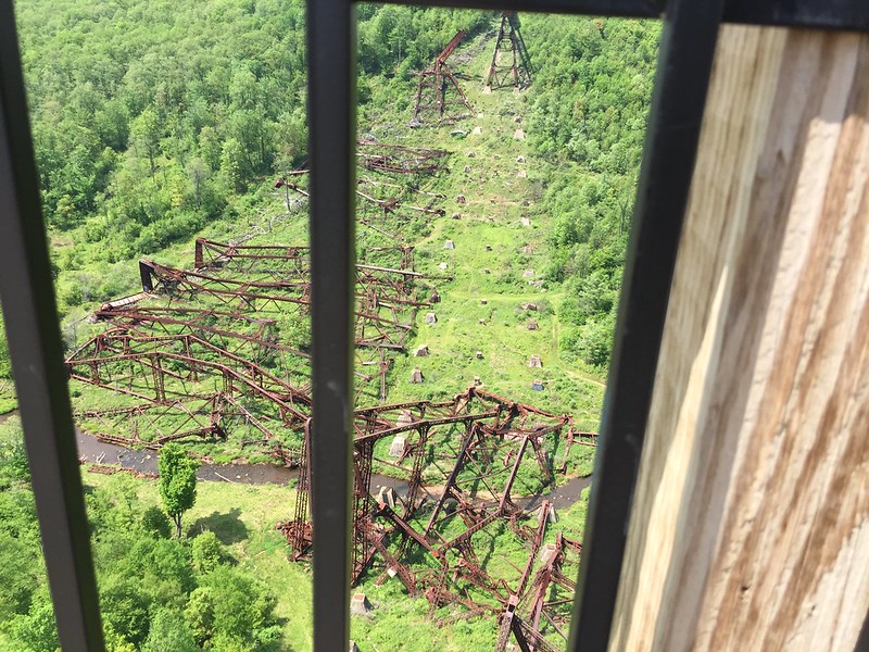
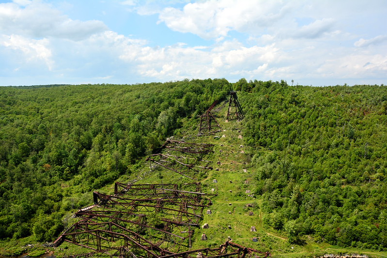
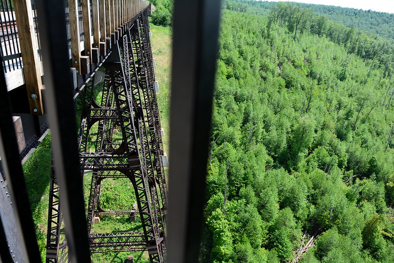
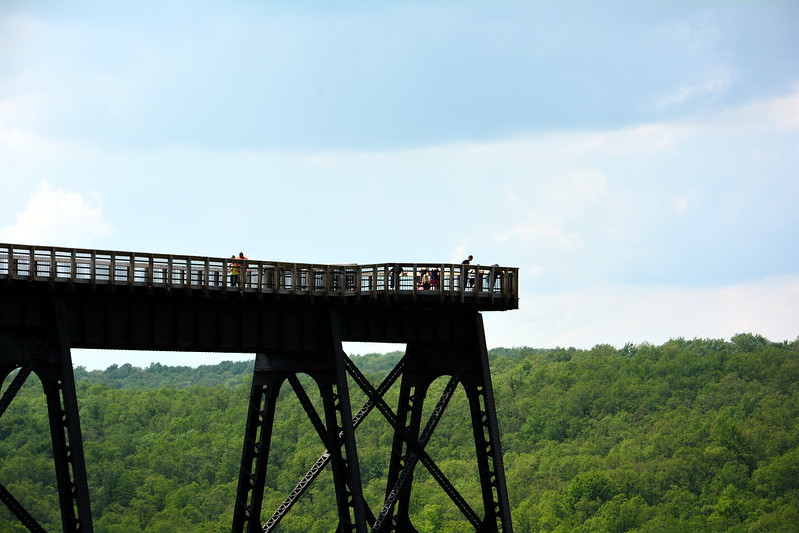
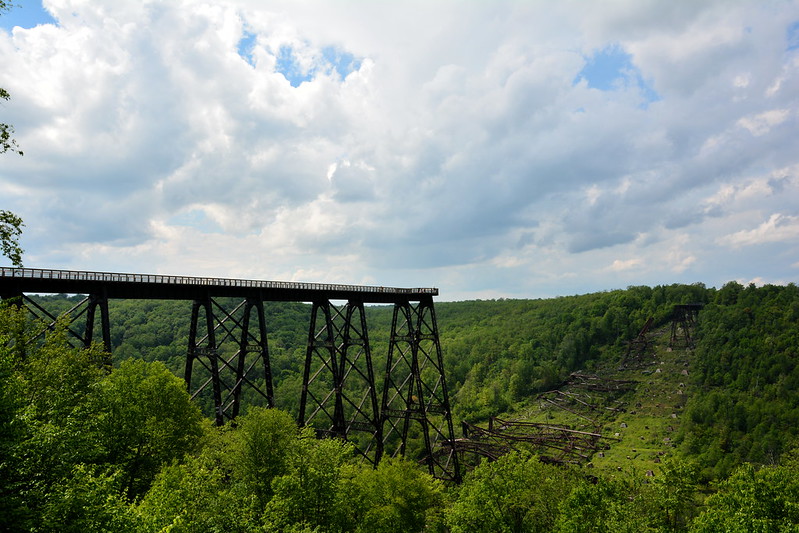
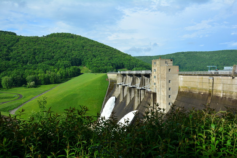
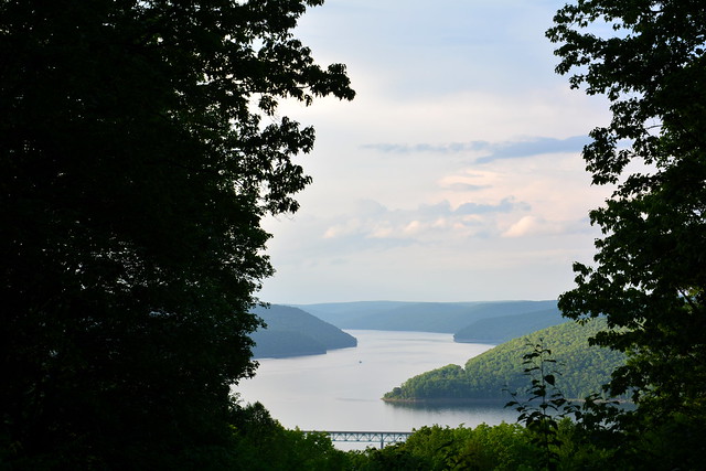
Kinzua Bridge

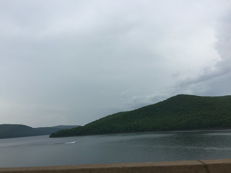
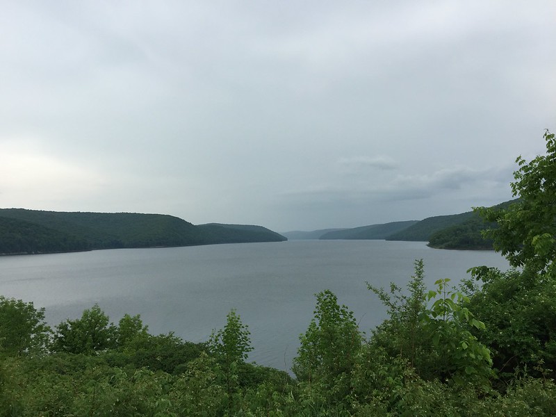
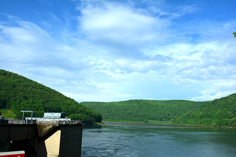
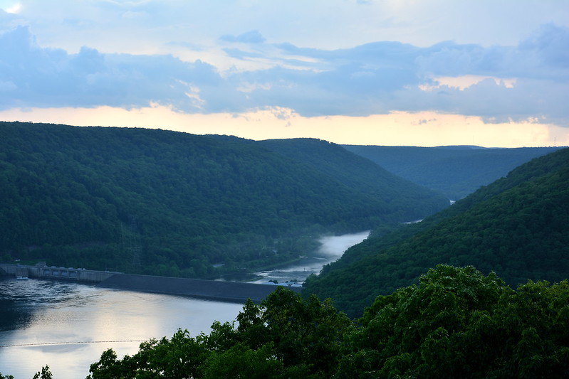
My ears perked up again at the mention of Kinzua Bridge. I’d found out about Kinzua Bridge State Park when I was looking up Kinzua Dam, another place I’d visited as a child, for my 2015 swing through Ohio, New York, and Pennsylvania.

It turns out that Octave Chanute was behind the original 2,000-foot-long Kinzua Bridge (or Viaduct), built in 1882 at 302 feet above the narrow valley floor. Short calls it Chanute’s “most spectacular bridge.” She adds that the bridge was rebuilt in 1900 “to keep up with the increasing volume and weight of the coal traffic.” Carl W. Buchholz redesigned the superstructure on the original masonry foundation piers.

By 1959 the viaduct failed safety inspections and was closed to commercial rail traffic. Restoration began in 2002, but in 2003 an F2 tornado “tore eleven towers from their concrete bases. Investigators found that the anchor bolts, installed under Chanute’s supervision, had rusted over the past 120 years.” Over time, the materials had failed the design.

After seeing this film, I’m even happier that I had the opportunity to walk out on what’s still standing of Kinzua Bridge and get a look at the remnants resting in peace on the valley floor. Even destroyed, Kinzua Bridge is indeed a “spectacular” sight.

Kinzua Bridge State Park
Remnants of the rebuilt and now repurposed Kinzua Bridge near Mount Jewett, Pennsylvania
Kinzua Bridge State Park
Kinzua Bridge Skywalk with visitors
Kinzua Bridge State Park
Railroad tracks on Kinzua Bridge
Kinzua Bridge State Park
View down from Kinzua Bridge

Why Indiana Dunes?

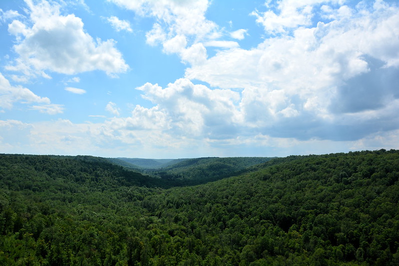
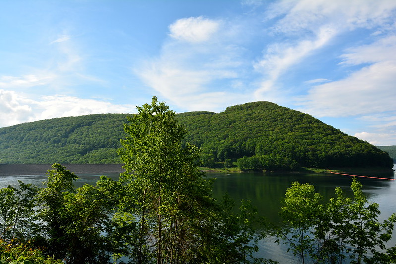
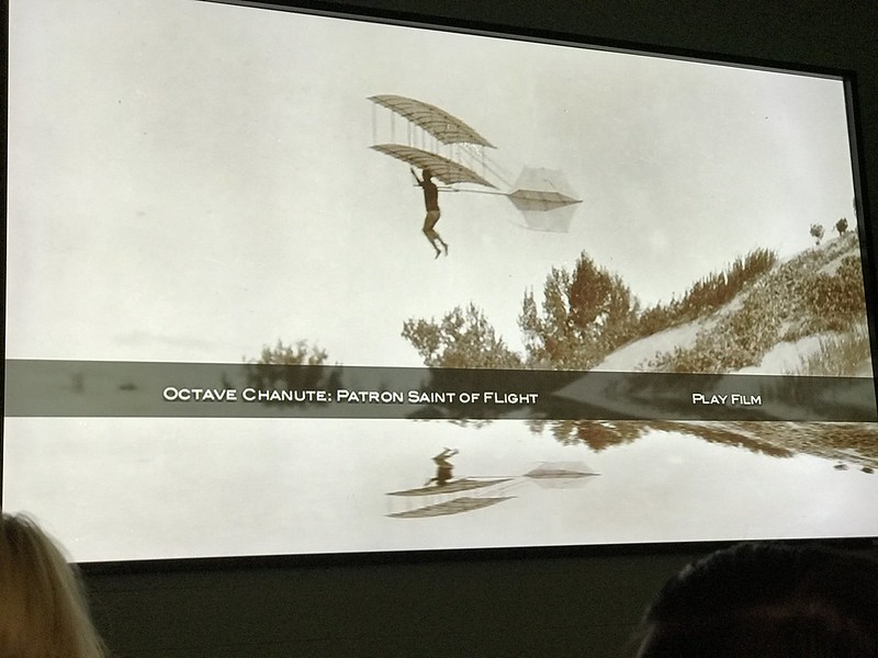
Of course, most of the film was about Chanute’s contributions to flight and relationship with Wilbur Wright (rocky; Chanute was an open source kind of man and Wilbur believed in closely held information). What’s the link to Indiana Dunes? With their lake winds, elevations, and soft sand, the Dunes were Chanute’s choice for safely testing their experiments — the Kitty Hawk of the Midwest.

Epilogue, March 8, 2020

Octave Grill in Chesterton is named for Octave Chanute. Found out they serve a Chanute burger.

Chanute burger at Octave Grill in Chesterton, Indiana
Chanute burger at Octave Grill in Chesterton
Posted in Blog, Film | Tagged film, friend, Indiana state park, Letchworth, National Park Service, New York state park, Pennsylvania state park, photo | 1 Reply

Pennsylvania: Wellsboro, Pine Creek Gorge (Leonard Harrison and Colton Point State Parks)

words and images Posted on September 3, 2019 by dlschirfJuly 28, 2020
September 3

When I visited Pine Creek Gorge (Pennsylvania’s Grand Canyon) in 2015, I hadn’t expected to return. My cousin and his wife suggested a trip there, so off we went. A stop in Wellsboro for lunch was my idea. After visiting Wellsboro in 2015, I’d read it’s one of Pennsylvania’s most picturesque towns. Soon after that, I’d heard about the Wellsboro Diner, which looks like an old rail car but likely isn’t. I never thought I’d be able to go there and am grateful for the chance to put away a grilled cheese and a side of cottage cheese. (I’m strange.)

Wellsboro Diner
Wellsboro Diner
Wellsboro Diner

Wellsboro itself seemed busy, perhaps due to a lot of road construction. I think it’s best approached from the west, where it seems like a surprise after miles of hills and countryside.

I remembered a red church on the way to Leonard Harrison State Park and asked to stop there again. A room, still in progress it appears, had been added to the back since 2015. This church is so distinctive the state park gift shop sells postcards of it. From the back of one of them:

Before entering Leonard Harrison State Park at the PA Grand Canyon, one will pass The Little Red Church. This landmark was buil in 1897, and donns [sic] eight beautiful stained glass windows. Because bricks were expensive, it was built of basswood siding with dado cuts to resemble brick. Electricity was installed in 1954.

Middle Ridge United Methodist Church

Our next stop was Leonard Harrison State Park with its visitor center and gorge overlooks. No spring flowers this time, but the views of the now second-growth forest that’s covered the scars of 19th- and 20th-century clear-cutting are inspiring. If I lived in the area and were more mobile, I’d take the trail down past waterfalls and other wonders. (And, of course, have to take it back up.)

Pine Creek Gorge from Leonard Harrison State Park

As we headed out, we passed a statue I didn’t remember from 2015 — a tribute to Civilian Conservation Corps workers. It appears the CCC was active all over the Alleghenies of Pennsylvania, replanting Pine Creek Gorge and building the facilities at our next destination, Colton Point State Park on the western rim.

Tioga County "C C C Worker" 1933 – 1942

I had not gone to Colton Point in 2015. It’s described as more “rustic” or “primitive” than Leonard Harrison — take your pick. Not surprisingly the road up to Colton Point is twisty with steep drop-offs. At the top it turned into a choice of more “rustic” roads. We looked for an overlook and found a couple of places where you could see a little through the trees. We found only one parking area nearby, and someone had managed to crowd both spaces.

We noticed the same rocky wall we’d seen from Leonard Harrison. I read later that when the trees are bare Pine Creek Gorge sports more of a western canyon look.

When we got back to the main road/entrance, we saw what I had half noticed before — a small parking lot. Across from the parking lot? A fancy overlook with a view rivaling those from Leonard Harrison across the way.

As we stood in the circular overlook, which reminded me of Letchworth State Park in New York minus the waterfall, a parade of heavy construction vehicles headed past us uphill — strange, we thought, since it was now late afternoon. We tried to imagine them navigating the narrow “rustic” roads through the trees at the top. I wondered why they were there. Rustic road repair?

Tourist
Pine Creek Gorge from Colton Point State Park
Posted in Adventure, Blog | Tagged Pennsylvania, Pennsylvania state park, photo, state park, travel | 3 Replies

Pennsylvania: Logan Valley Cemetery, Sinking Valley, Whipple Dam State Park

words and images Posted on September 2, 2019 by dlschirfApril 5, 2020
September 2

We visited my parents’ graves at Logan Valley Cemetery, located across from the high school. A cousin I haven’t seen in decades had left flowers at my dad’s grave. His flag holder for veterans still has a metal medallion. The newer medallions are plastic thanks to theft. Once upon a time I was young enough to find it shocking someone would steal the flag holder from a veteran’s grave.

Dad's marker

In Sinking Valley, this little mare and her young’un attract customers to Hilltop Farm. There’s also a wee donkey.

Wee ponies and donkey

On to Whipple Dam State Park, which was new to me. It’s yet another part of our legacy from the Civilian Conservation Corps. As it was Labor Day and central Pennsylvania isn’t rich with beaches, a college-age crowd had gathered at Whipple Dam’s postage stamp of sand to play volleyball and stand in the relatively shallow water. Despite the crowd, the surrounding woods gave the lake and beach an isolated feeling that reminded me of Pewit’s Nest in Wisconsin.

Whipple Dam State Park
Autumn meadowhawk
Whipple Dam State Park

We’d passed the road to Shaver Creek Environmental Center and stopped on the way back. The buildings were closed for the holiday, so we relaxed on the deck’s Adirondack chairs. I kept hoping to hear a creek.

On the way to the park, V. spotted a plant she thought might be teaberry (ICE CREAM!). According to the folks of iNaturalist, it’s partridgeberry. Pretty, but perhaps not as weirdly tasty as teaberry. If you can’t get teaberry ice cream, try Clark’s teaberry gum. You won’t thank me, I think. It’s an acquired taste, associated with childhood 50 years ago.

Partridgeberry
Posted in Adventure, Blog | Tagged family, insect, Pennsylvania, Pennsylvania state park, photo, state park, travel, wildlife | Leave a reply

Presque Isle State Park in Erie, Pennsylvania

words and images Posted on May 31, 2015 by dlschirfMay 2, 2020
May 31, 2015
Erie, Pennsylvania
Erie, Pennsylvania
3 photos

After a comfortably warm and mostly sunny week, the weather had taken a turn for the chilly. With a little more time available in Erie, we fueled up at Tim Horton’s, then visited the Tom Ridge Environmental Center, where we got lighthouse and park stamps plus goodies from the gift shop.

Next we drove farther out onto the Presque Isle State Park Peninsula, far enough to get to the beach with the Presque Isle light. J. made it to the light, but after crossing the in what felt like gale-force winds and having sand driven into my mouth and pebbles into my bare calves, I decided I could live with a slightly more distant view of the light.

By the time we tore ourselves from Presque Isle, it was time to make tracks if we wanted to get to Maumee, Ohio, at a reasonable hour. There wasn’t enough time for a detour to Cuyahoga Valley National Park. I wasn’t too disappointed given the gloomy, wet, windy weather, which softened the pain of returning from a wonderful trip just a teeny bit.

Posted in Adventure, Blog | Tagged friend, lighthouse, Pennsylvania state park, photo, state park | Leave a reply

Last call for the Pennsylvania Wilds

words and images Posted on May 30, 2015 by dlschirfMay 2, 2020
May 30, 2015

At breakfast, J met Joe Hurley, who wrote Ten Million Steps: A fresh look at America and Americans from Cape Cod to California on Route 6, and walked away with autographed copies. He knows how to travel. Afterward, we said a long goodbye to the hens, who didn’t care that we were sad to leave and that vacation was almost over.

Frosty Hollow
Frosty Hollow

We stopped in Coudersport at Sheetz for fuel (gas and coffee and Mallo Cups) and discovered Old Hickory, a building in a state of decay that would put Miss Havisham to shame. Eliot Ness is said to have visited the inn — I wonder why?

Old Hickory in Coudersport, Pennsylvania
Untitled
Untitled

After passing through Port Allegheny and Smethport (“Home of Wooly Willy”), we came to Mount Jewett and the road to Kinzua Bridge State Park. On the way the eagle-eyed driver spotted a sign for “Maple Syrup 500 Ft.” Determined to get maple syrup somewhere on this trip, we stopped, parked, and rang the bell. The back door was unlocked, and several windows were open, despite a threatening sky. We rang again — no answer. A half mile back, a pedestrian had tried to flag us down, so I could only speculate that he was a stranger who’d killed the family and was trying to get away (although in the direction of the park, where the road ends), but when the police came the neighbors would remember only us and how the car had been parked for a while as we knocked and peered in the back shop. It was a mystery. I’ve read too many true crime stories.

Untitled
Wooly Willy
Untitled

At last we arrived at the park, where a visitor center with park offices is under construction. For being a little out of the way, the park seems popular. Out on the skywalk, one man told us he’d brought his wife in preparation for an upcoming trip to the Grand Canyon. She couldn’t quite handle 300 feet down, however, let alone thousands.

I asked a man familiar with the area about the F1 tornado that had taken out half the bridge. Tornado watches and warnings are a weekly, even daily occurrence in the Midwest, but not in western New York or Pennsylvania. He said a tornado will arise now and then, but its path usually zigzags and its duration is usually short. The mountains and irregularity of the surface probably inhibits a tornado’s ability to build a full head of steam. The 2003 tornado, however, was strong enough to take down half the (compromised) bridge. It’s a lovely area, and there are trails down the slope for those with more time.

DSC_9428_AL
Kinzua Bridge State Park
DSC_9430_AL
Kinzua Bridge State Park
DSC_9431_AL
Kinzua Bridge State Park
DSC_9434_AL
Kinzua Bridge State Park
Untitled
Kinzua Bridge State Park
DSC_9440_AL
Kinzua Bridge State Park
Untitled
Kinzua Bridge State Park
DSC_9444_AL
Kinzua Bridge State Park
DSC_9451_AL
Kinzua Bridge State Park
DSC_9453_AL
Kinzua Bridge State Park
DSC_9457_AL
Kinzua Bridge State Park
DSC_9469_AL
Kinzua Bridge State Park
DSC_9470_AL
Kinzua Bridge State Park

On the return, we stopped again at the place with maple syrup. To my relief, the people were home (unless, of course, they were murderers covering for their crime — how would strangers like us know?). The mundane explanation was they’d gone to a ball game and forgotten to turn off the “Open” light and shut up the place properly. That was their story, which must be true as I haven’t seen any gruesome stories from Mount Jewett in the news.

Rain came, and when we arrived at the Kinzua Dam area, a mist hovered over the water in places even as the skies repeatedly tried to clear up. I’d been to Kinzua Dam at least once with my parents — long before it became part of the “Pennsylvania Wilds” — but I don’t know how many times. The dam was relatively new then, controversial because it flooded treaty land. On this day it seemed familiar-but-not-quite. I’d been here before, but not often or long enough for it to seep into my being’s core memory. I was left with an impression, not a picture.

Untitled
Kinzua Dam area
Untitled
Kinzua Dam area
Untitled
Kinzua Dam area

While the dam and the water are impressive, I was more fascinated by the numerous ribbon waterfalls running down the bluff through which the road had been cut, the water seeming to disappear at the base. If my dad had been there, he might have tried to collect water from them in a plastic jug for the rest of the trip, although in the 1970s signs had popped up near many of Pennsylvania’s roadside springs warning of contamination from coal mining activities. Back then this disappointed me, and I wondered why post warning signs instead of cleaning up the pollution. Young and naive then, I still question that approach. I wonder if any of the springs we used to pass are viable today.

DSC_9488_AL
Ribbon waterfalls
DSC_9493_AL
Ribbon waterfalls
DSC_9512_AL
Kinzua Dam
DSC_9519_AL
Kinzua Dam
DSC_9521_AL
Kinzua Dam area

Next we found, almost by accident, the easy-to-miss parking lot for Bent Run Falls. The trail, steep and uneven, was muddy and slippery after the rainfall. The early part is overgrown, so I was able to get only glimpses of the water flowing along. I couldn’t get very far, and J. didn’t want to leave me behind so he didn’t get much farther. I’ve seen photos of the falls from a few different vantage points that looked lovely, but I’ve no idea where you have to go to see them from that perspective.

DSC_9527_AL
Near Bent Run Falls

Our next stop was Jakes Rocks (no possessive apostrophe), where at a few places along the road you can get great views overlooking the lake. As is typical. when I spotted a colorful millipede sauntering around the parking area, I spent half my time stalking it, trying to take a closeup. Undaunted, it never slowed down enough for me to get a crisp photo within the frame. I resisted picking it up.

DSC_9563_AL
Kinzua Dam area
DSC_9566_AL
Kinzua Dam area
DSC_9580_AL
Colorful millipede
Untitled
Jakes Rocks
Untitled
DSC_9596_AL
Farewell to Kinzua Dam . . .

Reluctantly we left and headed toward Warren, where we hoped to find a restaurant. When we got there, nearly all of the local places were closed or closing, except for one bar that didn’t look popular, so we settled for Perkins.

Warren, Pennsylvania

Given the time of day and where we were, we decided to stay in Erie. By now it was getting dark and threatening, then it rained hard enough to make seeing much difficult. Just as it seemed the conditions couldn’t be any worse, J. swerved slightly, just enough to miss hitting a deer that had leapt at us from out of the streaming darkness, perhaps trying to join his five or six deer brothers we’d seen earlier on the road, dead.

After we had dodged the deer — barely — I made the mistake of saying that I didn’t think conditions could be any worse. Almost on cue, the hail started. To me it now seems that any trip home must be attended by bad, even dangerous weather. After the rain, the deer, and the hail, and the accompanying adrenaline rushes, finally we made it to Springhill Suites in Erie in one exhausted, shaking piece.

Posted in Adventure, Blog, Photography | Tagged National Forest, Pennsylvania, Pennsylvania state park, photo, state park | 2 Replies

Day 2 in the Pennsylvania Wilds, or elk country

words and images Posted on May 29, 2015 by dlschirfMay 2, 2020
May 29, 2015
Pennsylvania wapiti, or elusive elk in Benezette
22 photos
DSC_9415_AL
DSC_9417_AL
Beach at Lyman Run State Park
Smokey is looking droopy here
DSC_9423_AL
DSC_9426_AL Elk overlook
Elk overlook
Those cream-colored rumps belong to some wapiti
Fixer-upper
Love creeks

Because we’d been to Cherry Springs, we had to get our state parks books stamped. At the park, though, the ranger told J. we’d have to go to Lyman’s Run State Park a few miles away for the Cherry Springs stamp. Getting there involved a narrow, winding road around mountains, constrained on one side by a guard rail unprotected by more than a couple of inches of shoulder — J’s favorite kind of driving conditions. Just as we found Lyman’s Run, a deer crossed the road well ahead of us, then, to our surprise, a fawn on spindly legs appeared and stood in the road, confused for a few moments before wandering off in Mom’s direction.

At the Lyman’s Run office, we told the ranger about the deer. A few moments later, she asked where exactly we’d seen them — a couple desperate to see deer had just come in.

At a beach below the nearby dam, a family or two was splashing about in the water. I always hope that when these children grow up they will want their own children to enjoy the same kinds of outdoor experiences they had.

At breakfast someone had told of seeing elk in Benezette and of a motorcyclist who’d feared for his bike’s life when a big bull elk eyed it. Benezette had been a possible destination, but now it became a must-see. I’d never gone there from the north, and we found ourselves on the narrow, twisting road to Galeton, then on more narrow, twisting roads post what seemed to be a lot of state parks and recreation areas. We had to hustle to get to the Elk Country Visitor Center before it closed at 5 — we just made it, at about 4:40 or so. I was surprised I found it as easily as I did.

We hadn’t seen any elk in town or near the visitor center, so I steered him toward the overlook where the bull elk had looked upon the motorcycle. Nothing. Seating had been added, and a man sitting there told us he’d seen some animals earlier, so we sat down to wait patiently.

Within about 10 minutes a female showed up at the edge of the woods and tucked into the field vegetation. Soon she was joined by a second and then a third, who also seemed to materialize from nothing. None of them strayed far from the wood’s edge.

We’d seen elk, if only a small number, if only at a distance. J proclaimed himself content.

We returrned to Benezette, driving around for a bit and spotting the top of a deer’s head among the high grasses along the river. Even the picnic area, jammed with elk during my December visits, was populated only by a few people and vehicles.

After eating at the Benezette Hotel (where J got an elk burger to go), we called it a day, knowing we had a long way to go. On the road out of town, however, elk began popping up in front yards, including three bulls in velvet. By now the residents of Benezette and beyond must have given up on any kind of garden or landscaping and let the elk have at their yards.

We stopped at length in front of several houses, sometimes in awkward spots ahead of road curves. I worried about being rear-ended, but the few times we saw cars, they slowed down and stopped too. The elk are hard to resist.

On the way back we noticed several popular fishing spots and some vintage bridges. Oh, to have a creek nearby to visit every day . . . preferably an uncontaminated one. In Pennsylvania, you never know.

For the last leg of this day trip, Google Maps helpfully steered me toward a long gravel road overrun by creatures that, in the growing darkness, could have been toads or chipmunks or something else — they scooted across so fast it was hard to tell. After two to three miles we came to the main road to Frosty Hollow, where a sign invites you to detour four miles up the gravel road (the way we’d come) to Jackson’s Bargain Barn & Gift Shop (open Thurs., Fri., and Sat.). When we’d passed the sign earlier, J had pointed it out and wondered if anyone (like us) would ever choose to go up that road. Ooops. Thank you, Google Maps (and for trying to take us down a footpath at Chestnut Ridge Park). We got back as rain began — no need to debate a return to Cherry Springs. Sitting on the barn porch, watching the rain come down, ended the day in the country perfectly.

Posted in Adventure, Blog | Tagged elk, friend, Pennsylvania, Pennsylvania state park, photo, wildlife | Leave a reply

Pine Creek Gorge, or the Grand Canyon of Pennsylvania

words and images Posted on May 28, 2015 by dlschirfMay 2, 2020
May 28, 2015
Pine Creek Gorge, Cherry Springs State Park
16 photos
DSC_9332_AL
DSC_9334_AL
DSC_9337_AL
DSC_9351_AL
DSC_9360_AL
DSC_9378_AL
DSC_9384_AL
DSC_9390_AL
DSC_9392_AL
DSC_9394_AL
DSC_9396_AL

After breakfast in the barn, we turned toward Pine Creek Gorge at Leonard Harrison State Park (the eastern overlook). Before we could get there, however, J. had to stop at an unexpected Harley-Davidson dealership in Galeton (Larry’s) for t-shirt gifts. After looking around for a bit, I returned to the car and watched two older men lust after a bike parked a few spots down. The owner appeared and shared the specs and some of his adventures on it (I heard “Tennessee” among others). The one man never stopped moving around the bike, drinking in its details like he couldn’t stop. To me it seemed unremarkable, but he looked like an art collector sizing up a reputed da Vinci.

The drive along country roads always seems longer than expected, especially when their condition isn’t great and there’s the ever-present threat of deer and/or trucks. We made it, however, and found a long, deep, curving gorge, the “Grand Canyon of Pennsylvania,” the green of the forest nearly unbroken except for the creek.

Deforested Pine Creek Gorge (from Wikipedia)

Pine Creek Gorge wasn’t always so verdant. After we took many photos and J. wandered a short way on a trail down (I wasn’t up to it), we watched a video at the visitor center that showed the voracious cutting of the gorge’s old-growth white pine and eastern hemlock. Where men of the time saw money and profits, I saw only destruction and devastation. First the white pine was cut, then the eastern hemlock, then the hardwoods. Clear cutting replaced selective harvesting, leaving denuded hills behind. My heart broke to see the “Grand Canyon” reduced to the “Pennsylvania Desert.” Did no one foresee the result of clear cutting, or care?

Today, thanks partly to the efforts of the Civilian Conservation Corps, second-growth forest covers the gorge, and wildlife has returned. This north central part of the state, including Allegheny National Forest, has been branded the “Pennsylvania Wilds,” which attracts outdoorsy tourists such as hikers, cyclists, fishers, skiers and snowboarders. The men who profited from destroying the forest are long dead, their best legacy a reminder of the foolishness of benefiting in the short term at the expense of the future. I hope the Wilds can be sustainable as a tourist attraction because there are so few places like it left.

We picked up a couple of Pennsylvania State Parks and State Forests Passports, the state’s answer to the National Park Service’s stamp book program. You don’t have to be a kid to get a kick out of filling your book with stamps!

On the way back we stopped at an unusual church (United Methodist Congregation) and took photos. Later we realized it was featured on postcards we’d bought.

We visited Wellsboro, which is an impressive old town with impressive old houses lining the streets, and stopped at Peggy’s Candies and Gifts for Hershey’s ice cream. If you’re thinking of the Hershey Company (1894), you’d be as wrong as I was. Hershey’s ice cream (also 1894) is a different company with a different history. I thought there have to be trademark attorneys itching to tackle that, and I wasn’t wrong.

The weather looked better than I expected for the visit to Cherry Springs State Park — the long-term prediction had been for clouds and rain. We left around 8:45 p.m. so we’d have some light to see on the unfamiliar roads with their ubiquitous deer. When we arrived at the parking lot, a man ensconced in his car pointed us toward a nearby field with some picnic tables for regular folks.

For a long time we weren’t sure we were in the right place, probably because no one else appeared. We wandered over to the astronomers’ field, but there was no one there, either, and J. agreed we probably weren’t supposed to be there (it’s set up for professionals and amateurs with telescopes and has better restrooms).

The reason there were only a few people, mostly near the parking lot and usually for a short time, wasn’t the weather — it was surprisingly good. It was the moon. The bright, bright quarter moon.

The first few years of my life were spent near a pretty dark field (by Chicago standards), but I had forgotten how painfully bright even a quarter moon is. We could see a lot more stars than anywhere else, but the moon’s reflected glare obliterated most of the less brilliant stars, leaving some familiar planets and constellations in view. It was quiet, peaceful, and comforting to see the night sky in a way I haven’t been able to for decades. Many Americans have never experienced the magic of the night sky the way our ancestors did, and that is awful and sad.

J. took some photos, and we stayed until about 1 a.m. (If only we could have held out until 3:30 or so, the moon was due to set, although then the light from the dawning sun would have followed soon after.)

Before we left, J. said, “What’s that?” and in the cold moonlight I saw what looked like a weasel shuffling among the uncut grasses. I shone the red flashlight on it and discovered I wasn’t far off — it was a skunk, a member of the mustelid family. It seemed unconcerned, so I got closer than I should have, given a skunk can spray up to 10 feet accurately. I didn’t see any warning signs, and when it wandered off I didn’t follow. It’s not often I get to see a skunk that’s not flat and covered in gore.

Again I was relieved to get back to base without hitting Bambi, his mother, or any of his millions of relatives.

Posted in Adventure, Blog | Tagged friend, Pennsylvania, Pennsylvania state park, photo, state park | Leave a reply

Recent Posts

  • Future of artificial limbs (prosthetics)
  • Hodge, 2001 – 2013 (cat)
  • “Far more happier” (The Age of Wonder by Richard Holmes)
  • Pileated woodpecker pair at Sapsucker Woods
  • Eternal flame waterfall at Chestnut Ridge

Top Posts & Pages

  • Top 10 reasons Commander Riker walks with his head tilted
  • Book review: Zitkala-Sa: American Indian Stories, Legends, and Other Writings
  • Memories of South Shore Plaza, Hamburg, New York
  • Wopsononock Mountain, or Wopsy, in Blair County, Pennsylvania
  • Book review: Women in Love
  • Relics: The newsstand
  • Book review: Henry and June
  • Book Reviews
  • Sunset from Coffee Creek Park in Chesterton, Indiana
  • Horseshoe Curve National Historic Site, Tytoona Natural Area Cave Preserve

Archives

Other realms

  • BookCrossing
  • Facebook
  • Goodreads
  • Instagram
  • LibraryThing
  • Twitter
  • YouTube

Good viewing

  • Art of John Taft
  • bensozia
  • Bill of the Birds (no longer updated)
  • BrontëBlog
  • Edge
  • Karen Winters Fine Art
  • Mental Floss
  • Musical Assumptions
  • National Geographic News
  • Orange Crate Art
  • Sexy Archaeology
  • The Creative Journey
  • The Introvert's Corner
  • The Pen Addict
  • The Raucous Royals
  • Thrilling Days of Yesteryear
  • Woodclinched
  • World-O-Crap

BOINC Stats

Copyright © 1996–2023 Diane Schirf. Photographs and writing mine unless noted.
↑
 

Loading Comments...