Kankakee River State Park
22 May 2010
As I took Metra to Homewood and walked to Blueberry Hill Pancake House to meet J, I started to get the idea the day might prove to be steamy. It was overcast and looked like rain, but the forecast was for afternoon sun. And a temperature of 89 degrees F.
When he arrived, we ate half a breakfast of champions, boxed the rest, then went to pick up something he thought he’d forgotten but was actually in his trunk. On the way, we stopped at Heritage Health to pick up something for a little picnic. After fueling at Caribou (something iced for me — already steamed), finally we left for Kankakee River State Park.
Past Frankfort on Illinois Rte. 45, the vista opens up onto farmland that in some inexplicable way is more attractive than much of that further downstate. Perhaps it’s the use of tree lines and fences, or the nature of the houses, although the land itself is just as flat and monotonous. We passed a traditional white frame church set close to the road, a small cemetery beside it. It was like seeing something from another era, perhaps that of Laura Ingalls Wilder, tangible yet not quite real.
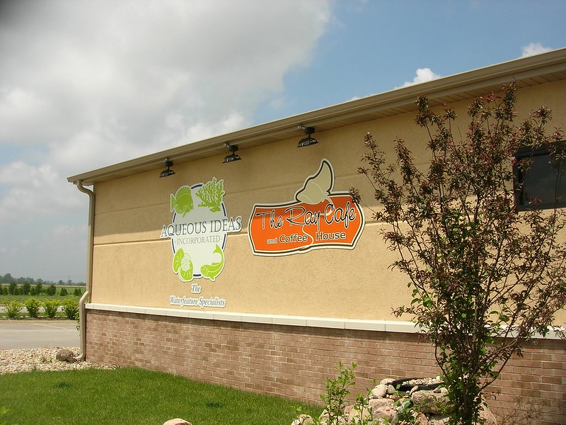
Further on, a sign led us down a side road, where a building that looked new — dirt was still piled up in front — was divided into a café and an aquarium store. The combination would have seemed odd anywhere, and, in an area where the main retail venues seem to be gas stations (something has to power all those John Deeres), I wouldn’t have thought of a burning need for either a café or an aquarium store. Alas, neither was open yet — perhaps they’re still in the throes of getting started. Too bad; the café looked like a potential gem.
Closer to Kankakee, we made another detour, this time to Office Max to replace the car charger I’d bought for the iPhone. At this plaza, two of the biggest stores, including a Petco, had pulled out, leaving behind only the marks of their old signs. The parking lot was mostly empty, with only a handful of cars in front of Office Max. The three male employees seemed happy to talk to anyone. Noting my Midewin National Tallgrass Prairie shirt, one asked me if I’m a conservationist. We talked a little about the Gulf oil disaster, and I left him with something new to research — dead zones. It was a well-stocked, bright store, but the empty storefronts and parking lot reminded me of South Shore Plaza less than 20 years after it had opened to great fanfare. I wonder if this place has been hit especially hard by the recession, if something bigger and better had come along nearby, or if it had been in trouble already for other reasons. And if it will make a comeback, or if it’s turned the corner on the road to nowhere.
I wonder how the café and aquarium store will fare.
Driving around this area is interesting, especially as you cross the river. Just as Wauconda made me think every small town should have a feature like Bangs Lake, this area made me think how fun it would be to live near a river — a clean, wide river with banks that aren’t shored up by concrete, where the current is fast and free.
The Chicago River does not count.
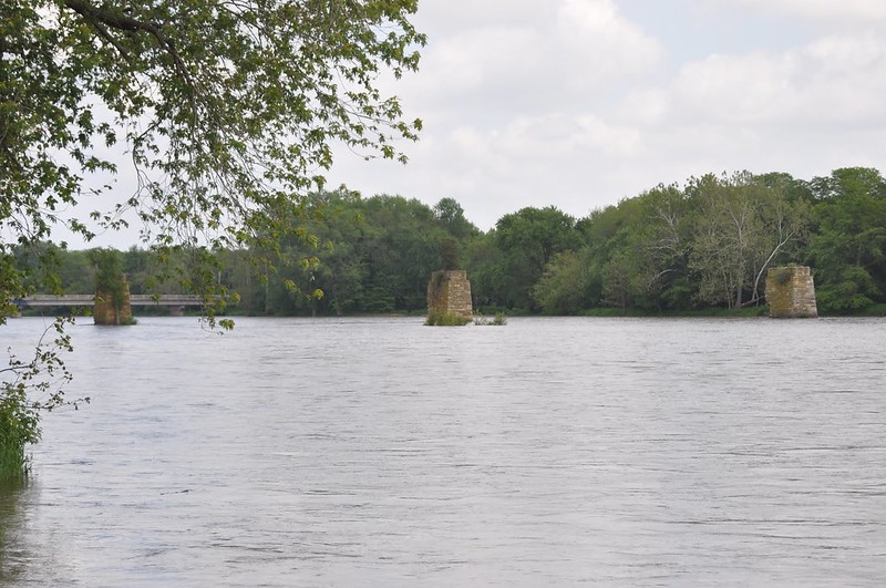
Kankakee River State Park is long, with many designated hunting and fishing spots. As we crossed a bridge over the river, we spotted stone supports for another bridge in the stream — but no span across them them, only some trees of respectable size atop them, rooted in the rock piles. A world without people indeed. We drove into the fishing area on the other side to get some photos. Walking along the water’s edge, we could see why swimming in the Kankakee is not allowed — the current is swift. Even a great swimmer wouldn’t want to be caught in it, plus there are other hazards, like undertows. Its fast flow fascinated me, so unlike that of most of the small rivers around here, the Chicago, the Des Plaines, the DuPage. I thought I may have overheard someone say that the Kankakee was at or close to flood stage, but I was doubtful. Still, it flowed, carrying a log rapidly, relentlessly in its current. Will that log ever touch land again, or will it spill out into the Gulf, along with millions of gallons of oil?
We drove to the visitor center, where live animals (turtles, fish, snakes) and stuffed (mostly birds) help to educate people. One beautiful heron, a sign explains, met its fate when it became entangled in fishing line. What a horrible way to go. Leave only footprints, take only memories (or photos).
We crossed to the other side, where a bridal party was having photos taken. We walked out onto an observation deck, then over a wooden bridge and partway down a trail. In our wanderings we found Smith Cemetery, full of eroded limestone markers from the mid-1800s, many of them for children. One marked the grave of 10-month-old twins, Gay and Jay, who died 10 days apart. The heartbreak . . . someone had filled around the flat stones in the ground with cement, I suppose to protect them, although they are still at the mercy of the elements. I couldn’t help but cringe when a little girl walked on the stones with their worn and increasingly illegible writing. Soon Gay and Jay will be unnoticed by visitors, although the stone marked only with LOVEABLE remains sharp for now.
As we came close to the picnic area, J. suggested we eat before seeking the trail to the waterfall. By now, it was about 4 o’clock, so this seemed like a good idea. I retrieved the bag from the back of the car only to discover that it was coated with oil. Not long before when I had checked, everything had been find, but while we were walking and the car had been parked in full sun, the plastic container with the salad, humus, and pita had warped open, spilling olive oil into the bag. Nothing was beyond salvaging, but what a mess — not quite the relaxed picnic I had imagined.
We realized Rock Creek was across the street, so we parked and found the self-guided trail — except I didn’t realize the significance of the numbers until we had already passed most of the markers; then it occurred to me they corresponded to the comments in the printed guide. I plead tiredness.
This isn’t a particularly difficult trail, although near the beginning the incline was muddy and slick. It passes through trees, then becomes more open where it parallels the creek. At one point, the guide notes, it was a former landing strip, so here it’s paved.
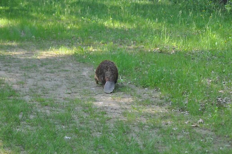
Not too long after we had come into a more open area, I exclaimed in a whisper without thinking, “BEAVER!” A beaver was waddling in front of us, a little off trail. At the same time a group of perhaps 8 to 12 people was headed toward us, trapping the beaver between our groups. The other group respectfully gave him a wide berth, but he didn’t seem to appreciate their sheer numbers. He stopped, turned toward them, and indicated his displeasure through body language and perhaps sound. They sidled around the side of the trail closer to the creek while we hung back, although he seemed less impressed by the two of us. As the other group passed, I said to a man, “They said to look for animal tracks, but not the real thing!” He said they too had never expected to see such a sight.
He was missing a chunk from the right side of his tail, and for some reason — perhaps I am anthropomorphizing — I had an impression of age and perhaps stress and disorientation. Although I have no idea of how he would have returned to the water, which from what we could see runs between cliffs, presumably he’s more familiar with the area geography. It’s sad to think that the beaver was hunted and trapped to near extinction; this one seemed vulnerable behind its bravado.
Soon after, J spotted a baby snake little bigger than a pencil. Unlike the beaver, it quickly disappeared into the grass.
We could see the creek through the trees and could hear what I thought were the falls. Further on, we saw that the rushing sound came from mini-rapids. There’s no swimming in Rock Creek, either; while it’s no Niagara River, it isn’t the shallow, peaceful creek I’d envisioned, either.
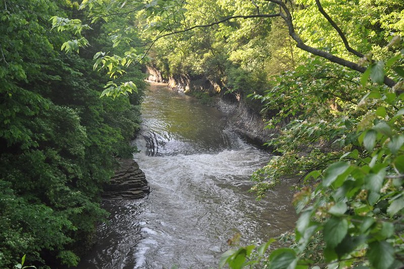
We came upon a couple of paths that branched off toward the creek. J took the first cautiously. They led downward to rocky platforms overlooking the creek. He said the first came to the edge of a cliff, which made me decide not to press my luck, especially as the falls weren’t visible from there. I steeled myself for the other one or two, and ultimately was rewarded with a great view of the waterfall. Don’t expect even the modest height of Starved Rock’s canyon waterfalls; this is a modest creek drop-off. It’s lovely and worth the little climb down, especially if your ability to balance when nervous and tired is better than mine. After taking photos, we relaxed a bit on a bench above and dug out our little bottles of Off! as the mosquitoes made their presence and hunger felt.
On the trail back, we were passed by a boy and two girls, teenagers, on horses; they were from a nearby camp. I’d like to see the world from horseback.
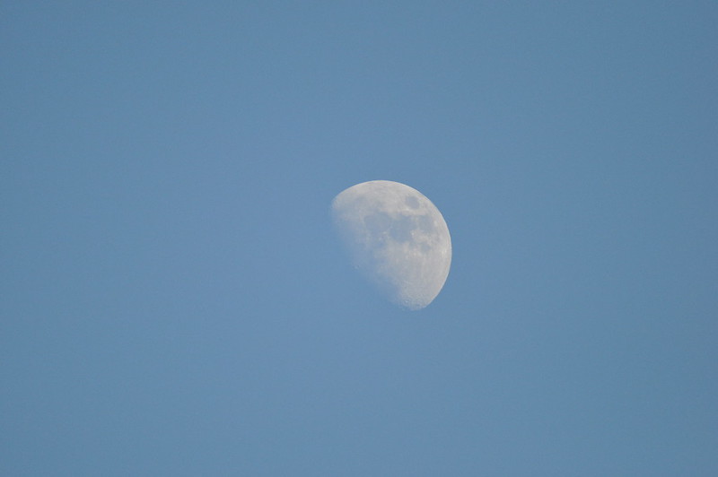
In the parking lot, J set up his monopod and took photos of the waxing moon. Used to my own blurry attempts, I was surprised to see that he’d managed to capture some of its features.
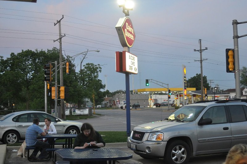
Our next stop was Blue’s Café, a diner that’s probably less throwback and more relic. We managed to get in our meal before the 8 o’clock closing time and to get pie to go. Then we detoured to Dairy Queen, where it was warm enough to sit at the picnic tables outdoors. I can almost picture the Dairy Queen on the road I used to take to Armor, in New York, 35 years ago.
Ice cream at sunset in a river town.
How much better can it get than that?


I am glad that you enjoyed visiting our town. On a happy note, I wanted to let you know that the Office Max that you visited that was located in an ‘mostly empty plaza’ … the plaza along with a bigger and better super walmart was relocated down the street . You wondered “this place has been hit especially hard by the recession, if something bigger and better had come along nearby, or if it had been in trouble already for other reasons. ” No trouble just a growing community 🙂 It has happened quite recently and all of the store fronts aren’t quite rented out yet.