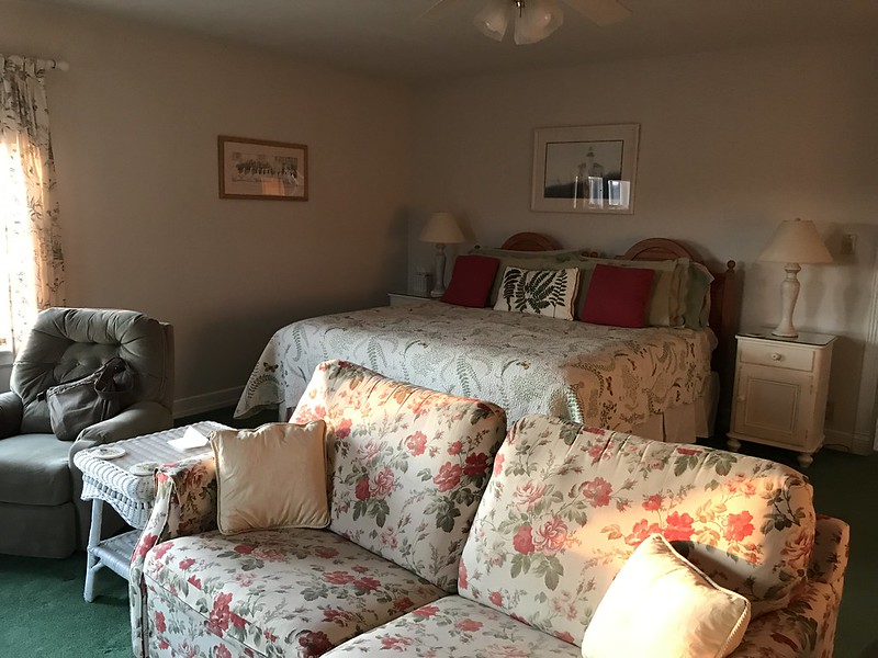
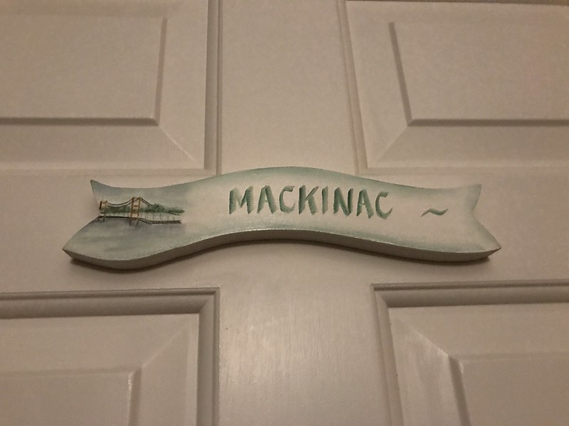
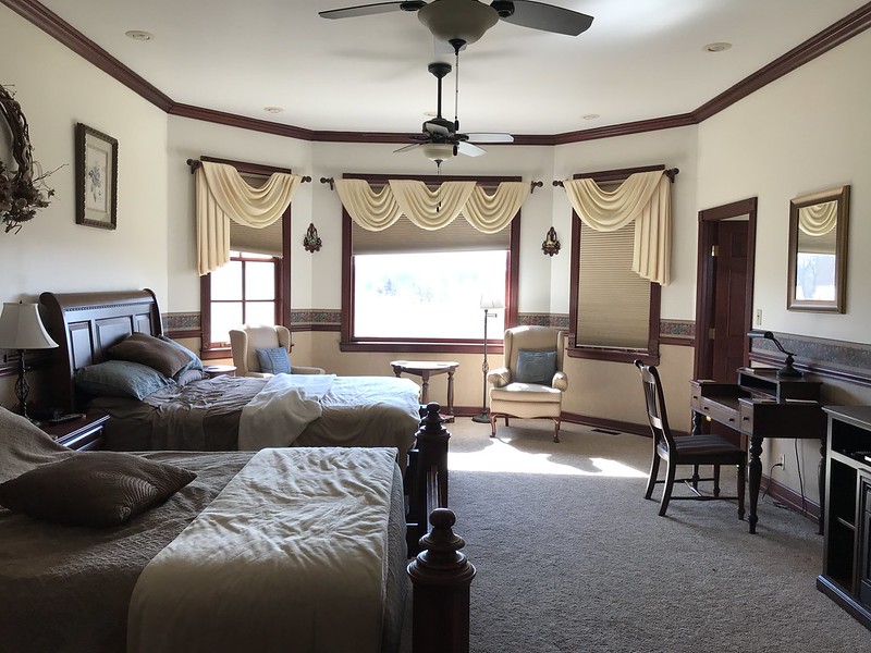
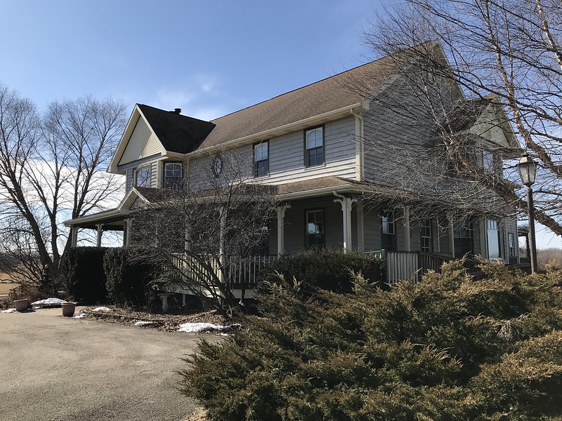
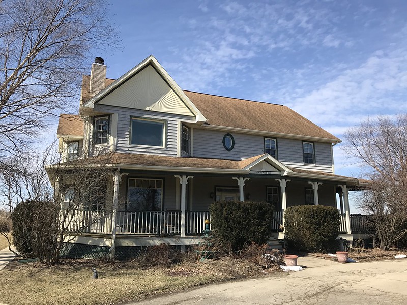
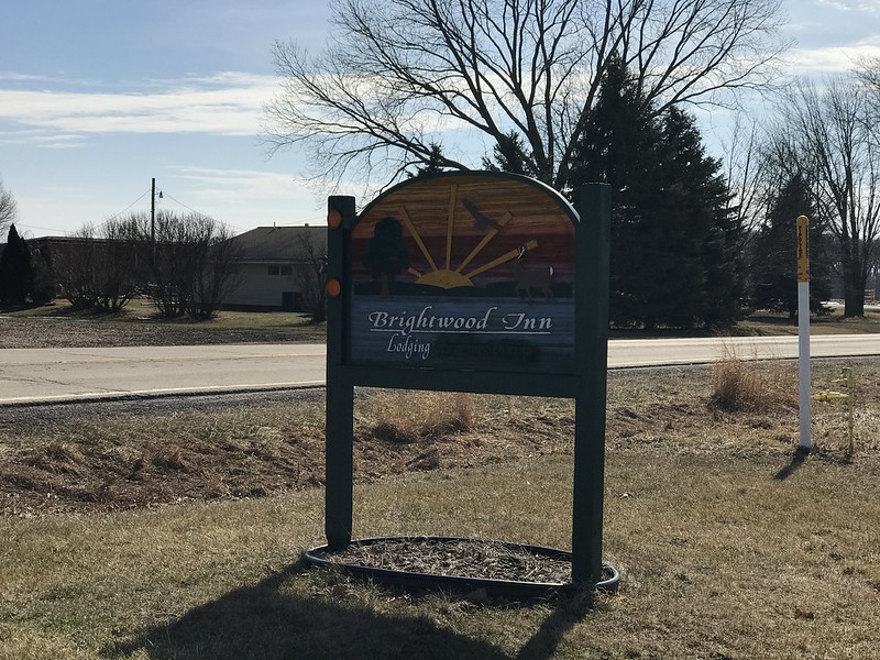
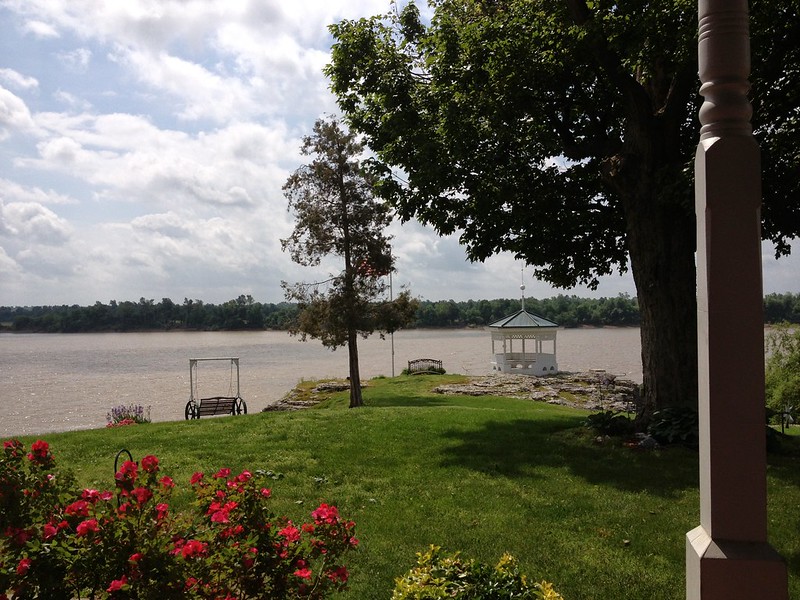
With a short visit to Starved Rock planned to see bald eagles (maybe), I decided to look for a place to stay in or near Utica vs. Ottawa. I wasn’t optimistic, but to my surprise I found one only a couple of miles from Starved Rock. For some rooms, they didn’t require a two-night stay. Feeling northwoodsy (or nautical), I booked the Mackinac because it looked comfortable. I wasn’t disappointed.
I told the owners about the themed room at Ann Arbor Bed & Breakfast, including how my favorite room, the Maine Woods, earned its name and decor from the rich green carpet. They said they too named their rooms for their favorite places. They mentioned the Aspen room upstairs. Why Aspen? I must have looked puzzled. Because it’s on the top floor. Yes, I’m slow.
The Mackinac has a big gas fireplace, which we tried briefly. After dinner, we found Trivial Pursuit in one of the comfortable public rooms and played until too worn out to continue. The questions were more difficult than I remember, even in my better categories (science and nature, history, geography).
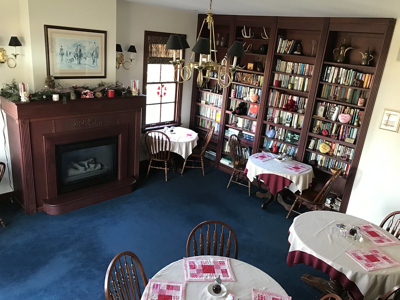
The next day we had our choice of bananas foster or eggs Benedict, along with muffins, cereal, fruit, etc. A gas fire warmed the breakfast room, which looked like it’d been decorated for Valentine’s Day. You can’t go wrong in a dining room with book-lined shelves, one fronted by a realistic morel mushroom knickknack.
The Mackinac has a large whirlpool that I didn’t take advantage of . . . this time. The room overlooks a couple of corn mazes that would be fun to try when grown. I did turn on the fireplace again and kick back in the recliner. Ahhh.
On the way out, I picked up a jar of aronia berry jam and a candle — I have enough candles for a couple of lifetimes.
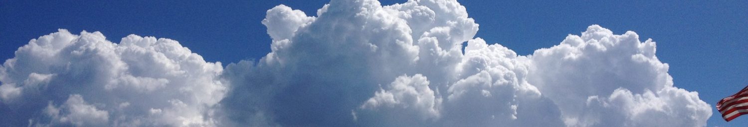
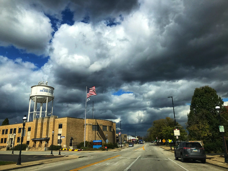
I was reading an episode in Anne of Avonlea in which a terrifying black cloud emerges on a sunny May day, bringing wind and dropping hail, leaving devastation behind, when I left to meet J in Homewood. It was windy enough that my Fitbit Blaze was fooled into recording that I had climbed 12 floors (in reality, a few steps).
After lunch at Redbird Cafe, I noticed the buildup of impressive clouds. The day I thought would be sunny and comfortable was turning into crazy weather day, with “snow” making a brief appearance in the AccuWeather Minute by MinuteTM forecast before changing to “rain.”
While at the Three Rivers rest stop on I80, I saw I’d gotten a call from the I&M Canal Boat folks—the mule-pulled canal boat ride I’d booked had been canceled due to wind. We decided to head to the Starved Rock area anyway, possibly to go on one of the next day’s rides if the weather were better.
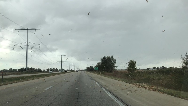
Wind, wind, wind, WIND blowing corn husk bits and small branches along I80 West
While it’d been windy at the rest stop, it hadn’t seemed extraordinary. Now, however, we noticed dried corn husk debris from the fields whipping around us, and leafy twigs were starting to litter the interstate. J. even ran into a small fallen branch—no time to stop or swerve. I half expected to see a skinny-legged witch fall out of the sky or Conrad Veidt to appear, saying, “Wind! Wind! Wind! WIND!”
After a stop at Jeremiah Joe, we checked out the river, which had been calm as a mirror at the end of July. The wind, about 25 mph with 50 mph gusts, was rippling the water toward the southern shore. I thought about the mules and wondered if they could get blown off the towpath. On E. 875th Rd., a government truck blocked our lane because a tree had fallen down the hillside—presumably torn up by the wind.
Given the wind and the corresponding chill, hiking didn’t appeal to me, so we went to Starved Rock Lodge for dinner. By the time we left the lodge around 6 p.m., the wind had died down, leaving behind torn branches and twigs and a strangely calm evening.
21 October 2018: Ottawa, Utica, Lasalle
Overnight, I saw the temperature dip to 23ºF. Brrr. And it was 90ºF only a couple of weeks ago.
Sunday dawned sunny and brisk, so there was an excuse to go to Jeremiah Joe after breakfast and a soak in the spa.
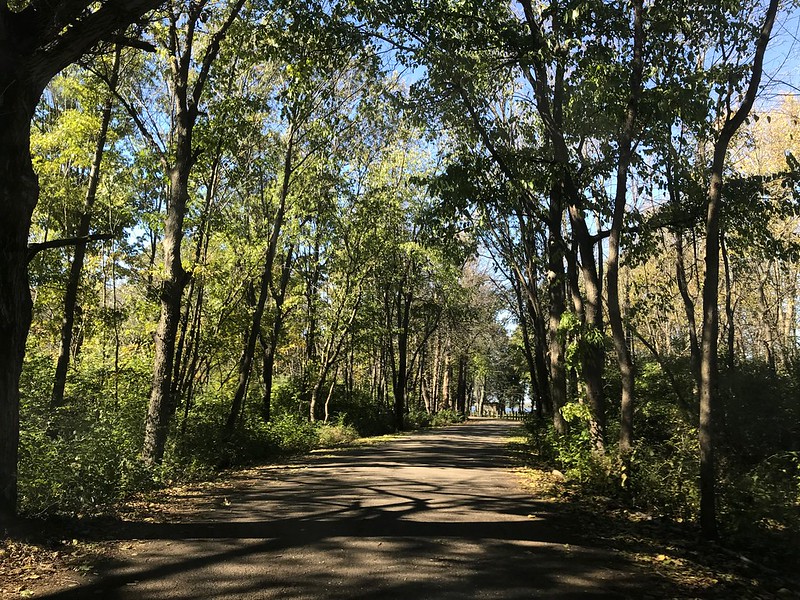
A sun-dappled road beckons
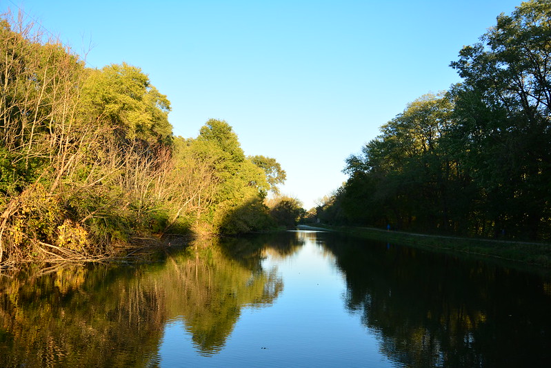
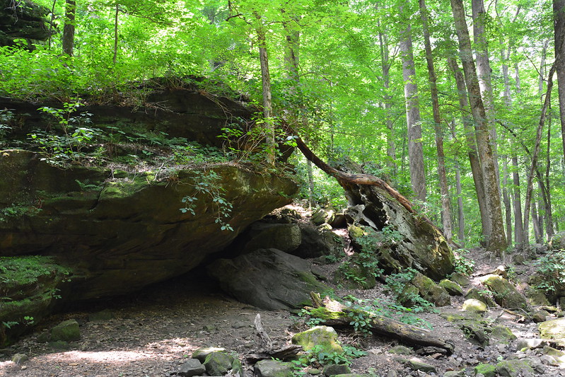
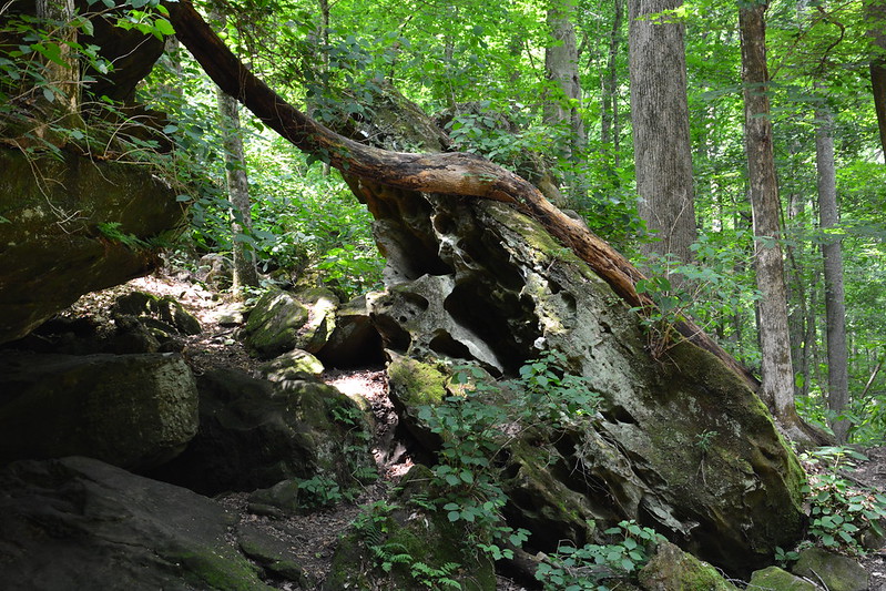
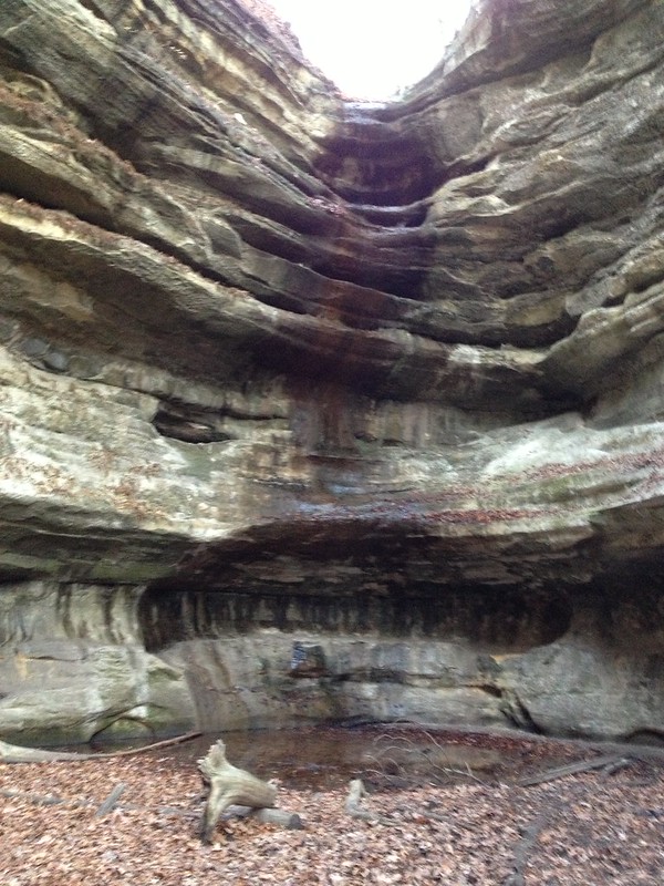
The next detour was Lone Point Shelter at the eastern end of Starved Rock State Park. I walked out on the floating dock, where two pre-teen boys, one with a little white dog, did their best to make me seasick. One boy said something about falling in, so I told them the carp would eat them. One of them looked skeptical. “Carp don’t have teeth,” he said without confidence. I resisted pointing out they wouldn’t need teeth at a certain point of decay. Meanwhile, a big boat chugged between the opposite shore and an island. The size surprised me until I realized the river accommodates massive barges, of course.
We stopped at Nonie’s Bakery and Cafe in Utica to pick up sandwiches to go for dinner on the road since we were going to get a late start back. Nonie’s is a quaint place in a house that looks like a house, inside and out.
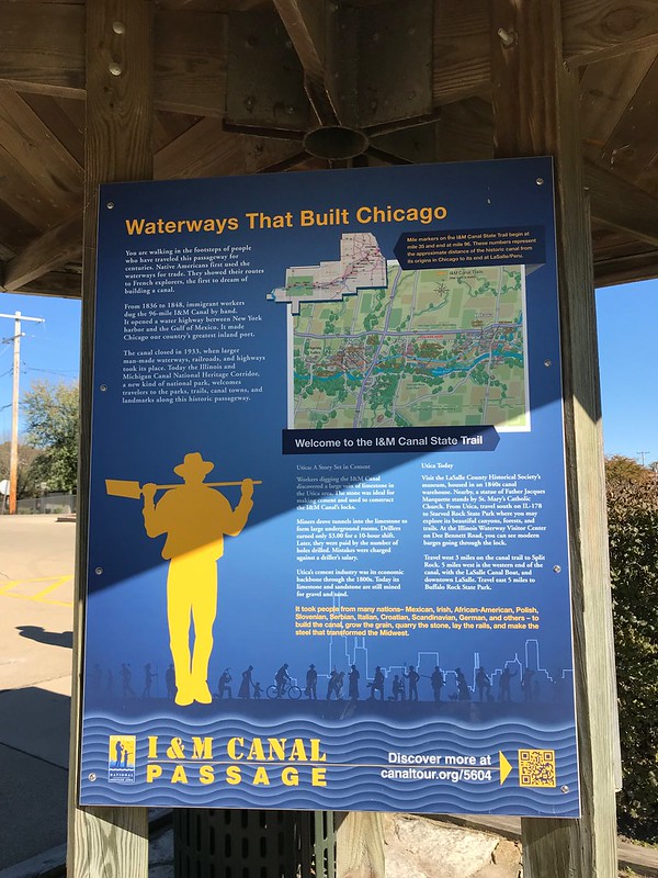
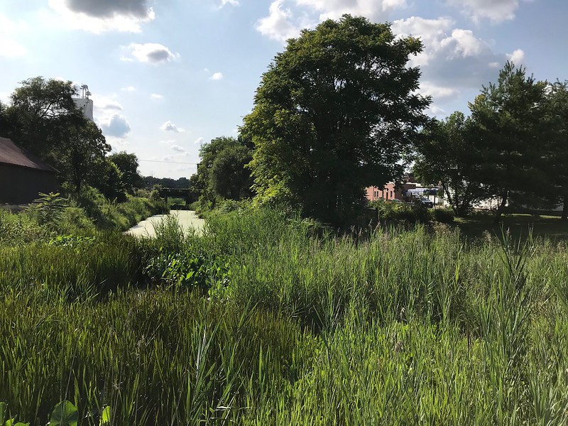
Sign by the remnants of the Illinois & Michigan Canal in Utica, Illinois
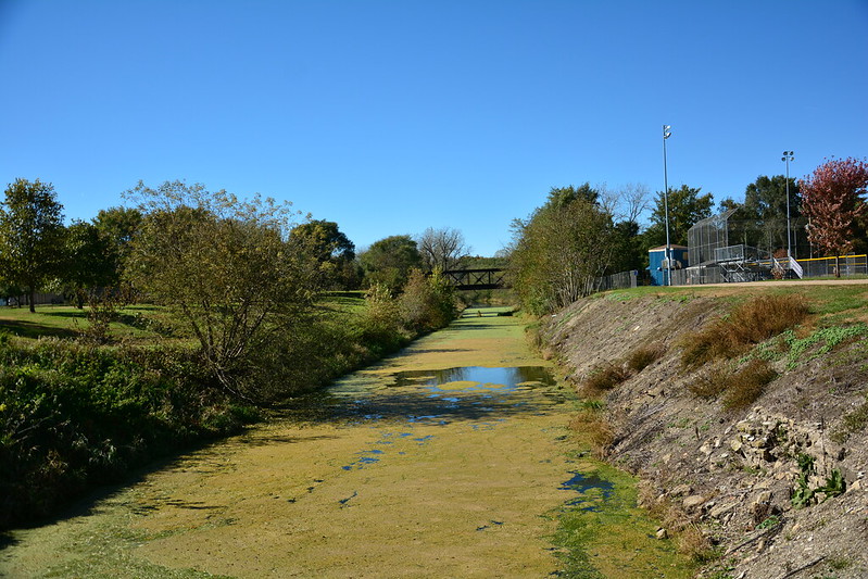
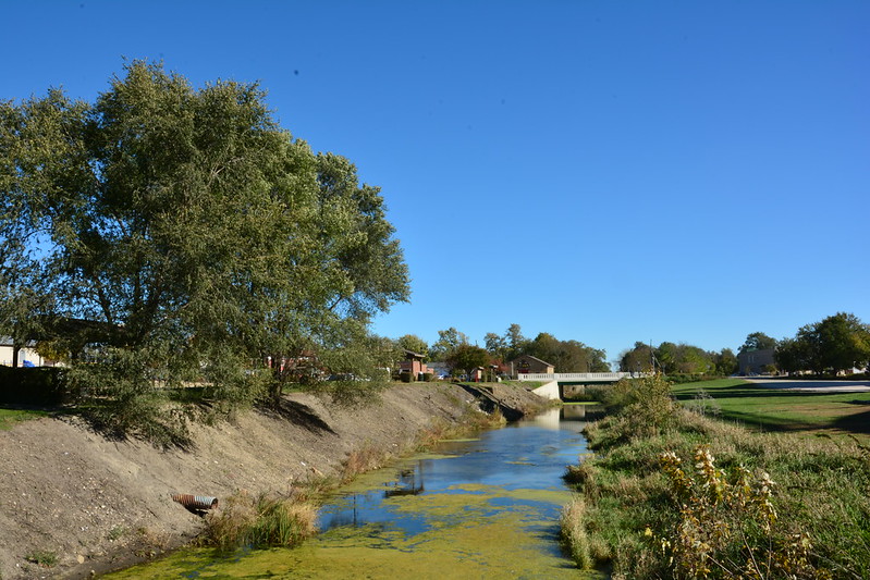
After Nonie’s we stopped at a different pedestrian bridge over the Illinois and Michigan Canal in Utica. I wonder what will happen to bridge and detailed signs once the canal is filled in, as I read is planned in the not-too-distant future.
Illinois & Michigan Canal remnant in UticaIllinois & Michigan Canal remnant in Utica
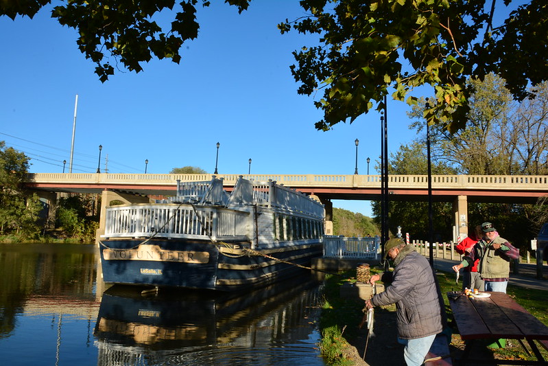
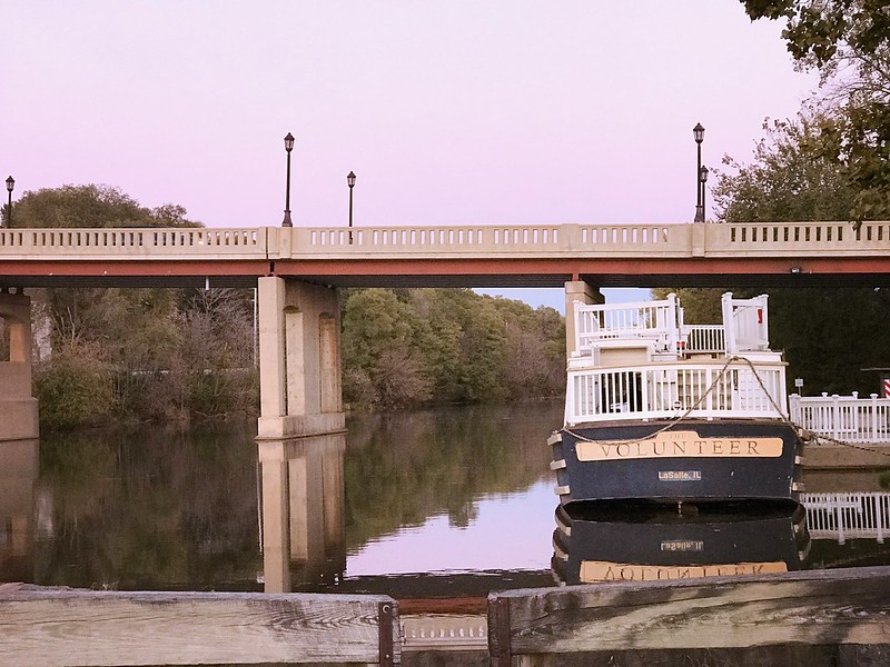
Now we set out for our main objective—Lock 16 Café and Gift Shop in LaSalle. The kitchen closes at 3, but we made it there in plenty of time for a late lunch and to look over the goods. Who can resist a “Moe and Joe” mule t-shirt? Not I.
The Volunteer at LaSalle, Illinois
The ride, complete with ghost stories, was to start at 5, so we wandered around the lock (Lock 14, not 16), where a number of men and boys were fishing for trout—one fellow had four on a line in the water. I wondered how far the canal goes.
I didn’t see any sign of mules or tack. I knew Joe had died last summer. After boarding we found out Moe, age 45, had died of Cushing’s disease a couple of weeks earlier. The remaining mule, Larry, had hurt himself where the belly band would go. Smart mule. One passenger said, “What? No Shemp?” Our guide told a credulous boy that the canal ride to Chicago would have taken 24 hours compared to a week for a carriage.
Our host told us amusing tales about the mules competing with each other (pulling the boat out of the canal when in tandem, or completing the hour-long trip in 40 minutes when one was in front of the other). If one pulled, the one left alone would have panic attacks, so a nanny goat was procured to keep him company—until the two teamed up to pick on her. Even gone, Moe and Joe were stars.
Our ghost storyteller was paranormal writer Sylvia Shults, who started off with a tale from Seneca, Illinois, about spontaneous combustion. Reflect on that the next time you want to say, “I’m so mad at her! She burns me up!”
On my previous mule-pulled canal ride, on the Chesapeake and Ohio (C&O) Canal starting in Georgetown in Washington, D.C., the boat had passed through a lock first thing. I remember the boat lowering and seeing the slimy green-covered wall appear (or I think I do—I may be confusing it with a boat ride in Chicago).
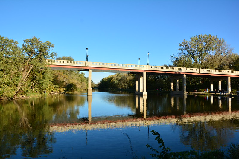
Bridge over the restored Illinois & Michigan Canal in LaSalle
There are no locks on the short I&M ride, and Lock 14 (immediately behind where the boat is docked) looks like it hasn’t been used in years. In this case, the boat, dubbed The Volunteer, passes under a bridge at Joliet Street. As it falls under the jurisdiction of the U.S. Coast Guard, passengers are required to remain seated as there could be a jolt if the boat bumps near the bridge. It did, and there was. If I’d been standing, I’d have keeled over. Wooomff.
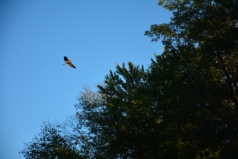
Illinois & Michigan Canal from The VolunteerGreat blue heron fly-by
As soon as I could I walked up the steps to the Texas deck, while J. alternated between above and below. Naturally, just after he went below a great blue heron flapped its ponderous way toward us. “What is THAT?” a woman asked me. I was tempted to reply, “A pterodactyl.” It’s a rare moment when I’m the resident bird expert.
I watched from the bow as The Volunteer approached a trestle, beyond which is the Little Vermilion River Aqueduct. I could see that we would have to start to make our way back—the canal narrows and appears to be shallow. I learned later the canal had been restored in this location specifically for the canal boat ride. Someday we’ll have to see more by walking the I&M Canal trail. On our return trip, a woman on the boat called out to a woman on the trail: “How far does that path go?” They had to yell back and forth several times, but I think the walker said Ottawa. I’ll be lucky if I can make it past the trestle.
In Google Maps’ satellite imagery, the canal is a frightening neon yellow-green, although it looked okay as far as I could tell (and the men and boys fishing clearly the intended to eat their catch!).
Sunset on the Illinois & Michigan Canal in LaSalle
This ride was timed just right to head back toward the golden glow of the setting sun, which wasn’t blindingly bright. Despite the distant pounding from Illinois Cement to the east, the trip was calming, and I wished the glow could last a bit longer.
Work done, The Volunteer is docked for the night in LaSalle
Not surprisingly, Ms. Shults was selling and signing her books so before disembarking I bought a couple after telling her I was interested equally in history and ghosts. She recommended a book on an asylum in Peoria . . .
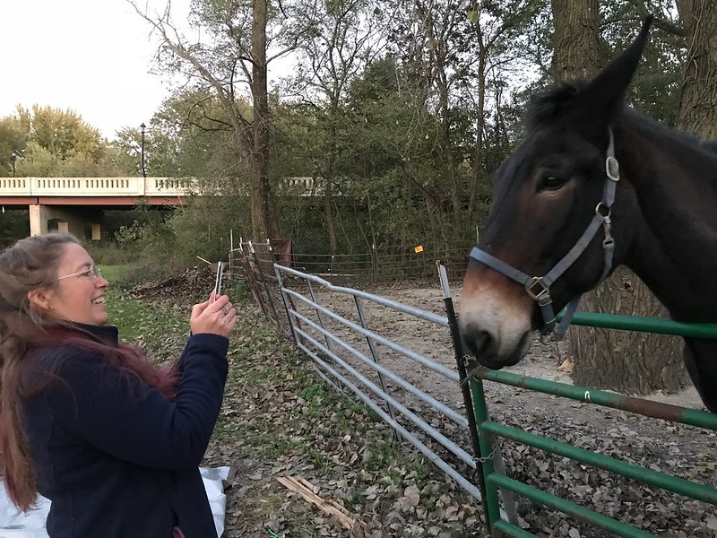
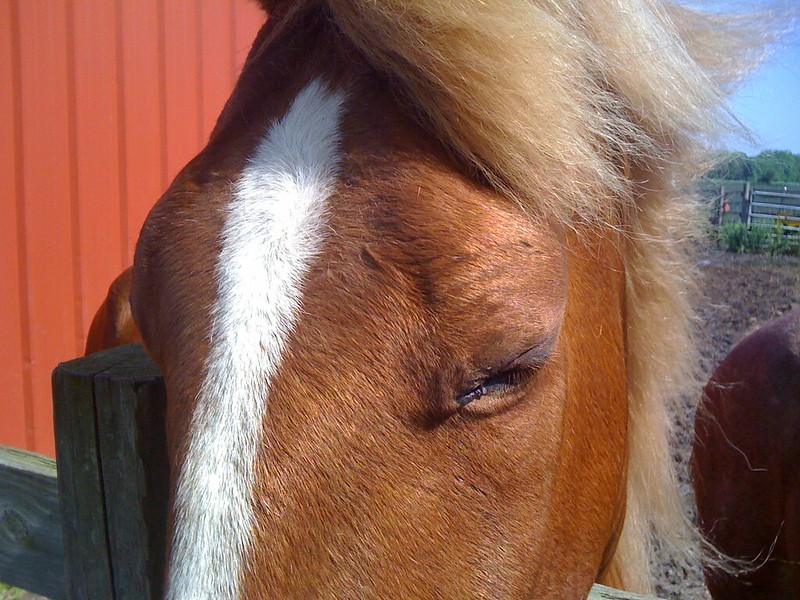
We had a long trip and a work day ahead, so reluctantly we headed toward the parking lot prepared to leave. It was then I spotted the silhouette of a mule, similar to the metal cutouts of historical figures we’d seen dotting the area. Then I noticed it had a couple of tones, unlike the cutouts. Then it swung its head. It was Larry the mule! We ran over to meet Larry and found him eating apples from Ms. Shults’ hand. After she’d run out of goodies an older man came along this carrots and marshmallows, and a woman pulled a little grass as a treat. It wouldn’t surprise me if Larry returns to his farm in Utica in early November weighing a wee bit more, even after a summer of canal boat pulling.
Larry the mule poses after being stuffed with treats
After the visitors bearing gifts left, Larry, who’d walked away from me several times to follow them, suddenly started pushing my left arm around with his head and exploring my sleeve with his big mule tongue. Alas, I had no apples, carrots, or anything else a hungry mule might be interested in. If I ever get a chance to go back to LaSalle for a mule-pulled canal boat ride, I’ll know to bring healthy mule bribes, er, treats.
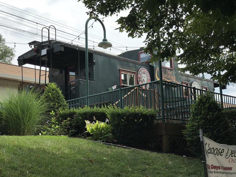
It was about 77ºF with a few clouds when I left Hyde Park by train to meet J at Homewood, where we had lunch at Redbird Cafe. I had the brilliant idea of going to Flossmoor’s Old Caboose Ice Cream Shoppe—brilliant except that it wasn’t going to open until 4 p.m.
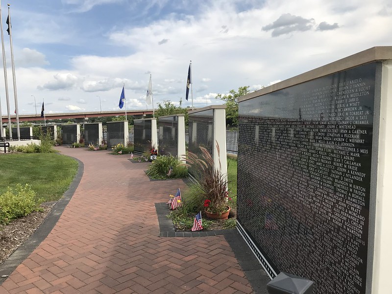
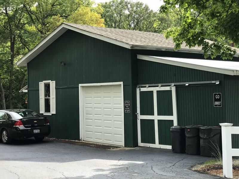
After J went home to shut down his computer, we hit I-80 for Starved Rock Lodge, where I’d reserved a “sunset” cabin (on the west side). On the way we stopped at the Middle East Conflicts Memorial Wall in Marseilles along the Illinois River across from Illini State Park. Only one couple arrived during our time there. and I moved off in case they were there for someone they knew. We found a great blue heron further down, keeping an eye out for dinner. Marseilles seems to be a friendly place. One home garage sports signs such as “GO AWAY” and “IF YOU CAN READ THIS YOU’RE IN RANGE.” At least stopping in Marseilles gave us an excuse to ditch I-80 and take the Illinois River Road the rest of the way.
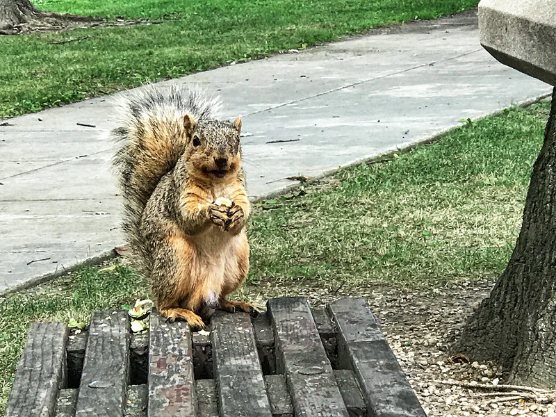
Old Caboose Ice Cream ShoppeNutty squirrel at I80 Three Rivers westbound rest stopMemorial wall in MarseillesWelcoming sign
From one of the informal waysides between Ottawa and Starved Rock State Park, we spotted another great blue heron among the tall grasses across the river. We also noted something periodically breaking the surface of the water—fish?
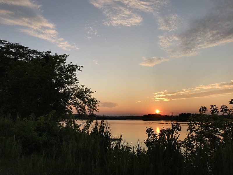
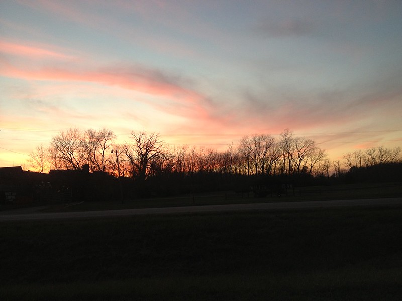
Sunset on Illinois River
At Starved Rock Lodge we checked in, checked out the cafe and the cabin, and went to the dining room. We finished dinner just in time to go back to the waysides to watch the sun set over the river. Although the sky wasn’t as brilliantly colorful as it’s been in the past, the river seemed eerily calm and glassy.
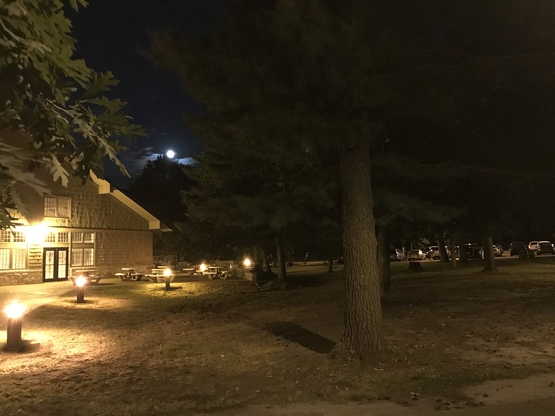
On the short way to the pool building at the lodge, J pointed out the call of a barred owl nearby, or at not a very great a distance. It accompanied us down the brief walk. I would love to hear a barred owl every night, “cooking” me to sleep.
Moon over Starved Rock Lodge
After I’d been soaking in the spa for about 10 minutes, the couple who’d been sitting in it when I arrived returned and, red-faced, admitted they hadn’t known how to turn the jets on. After that we sat outside listening to the summer chorus of insects and hoping to hear the barred owl again (it must have moved on or gone silent). I could have stayed outdoors all night . . .
July 29, 2018
On the way to the lodge cafe we encountered people looking intently at the base of some bushes. Tiny gray birds with, I think, white mustaches were running around, then disappeared into the greenery. I still haven’t figured out what they were.
Take it easy
After getting surprisingly good coffee at the cafe we went to Nonie’s Bakery and Cafe in Utica. I love restaurants in houses (Nonie’s, Ivy’s Bohemian House in Chesterton, Captain’s House in Gary, Front Porch Coffee and Tea Company in Ely, Minnesota), and after a little wait in line breakfast was surprisingly quick and good. My only regret was sitting inside rather than out on the porch.
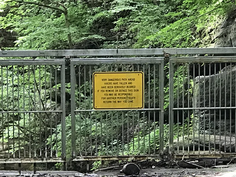
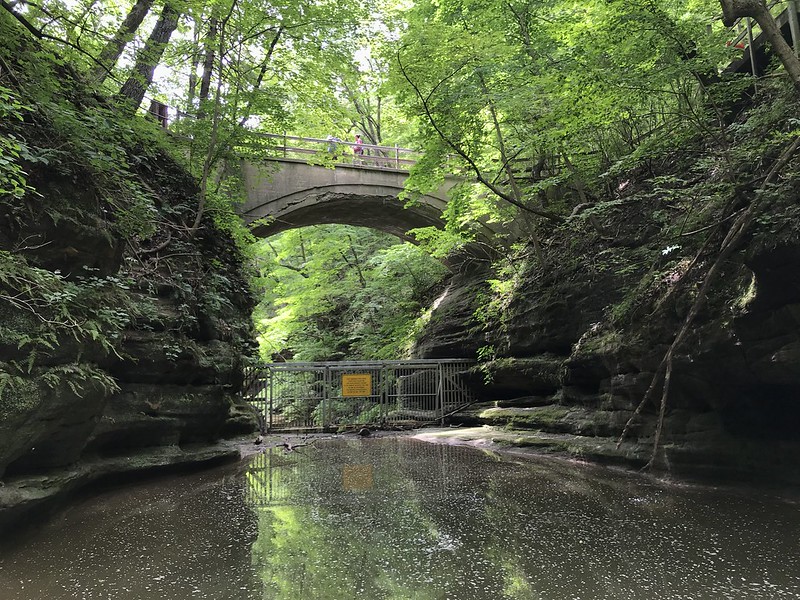
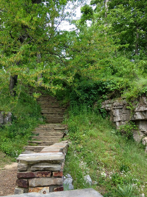
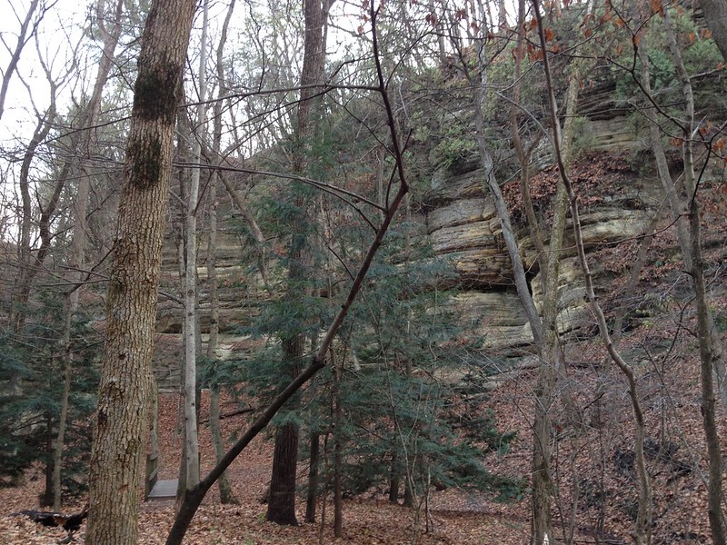
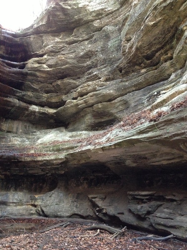
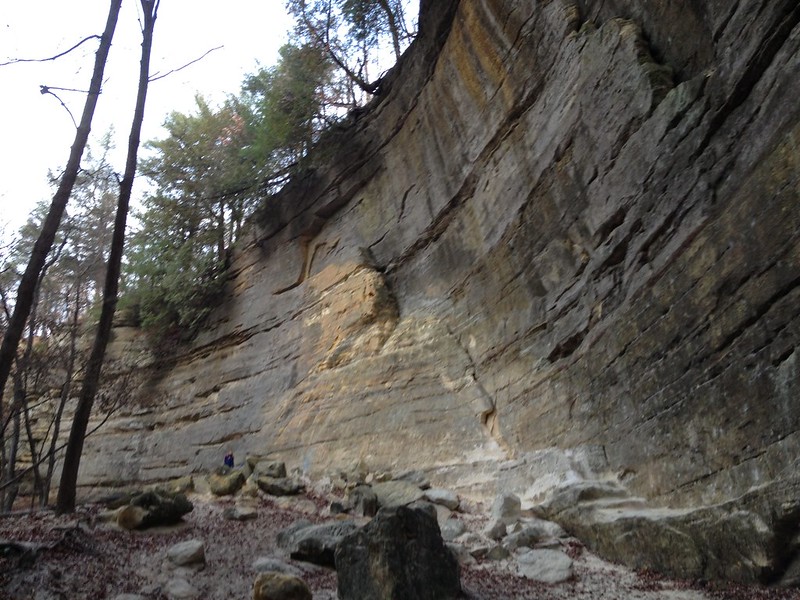
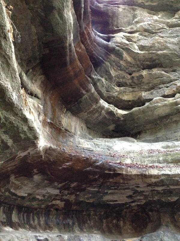
The visitor center parking lot was packed, so we set out for Matthiessen State Park, which for reasons I can’t explain now I’ve always found confusing. I’m not sure if they have new signs or I was more lucid than usual this time, but after going down all the steps and crossing the muddy bridge (very carefully, on the only dry area), we found signs pointing to Upper Dells (right) and Lower Dells (left). To the right, stairs I’d never noticed before led downward to one of a spot with a view up toward the bridge. We could walk across the water without using the stepping-stones because the level was low due to lack of rain. A gate at what looks like a drop sports a sign warning you of danger—and not to remove the sign if you don’t want to be responsible for the death of others. The gate does nothing for the picturesqueness of the scene, but it’s likely necessary as we will hear later.
Danger at Matthiessen State Park
Very dangerous path ahead Hikers have fallen and Have been seriously injured If you remove or deface this sign You may be responsible For another person’s death Return the way you came
Matthiessen State Park sign
Matthiessen State Park
Back on the bridge, we could see many people all over the place in the lower dells, placed randomly and tinily enough for a Hieronymus Bosch painting, or maybe a “Where’s Waldo?” scene. Given the numbers and the state of the dells parking lot, it looks like Matthiessen may be starting to catch up with Starved Rock in popularity.
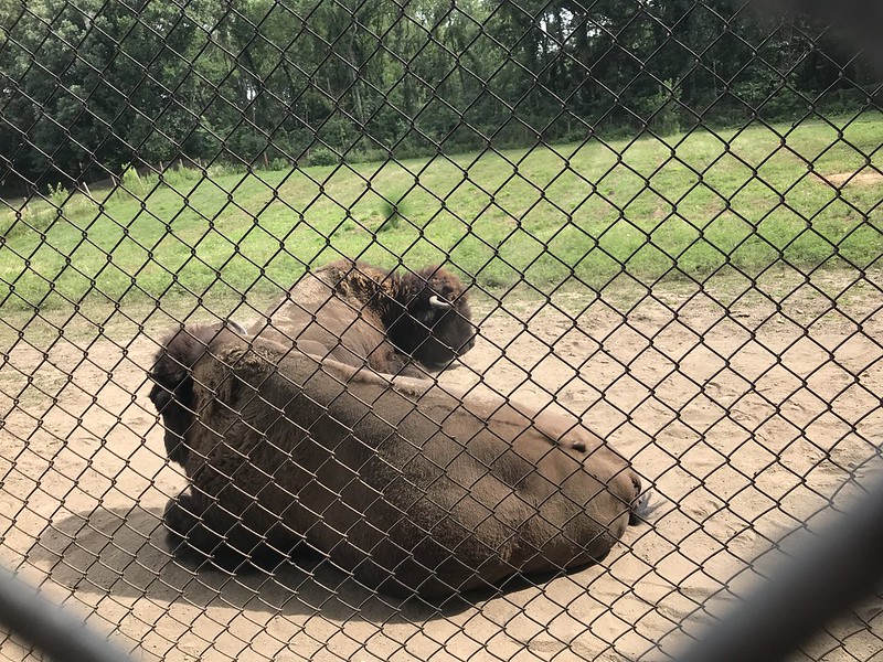
Next, we went to the least popular of the three parks, Buffalo Rock, where we ate the sandwiches we’d taken out from Nonie’s. When we’d visited Buffalo Rock previously, we hadn’t known about the bison, so this time I made a point of seeking them out. The pair was lying down at the end of the enclosure, as far from people (and the motorcycle racket) as they could get. No roaming for them.
Bison at Buffalo Rock State Park
In an odd moment, a woman ran up to me, hugged me, and exclaimed, “SANDY!” I drew back, she looked at me, and said, “You’re not Sandy?” I’ll never know who Sandy is or how I was mistaken for her.
While at the lodge cafe we’d found a postcard of a massive field of sunflowers taken at Matthiessen. We found this at the “river” entrance to the park, next to model airplane flying field. Alas, the sunflowers were well past their prime, which reminded me again how short spring and summer seem to be.
Back at the lodge we chilled a couple of local beers we’d bought at the cafe the day before and drank them on the bench outside the cabin door, enjoying the fine day and the sounds of the outdoors. I could live like this.
We went to Ottawa for dinner at the Lone Buffalo, where we were exiled to the sidewalk. My love for al fresco dining began when my aunt took me to a very old school Italian restaurant in Washington, DC, Roma, where we dined in a secluded garden area overrun by grapevines on trellises surrounding the outdoor booths and populated by European house sparrows relentlessly begging for crumbs.
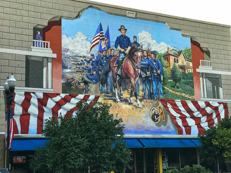
Mural in Ottawa
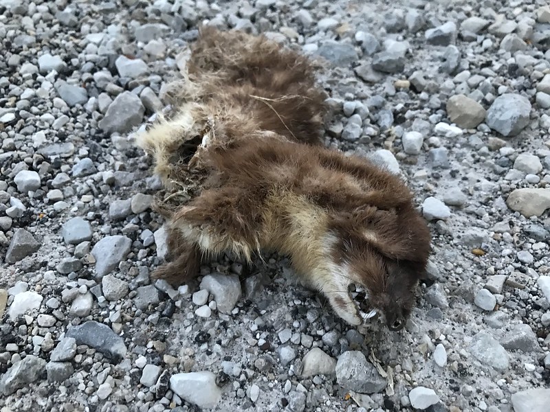
We spent a little time at one of the sunset spots, where I found a partial body — possibly a mink? After that, we again enjoyed the night air and the cacophony of dog day harvest flies.
Late weasel?
July 30, 2018
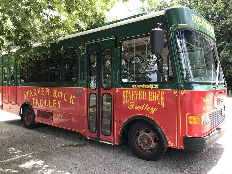
Starved Rock Lodge trolley
On Monday, we picked up breakfast sandwiches at the lodge cafe and ate them outside, then walked around the grounds near the cabin, reluctant to check out. Our lunch-trolley-boat tour started at 11 with a better selection than I expected, followed by an informative, entertaining, more extensive trolley tour than I expected. (I’d thought the trolley would simply take us to the boat.)
We went through “North” Utica, learning what had happened to South Utica. Our guide recommended Mix’s Trading Post as well as some new shops (e.g., spices) on the main street. The tour consisted of “myths” and “legends” mixed in with some possible history, including the Starved Rock murders.
We stopped at the Illinois Waterway Visitor Center, where we learned that the Illinois is naturally shallow, but of course the dam has raised the water level. The driver pointed out one small narrow island south of the lock and dam, telling us thousands of feet of it are submerged—it’s much bigger than it looks. This explains something that had mystified me—why so many snags appear along the river between Ottawa and the Starved Rock State Park entrance. The river is full of such islands, wholly or partially submerged.
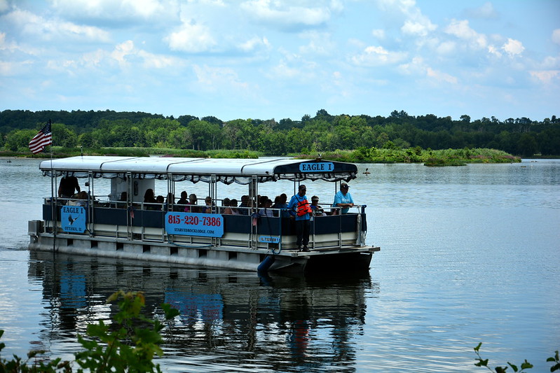
The Eagle 1
Our last stop was Lone Point Shelter, which we’d never been to as I’d foolishly assumed it was no more than a boring picnic area. It’s a picnic area with boat access on the Illinois River. There we waited for our ship, well, boat, to come in.
We’d been told the guide is a retired geology teacher who knows rocks. We sat near the pilot, who quietly gave us tips on where to look.
The Illinois is full of Asian carp. There’s an ongoing and perhaps belated fear that they’ll make their way into the Great Lakes system—but I don’t know much about them other than their devastating effect on habitat and wildlife. On embarking, we’d noticed chest-high clear plastic shields around the deck. I assumed they were to keep tourists, especially children, from falling out, although I’d never seen this on other boats. We soon learned this protective wall is not to keep us in, but to keep the carp1 out. They can leap impressively high. Later our guide told us they’re covered in mucus and have many blood vessels close to the surface, so when one slammed into a passenger, the man ended up covered in carp slime and blood. And this was supposed to be a pleasant little cruise. No carp made it aboard this day, however, but not for lack of trying. During the hour-plus of the tour, periodically a carp, disturbed by the boat’s passage, leaped against its hull, eliciting startled screams from several women. It felt a little like running a gauntlet—an unpredictable one. The pilot and the guide remained unruffled.
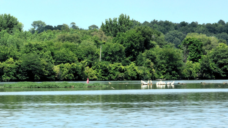
White pelicans on the Illinois River
Aside from carp, we spotted herons, egrets, and even a flock of white pelicans in the distance. There weren’t any eagles in our immediate future, although the pilot had optimistically told us we might see some.
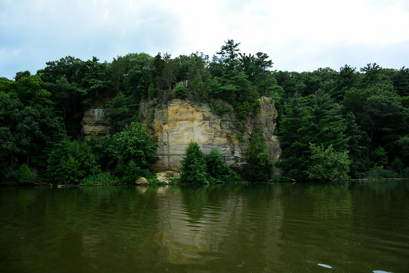
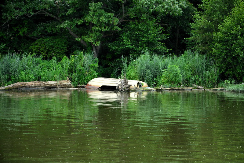
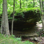
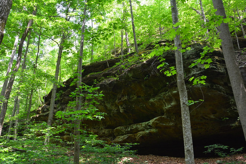
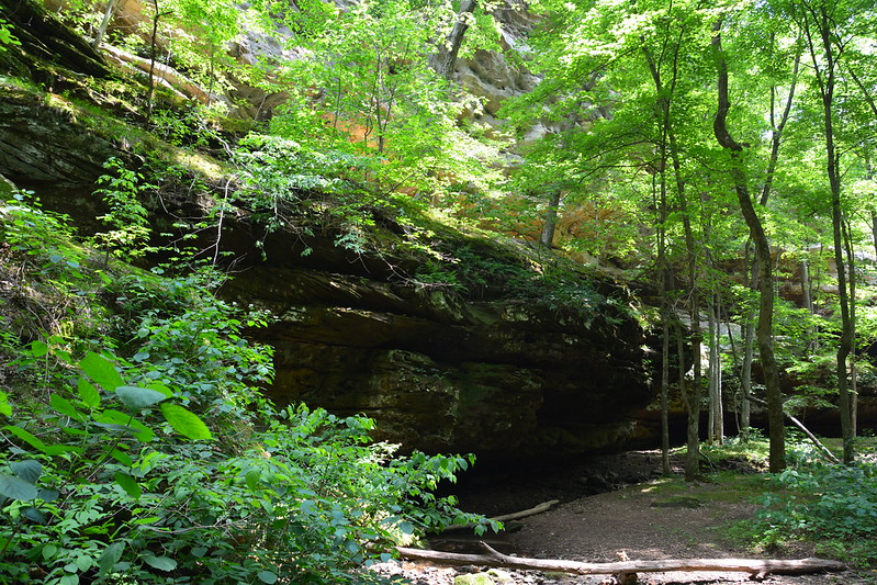
Starved Rock State ParkWrecked boat
For the first time, we saw Starved Rock from the perspective of the river. We’d hiked the river trail several years ago, and I thought I recognized a few spots along the way, including one where a bench overlooks a wrecked boat that’s been there for years. Our guide told us something about it, but I missed it. The boat, which isn’t large, looks mostly whole on one side and stove in on the other, if I remember right. I don’t know if I have any photos of it from the trail. The pilot and guide remarked on how the Illinois was the most placid they’d seen it in months.
Happy hikers
We could see many hikers through the trees, and I waved to some of them (some waved back).
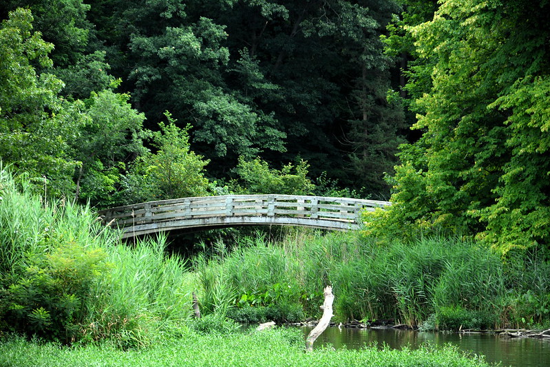
Bridge at Starved Rock State Park
Our guide gave us the names of the bridges and creeks we passed; I wish I could have taken it all in, taken photos, and written it all down, all while anticipating the bang of the next carp against the boat. For a moment I could almost imagine myself Lewis or Clark, if Lewis and Clark set out in a boat with silver-haired retirees.
While on the way to Buffalo Rock the day before, we’d noticed a big, haunted-looking house set back from the road and began speculating about it. It looked unoccupied, but I don’t want to land in jail (or hospital) for trespassing, so we didn’t stop to take photos. On the boat tour we learned this is Spring Valley House or Sulfur Springs Hotel, built in 1849 and closed only 13 years later due to the decline in river and stagecoach travel. Added to the National Register of Historic Places in 1987, it’s owned by the state of Illinois. Part of the Old Kaskaskia Village site, the property is closed to visitors, but I wonder if they’d mind photos from the driveway?
Besides birds, carp, and historic sites, the themes of the day were St. Peter sandstone and rescues. Our guide (the geology teacher) told us about fracking and why St. Peter sandstone’s rounded grains make it preferable to Arabian sand for fracking. As I know from personal experience, it can be a slippery walking surface. We learned there had beenfour rescues this year to date in/around Wildcat Canyon. Climbing is forbidden, but that doesn’t stop children and the determined. As we passed one rock, our guide told us a woman had fallen from it only a few weeks before—onto her face. She was airlifted to Peoria with a broken eye socket, among other injuries. I recalled watching children under 10 climbing and wondering if I would have been an overly cautious parent; theirs seemed unconcerned. A few weeks after, I read that a boy, about 7 or 8, had fallen to his death.
Today three or four adults were on the rock the woman had fallen from. The lowest, a woman, must have changed her mind for as we watched she started to make her way down cautiously. One potential tragedy averted.
All too soon it was time to return to the trolley for the trip back to the Lodge. As we disembarked from the boat, a raccoon was checking out the Lone Point Shelter full of hope but bereft of food.
At the lodge, we at ice cream, and I made final purchases at the cafe (fudge!). Outside the cafe, we used a machine based on old-school fun to press images of local attractions into pennies. Fifty years after childhood, my souvenir needs are easily satisfied.
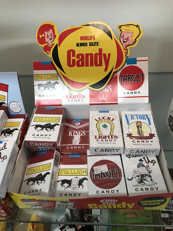
Candy cigarettes
In Utica, we stopped at Roxie’s, where you can get everything from good chocolate truffles to old-school candies, including wax lips and candy cigarettes. Who knew that someone somewhere still makes this stuff?
Remnants of the Illinois & Michigan Canal in Utica, Illinois
We checked out a pedestrian bridge over the I&M Canal that our driver had pointed out. What’s left of the canal is choked with plants, making it hard to imagine its heyday as part of the link between the Gulf of Mexico/Mississippi River and the Great Lakes. Since then I’ve read that Utica plans to fill in its portion of the canal in 2019. What an ignominious end!
Our final stop was at the new spice store, which seems an unusual addition to the main street’s other offerings. By then it was close to 5, and we couldn’t delay the inevitable return to reality (except with dinner at R Place in Morris). At least we could leave with visions of pelicans, carp, mansions, and risky rescues dancing in our heads.
1 The term “Asian carp” includes several species. The carp leaping at our boat were most likely silver carp. According to USFWS: “Silver carp spontaneously leap from the water when they feel threatened or hear loud noises such as a boat motor.” Silver carp can grow to four feet long and weigh 75–100 pounds. Video of silver carp in the Illinois here.
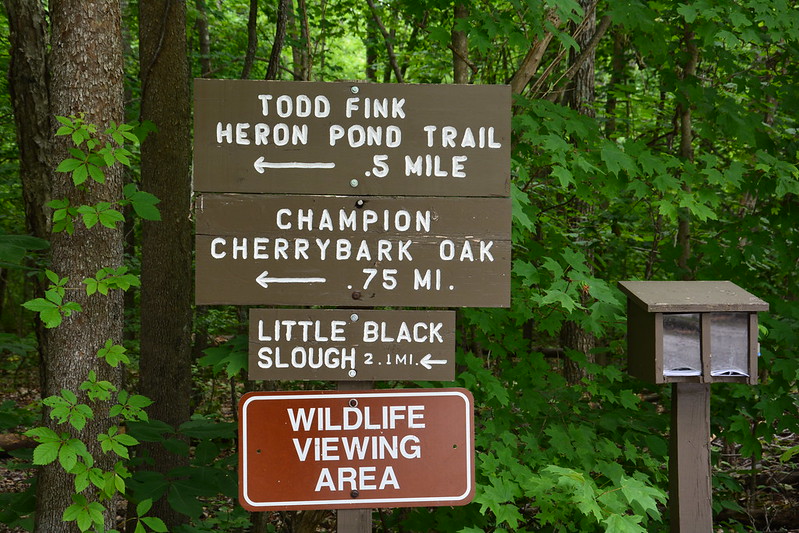
Champaign to Anna to Giant City State Park to Heron Pond to Fern Clyffe State Park, then home
May 23, 2014, late evening
J. and I set out for a brief return to Shawnee National Forest and the Cache River. Other than visiting Heron Pond, I didn’t have a plan.
We made it to Champaign before stopping. I forgot that Champaign is a few miles east of I57, so we overshot it.
After breakfast at Le Peep, we were on the road again. We had to bypass some of last year’s distractions, like Amish Arcola and Rend Lake. We did leave the expressway for Mattoon and a quick stop at a place I hate to leave: Common Grounds. Closer to our destination, in Mount Vernon we detoured to a Toyota dealer and a car parts store to look at the malfunctioning lower glove compartment. We also took a break at the Post Oak rest area, which with its bridge and trees is scenic and soothing. I remembered it from last year.
Post Oak rest stop
This time we focused on the more civilized western part of Shawnee, with home base at the Davie School Inn. Built in 1910, this elementary school is now a distinctive and very comfortable bed and breakfast — if the sight of a student desk and other holdovers from the school don’t traumatize you with memories.
Davie School Inn
Our host described Anna, which we’d been to before, as “just like Mayberry” (that is, there’s no need to freak out if you leave your car unlocked for a few minutes — or more).
Giant City State Park
May 24, 2014
I’d been intrigued by the name and description of Giant City State Park. As it was already late afternoon, it was nearby, and our host recommended the park’s lodge for dinner, it seemed like a great place to use the daylight we had left. On the way, we stopped in Makanda at what in any other place would be called a strip mall, only this was a rustic building carved into a hillside, and its stores were mostly local art and other tourist shops, with an ice cream joint in the middle. I loved its charming hillside location and unpolished design. You realize how sterile urban and suburban big box and brand shopping is when you see something like this.
Makanda, Illinois
We inadvertently took a hilly, twisty back way into Giant City State Park. These aren’t words I usually associate with the flat, bland Illinois landscape, so it’s like being in another world.
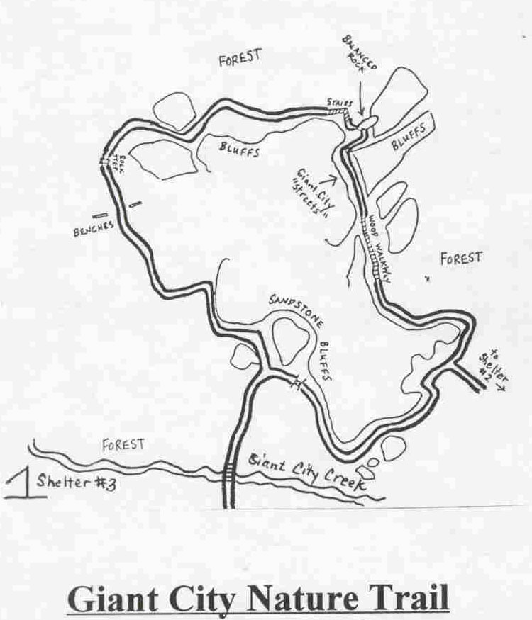
Giant City State Park has numerous trails, and I tried to find the one that was popular and not too difficult. (There may be a correlation.) After wandering around a while, we came upon the Giant City Nature Trail head, past a picnic area overrun with happy, screaming children.
This didn’t sound like something I couldn’t handle (although I wouldn’t be sure until the end). We were lucky because we weren’t swarmed by mosquitoes.
The “giants” of Giant City are huge rocks with “streets” between them, the natural antonym of a model scale urban canyon.
By far the most popular trail at Giant City, this 1 mile trail is home to the famous “streets” of Giant City. You’ll walk on a mulched trail with wooden walkways at difficult spots. There are some strenuous uphill portions on this trail. Take this trail to view a diversity of plant habitats from creek bottomland to dry blufftop. This is also a promising trail for seeing the largest woodpecker in the United States, the pileated woodpecker.
Illinois Department of Natural Resources
The giants are beautiful and impressive, and we would have stayed longer if we weren’t running out of daylight for photos and time to get to the lodge for dinner before it closed. After we passed the Giant City “streets,” I was even nervous that we wouldn’t be back to the trail head by dark — I wasn’t prepared with this convenient and easy-to-follow map.
I moved as quickly as I could over the more strenuous uphill portions and somewhat rougher terrain. Earlier we’d seen a woman who was in the final stages of pregnancy, and I’d marveled at first that she was going to attempt the trail, but then her family detoured back to the parking lot, so they saw only the sandstone bluffs.
When we got back to the trail head, I noticed the sign said Fat Man Squeeze was closed due to snake activity. I realized later we hadn’t inadvertently disrupted the snakes. Even if we had spotted Fat Man’s Squeeze (we weren’t sure), from the looks of the photos it would have been a miracle if I could have gotten even my arm through. For a lot of reasons (mainly the distance between us), the snakes will remain safe from me.
Like Starved Rock Lodge, Giant City Lodge was a CCC project and has a similar rustic, roughly timbered feel (although the construction style may be different — I’m no expert). It’s decorated with specimens of various taxa that have been treated by a taxidermist — deer, fish, ducks, etc. Food and drink were welcome after the long, tiring day, and so was the classroom with the Jacuzzi shower and bath at Davie School Inn.
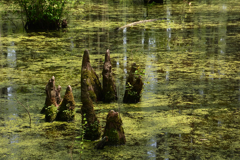
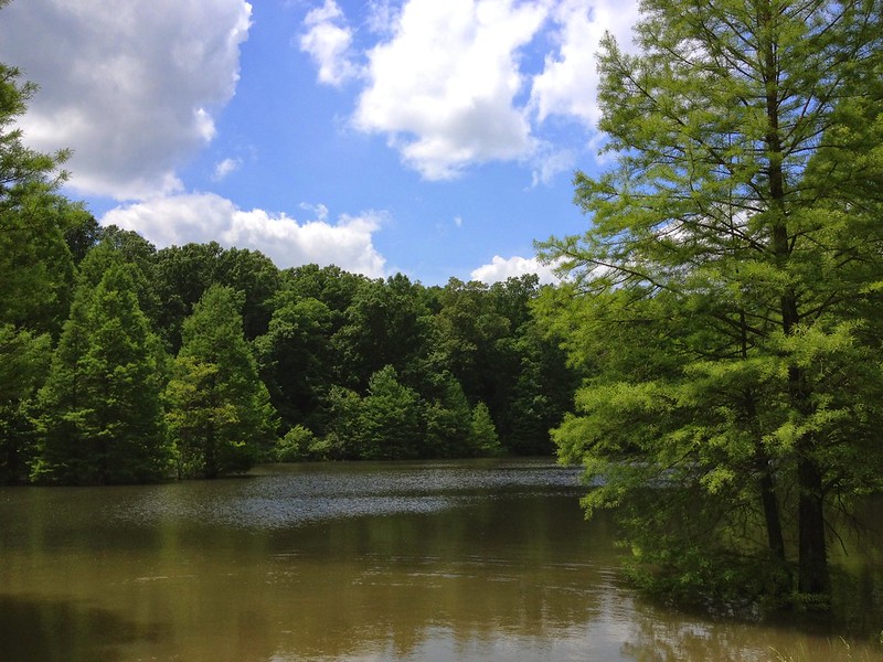
Heron Pond
May 25, 2014
After a big breakfast, we set out for the Barkhausen-Cache River Wetlands Center to get better directions than I had for Heron Pond, although on the way we spotted a few signs pointing to the pond. I’m glad we stopped at the center not only because having directions helped us to find it (what you’re supposed to pass through, how far to go) but also because for a little while we could watch the barn swallows and hummingbirds forage.
I’m not sure where we went wrong last year (I think we just gave up), but although Heron Pond is a little out of the way, with the signs and the directions it’s not hard to find. The final approach, however, is down a narrow, single-lane gravel road whose shoulders have been cut away so there’s a good drop on either side with not much room for error. We were in luck; we had just started down it when a car came toward us, so we didn’t have far to back up to get to a point where we could let them pass. I wonder if the road is being made wider, but I can’t say.
The road is long enough to make you wonder if you somehow missed the pond but eventually you do come to a crude parking area, and the trail head is clearly marked. The trail itself is easy, and we stopped to take photos at several spots that didn’t make me think of what I was looking for, but were scenic on their own. The sign at the trail head was a good clue, as was the bridge we crossed soon after starting out — I’d seen it in a video of Heron Pond.
Although we didn’t see wildlife galore, we did occasionally see movement, which in one case gave away the location of a lovely leopard frog. I’m assuming he’s of the southern variety.
While the first part of the trail is more open and the water looks like a conventional creek (or “crick”), soon we started seeing swampy areas to the left, with denser vegetation. By this time, though, the fatigue from the up-and-down Giant City trail was hitting me hard. The experience helped me understand the descriptions given by people with disease-related fatigue. My legs felt like heavy dead weights that were getting harder and harder to move, even when walking on level, even surfaces. As at Lusk Creek Canyon the year before, I told J. I couldn’t go any farther if I were to be able to make it back to the car. Also as at Lusk Creek Canyon, when we hit a signpost (in this case a fork), he left me so he could see how far off the destination was. It turns out that Heron Pond wasn’t much farther, although that is relative when you’re fatigued and hurt all over. I plodded along until we finally reached the Heron Pond boardwalk, where adorable anoles were one sign that we weren’t in northern Illinois anymore.
As one woman passed us, she asked if we’d seen the cottonmouth (copperhead?) under a tree we’d passed. No! I’m disappointed we missed it — I’d been hoping to see a snake, although last year we’d been told they’re elusive.
Years ago, I’d read Marjorie Zapf’s Mystery of the Great Swamp, set in the Okefenokee of 50 to 60 years ago. n the hot, humid air that would be more typical of summer than spring in northern Illinois, Heron Pond looks like something you might find in Georgia — a tiny, northern, less wild Okefenokee. In the book, though, you see the world from Jeb’s eyes as he poles a canoe through trees covered with Spanish moss. When I read The Mystery of the Great Swamp as a child, all of it — the swamp, the canoe, the venomous snakes dangling from the trees, the birds, the dappled lighting and the deep shadows, the profound stillness and subtle sounds as the animals carried on with life — all of this was deliciously alien to my imaginative child-self. I was young enough to think I was Jeb, poling through the silent but not still Okefenokee, in search of answers to questions no adult understood or admitted. I didn’t love the ending because it wasn’t an ending for just Jeb or just me; it felt like an end to something bigger and critical to life itself — the unknown. Without mystery in life, what’s left?
Heron Pond isn’t large or remote enough to harbor the Great Swamp’s mystery — nor, of course, is the Great Swamp. It’s lovely, peaceful, and otherworldly, though, especially after the hours spent passing through central Illinois, if you can imagine the other tourists and, in my case, the pain and fatigue away.
Despite the humid heat and the sun, we stayed a while , then J. wanted to head toward the state champion cherrybark oak. So did I. By this time, my legs felt like they weighed one hundred pounds each, and every step was a painful effort — so painful that I broke into tears and became and even more miserable travel companion. At least I got a lovely photo of the champion cherrybark oak and for a moment I was Jeb — in a 52-year-old woman’s body, chronic condition and all.
Before we passed the Wetlands Center on the way back, we picked up a high-profile, slow-moving farm vehicle in front of us. As he headed toward a large turtle parked in the middle of the lane, I cringed, expecting to see the big guy flattened. The farm vehicle, however, passed over it, so high off the ground on its giant wheels that the turtle was in no danger as long as it stayed in the middle. After the vehicle passed, the turtle, which had been hunkered down, stood as high on its legs at it could and began to hightail it across the road. I’ve never seen such long legs on a turtle. Later my hair stylist pointed out what should have been obvious to me — the turtle was trying to keep its body as far from the hot pavement as it could. I hope it made it to a nice cool spot nearby. As for the vehicle, after a convenience store stop, where we had lost it, it found us again, but finally it pulled off the road at a farmhouse a mile or two away.
Further along the road what I could swear was an otter crossed in front of us. It had the low profile and short legs of an otter and walked very differently from the only beaver I’ve seen walking (in Kankakee River State Park).
The plan had been to squeeze in another activity as it was not much past 4, and there would be daylight for a while. I didn’t have much left, however. After a rest, we went to El Jalapeño in Anna for dinner. By this time, beautiful clouds had built up, and thunder rumbled in the air, but not much came of the threat except the opportunity to relax all the sore muscles and stiff joints.
Fern Clyffe State Park
May 26, 2014
Monday (Memorial Day) came, and it was already time to return — after another hearty breakfast, of course. Before we left the Jonesboro area, we stopped at Hidden Lake Bed and Breakfast and learned that they had indeed sold the property in two parcels — the main building as a private home, and the guest house as an inn — and that they were getting to move within a month or two. I’m glad I was able to enjoy the amazing breakfast room overlooking the array of bird feeders and a brief walk around the hidden lake last year.
Because time was short, we made only a quick visit to Fern Clyffe State Park, seeing a dead coyote along the way. At Fern Clyffe, the waterfall that had not been running on my previous visit in late May 2013 was not running. One of visitors, who lives nearby, helpfully informed us that after a good rain it had been running the past weekend. Curses.
The rest of the drive back was uneventful. We stopped in Roger Ebert’s university town, Champaign, for a second Memorial Day visit to Café Kopi, another comfortable place that’s hard to leave. By the time we pulled over at the Main Line Station rest area, storm clouds had developed around us, just like last year at the same place. This was the third beautiful trip that ended in rainy or stormy weather — almost as if the weather were trying to brace us for the return to work and reality, to bring us back from the mystery of the great swamp to the banality of everyday life.
After packing our gear and bidding farewell to the Outdoorsman cabin, we pulled out onto the road, only to find the lane blocked by a sheriff’s car that had come out of nowhere and cut us off in the blink of an eye. There he isn’t, there he is. J. said, “What? Am I in the wrong lane?” and started to pose the same question to the sheriff when he ambled over. He asked if we had been staying at Willowbrook Cabins. “I saw you pulling out and wanted to check,” he said affably. “I like to keep an eye on the place.”
Seeing the look on our faces and the bags piled on the bag seat, he assured us we hadn’t done anything wrong, returned to his car, and took off. The owner of Willowbrook Cabins can rest easy, knowing that the sheriff is Johnny on the spot when the unsuspecting tourists leave.
After eating breakfast in Elizabethtown at Ma and Pa’s restaurant and picking up the key to the Magnolia Cottage at the River Rose Inn, we returned to Golconda, where there is both a local grocery and pharmacy, as well as more river views. The weather had turned overcast and iffy, which made it a good day for a more urban adventure.
Thanks to Google Maps (accessible from Golconda), we ended up on Homberg Road, a winding country road with charm and character. It’s part of the Trail of Tears, down which the Cherokee were drive westward to Oklahoma, with thousands suffering and dying along the way. Although I’ve read about the Trail of Tears, until I saw the signs I’d had no idea (or had forgotten) that part of the trail passed through Illinois. There’s even a Trail of Tears State Park near the Mississippi. It’s a very long way around to get to Oklahoma.
A little way down Homberg Road, a big black dog ran out from a yard, planted himself in front of the car (stopped to avoid hitting him), and expressed intentions that didn’t seem welcoming. J. was afraid he’d stand on his hind legs and scratch the car, but he contented himself with circling in a menacing manner. Finally he ran back into his yard (perhaps someone had called him) and let us pass, although he didn’t seem happy about it.
Most of the drive on Homberg was partly sunny, which made it easier to spot a male indigo bunting flitting among the roadside brush. This is their favorite type of habitat, and over the next few days we found out that they’re not an uncommon sight in southernmost Illinois — although less common than the turkey and black vultures that seemed to wheel above us everywhere.
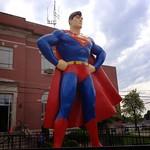
By the time we reached Metropolis around 3 p.m., the skies had clouded over with periods of drizzle. We entertained ourselves by posing with the giant Superman statue and cutouts in the center of town, then shopped for Superman T shirts, magnets, and other souvenirs. When we emerged, the skies had burst, which seemed like a good excuse to duck into Dippin Dots and celebrate our day’s lack of physical exertion by consuming lots of deliciously empty calories.
The weather wasn’t getting any less dark and wet, and Cairo was still a two-hour round trip. Again we compromised by agreeing to cross the Ohio to Paducah, Kentucky.
After a little discussion, we stopped at Fort Massac State Park, the oldest (1908) in Illinois. Located strategically on the Ohio, the site features a replica fort, including two barracks, three block houses, officers’ quarters, well, stockade, and fraise fence, as well as an outline of the 1757 French fort. I’d like to say how much I appreciated the history and the fort, but I was all too conscious of the rain beating on my borrowed poncho and of the mosquito hordes drilling into me. I can imagine how the common soldier felt on a warm, overcast summer’s day at Fort Massac. I still prefer Old Fort Niagara, where I heard mention of a dungeon.
It continued to pour as we crossed into Kentucky. At the exit, I noticed a Gander Mountain store. Still unhappy that, thanks to developing foot deformities I can no longer wear the great hiking shoes I’d worn only once or twice, I had J. pull into the mall. An hour or so later, we both emerged with waterproof hiking shoes, which we were going to need sooner than I expected.
Our last stop for the day was for a retro dinner at Parker’s Drive-In, where you can eat in your car as the rain pounds your car or in the large dining room.
And so back in the damp darkness to Elizabethtown and the Magnolia Cottage.
Again we set out for Cave-in-Rock for breakfast (and because the state park was on my must see list), and again we didn’t make it. While passing through Elizabethtown, west of Cave-in-Rock, J. spotted a short street leading to a big gazebo overlooking the Ohio River. At the end we found two impressive bed and breakfasts — the historic Rose Hotel (1812) to the east and the River Rose Inn (1914) to the west. Nearby the E-Town River Restaurant floats atop the river, connected to land by a gangplank.
The restaurant was to open at 11 a.m., so we took photos and checked out the gift shop at the Rose Hotel, which is operated by the State of Illinois. Photos in the gift shop show flood waters creeping up the lawn and up the side of their smaller gazebo, as well as a great blue heron taking advantage of the bountiful fishing opportunities.
At the E-Town River Restaurant, which sways gently back and forth with the water’s flow and the passing of boats, the server and I talked J. into ordering river catfish vs. pond catfish. The place and the fare aren’t fancy, but I’m told the fresh river catch is excellent if you like that sort of thing, the people are friendly, the experience is unique, and the views are marvelous — it proved to be one of those unplanned delights that help to make a trip extraordinary. Afterward, J. decided he wanted to stay at the River Rose Inn on Wednesday night, even though by then its far eastern location would be out of the way.
Ever since hearing its name, J. had had a burning desire to visit Whoopie Cat Lake (named for its former owner, Ernst “Whoopie Cat” Ralph). Miles down country and gravel roads, Whoopie Cat Lake is remote — in fact, it’s so remote that we never made it there, although I didn’t figure that out for another week or two. We found a sparkling blue lake surrounded by woods where two women were fishing — you would expect to come across Andy and Opie on its banks, whistling. Sure that we had found Whoopie Cat (we’d followed the signs), we took photos and savored the idyllic scene even as one of the women warned about ticks and Lyme disease. Later I found out we had stopped at Whoopie Cat’s sister lake, Tacumseh. The real Whoopie Cat is about a quarter mile away, reachable only by a foot path. On a map, its shape resembles that of a fish.
Our next stop was at Tower Rock Recreational Area, where we had difficulty finding the trailhead until a ranger who was about to leave pointed it out. It’s only one-eighth of a mile, overgrown and mostly uphill. At the top is another Ohio River vantage point from which we watched one of the longest barges I’ve ever seen.
Continuing east, finally we arrived at Cave-in-Rock and Cave-in-Rock State Park, also on the Ohio River, which served as a vantage point and base of operations for several gangs of murderers and thieves. Don’t expect a deep cave suitable for spelunking — it’s a hole in the rock with a good-sized fissure in the rock above that lets in daylight. I started to wonder what would happen to the cave if the New Madrid fault let rip — and glad I wasn’t going to be in the cave.
While walking up the wooden steps near the water, I spotted one of my favorite little critters — an anole, this one brown to match the wood. While anoles are common in places like Texas, they’re another sign that you’re not in a typical Illinois habitat anymore.
We tried the park’s lodge for dinner, but the restaurant is open only on weekends, which seems to be a recurring theme. We ended up at Rose’s Kountry Kitchen, where J. ordered fish (bluegill, I think). He’d decided that, when you’re so near the river that used to be their home, fresh fish has to be the order of the day every day.
Before leaving Cave-in-Rock, we considered taking the ferry to Kentucky, but, yes, I was the killjoy who nixed the idea (or voice of reason, depending on your point of view).
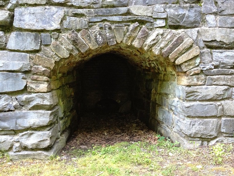
The compromise was to check out the Illinois Iron Furnace Historic Site, the only iron furnace structure in the state. Like Tacumseh and Whoopie Cat Lakes, the furnace doesn’t pull in out-of-towners. It’s a tall stone structure with furnaces on both sides, a little like a through-the-looking-glass effect. We were the only people there to take photos and to stoop into where the fires must have burned brightly and constantly. According to this, “it took forty men working in two shifts to keep the furnace in full blast.”
Across the road several families had gathered at a swimming hole, complete with ropes for swinging into the water — another place you might find Andy and Opie. While the children splashed happily, their parents stood around drinking beer and smoking as though high school were more than a recent memory.
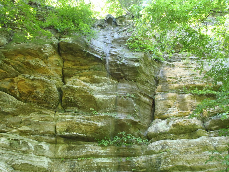
With the recent rain, J. thought Saturday, April 20 would be a good day to visit Starved Rock State Park — we might have a chance to see waterfalls powered by spring rains.
It sounded like a good idea. I’d been working from home during the rain, and when I looked out there seemed to be only the typical puddles — the kind you expect to see after a little rain. I’d seen flood warnings and heard about some flooded basements, but I had no concept of how much rain there had been or how bad the flooding was. This journey would open my eyes.
We met at Starbucks in Homewood (RIP, Caribou Coffee) and set out, making a few stops along the way — the surprisingly lovely Three Rivers rest stop on I80, where one of the vending machines sometimes includes Milk Bones for the well-traveled pooch, and Ottawa, Illinois.
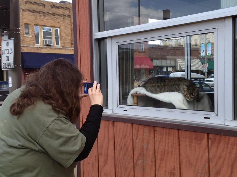
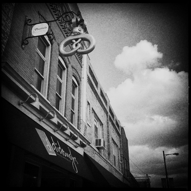
Our planned stop in Ottawa was Foothills Organics, which was moved recently from a house in Utica. On the way there, we noticed a pretzel shop. After stocking up on organic fruits, berries, vegetables, grains, and assorted goodies, we tried amazing pretzel-wrapped hot dogs — but not before checking out a happy cat lying in the window of the neighborhood law office. Who wouldn’t love a town where lawyers have set up a window seat, house, and toys for the resident cat in their office and where you can get hot dogs wrapped in buttery pretzels?
Not a legal beagleDidoughs in Ottawa, Illinois (no more)
Next stop — Utica, the gateway to Starved Rock State Park. After passing through Utica, you cross the Illinois River via a box girder bridge.
We didn’t make it through Utica, however. At the Willows Hotel, the town had turned into a lake, with an emergency boat and vehicles parked at its edge. Shop signs and lawn ornaments were half submerged, and at our feet a hose ran from the basement of a nearby house, spewing water back into the flood. I read later that flood stage is 21 feet and that the water had topped out at 33 feet. I’d never seen a flooded town before except in photos, and I was stunned by how far into town the river had encroached. Never could I have imagined it traveling that far.
Flooded Utica, Illinois
Going through Utica was out without a boat, so we turned toward Oglesby, where we could cross the bridge.
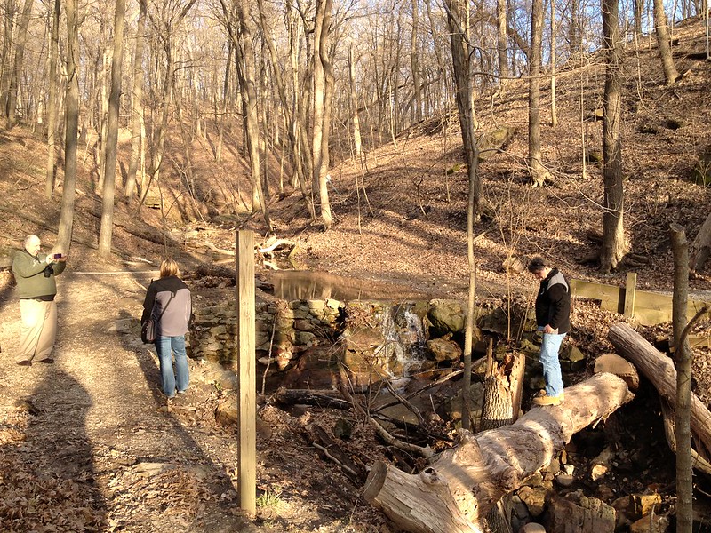
On arrival at Starved Rock Lodge, we saw that the road to the Visitor Center was closed, which is not surprising as the center is downhill from the Lodge and is separated from the water by a grassy picnic area. Update: Later I saw a photo of the Visitor Center partially submerged.
The Lodge’s front desk people told us that part of Matthiessen State Park was open, so we went there, walking down the many, many, steps that lead to an area above the water. Because the footbridge was muddy and ankle deep in water in places, I steered us to the left down an easy and mostly dry trail. Along the way, we heard a great horned owl calling, the traditional, “Who, who, who cooks for you?” I’ve heard them in the area before, but they remain elusive to the eyes. This one sounded distant.
We reached a point where you could cross the water to get to the rest of the trail, but I was out of steam, so I sat gingerly on the front edge of a bench tilted rakishly back while J. went on. While he was gone, a a young couple came from that direction. I told them they were headed toward the stairs and parking lot. “Oh, good; we are really lost,” the woman said. They must have been circling back without realizing it.
J. soon came back just as a middle-aged couple came along from the direction of the parking lot. A fallen tree lay above and across the stream, and the man decided it was meant to be a bridge. He wasn’t too sure of himself, though, and stopped halfway across. His wife didn’t seem too pleased. If the tree had become dislodged from the loose, sandy soil, he would have fallen onto a bed of rocks below, joined by a crashing tree trunk. I did’t want to see it, so I left just as J. took photos of the man posturing and of the couple.
More adventurous than IMatthiessen State Park
It was a glorious spring day in a glorious place, just what I needed to stave off growing stress and unease.
For a good couple of hours, right until we were halfway through Barrington Hills, Saturday’s destination was a mystery to me. I hadn’t quite heard the name and knew only that it was northwest, generally toward Volo Bog and Moraine Hills State Park. We made a few wrong turns and a few stops, including Fratello’s Hot Dogs, which has to be one of the best hot dog/hamburger joints I’ve stepped into — including strawberries in the strawberry shake.
At last I understood we were headed for Chain O’ Lakes State Park, about which I knew nothing. Having a name in mind made navigation easier, although the jaunt through Barrington Hills was an education in itself, an exposure to a way of life nearly as alien to me as almost anything I could imagine on another planet. Because we got off track so many times, I told J. I envisioned the local police being inundated with calls from nervous property owners about the 2004 blue Toyota Corolla pulling uninvited into their posh driveways. Even when we’d backtracked to the correct area, Google Maps us to the back gate for Chain O Lakes, which was closed. As J. suspected, we zigged when we should have zagged.
At last we arrived, at around 5 o’clock — leaving enough time to check out the little store and to look around a bit. We took the first and most obvious trail we found, which led into the woods. We headed in the general direction of what we thought was the nearest lake other than Grass Lake, which is where we’d parked. At one point, we emerged from the woods into the yard of a trailer at a campground, where a mix of expensive and not-as-expensive trailers, some basic pop-up (tent) campers, and a handful of pitched tents were ensconced in neatly delineated grounds. The place looked full or nearly so, and a pair of little girls raced past us joyously on their little pink bicycles, giggling and screaming. Enjoy it while you can — that obliviousness to the cares of life will never come again, at least not for me.
With some directions from a helpful camper, we found the road, crossed it, and made our way back to where I’d thought we should have gone. I rarely trust my instincts, although sometimes they’re right. Not always.
After passing through another campground, this one a little less upscale than the first but almost as full, we came to the colorful shores of Turner Lake, where it was really hard for me to deny that summer is over and autumn is here. While the trees are not at the height of color, and there’s still some green mixed in, the few photos I took are clearly autumnal. I wonder if I’ll have this much difficulty accepting winter when its time comes. I did find out later that Turner Lake isn’t part of Chain O Lakes.
By this time, it was getting too late to do much more exploring, especially as we took a few false turns walking and ended up needlessly wandering through more of both campgrounds than was necessary. An elderly woman at one of the better trailers told us the trail went into the woods at the next spot, and we made it back to the parking lot in a combination of twilight and moonlight. After trying to figure out if there was a way to walk around Grass Lake and shopping at the store (and depriving some camper of chicken and dumplings soup), J. tore himself away.
While driving through Fox Lake, we decided to check out Dockers for a potential future visit. When we found it, J. spotted fireworks across the lake, and I noticed a swan surrounded by an entourage of Canada geese. While the inveterate extrovert chatted with the only people sitting outside at Dockers, a couple, I sat on a bench near the water and watched the fireworks and the waterfowl in one of those perfect moments that soothe my fretfulness.
The plan had been to eat at the haunted Ole St. Andrews Inn, but when J. saw a Walker Bros. in Lake Zurich that was still open (with only one other group of patrons), there we landed for a delicious and ghost-free end to a lovely fall day.