↓
 

words and images

🇺🇦✏️✒️📚📔🌜dreamer 🌕 thinker 🌕 aspirant📱📷🚴‍♀️🏕🍄🌻

Menu
  • Home
  • Articles
  • Book Reviews
  • Letters
  • Photography
  • Poems & Stories
  • About Diane Schirf
  • Site Map

Tag Archives: historic fort

Fort Meigs in Perrysburg, Ohio, then home

words and images Posted on June 1, 2015 by dlschirfMay 2, 2020
June 1, 2015
Final leg through Ohio — Fort Meigs
13 photos

It was still overcast with on-and-off rain in Maumee, Ohio, where, still reluctant to return, we visited Georgette’s Coffee and Gift Shop (which carries, of all things, Solmates socks). We couldn’t leave without a walk around Fort Meigs in Perrysburg, which is closed on Mondays. Curses.

When Fort Meigs was built in 1813, it was the largest wooden walled fortification on the continent. As with Fort Massac in Metropolis, Illinois, Fort Meigs is a replica — for different reasons, wooden structures seem to be doomed to an early demise. Fort Meigs looked interesting, but its location and layout was no match for my favorite, Fort Niagara on the Niagara River at its mouth on Lake Ontario.

Back in town, J. spotted a purveyor of vintage candy that carries variations on the traditional Mallo Cup, so he picked up a lot — the Mallo Cup is a rare sight in the urban Midwest, or at least in the Chicago area.

At last we left the Maumee/Perrysburg area and drove through more on-and-off rain, with breaks at rest stop or two. At one we were able to get Hershey’s ice cream one last time (reminder: not affiliated with the candy company). Finally, we collected Petunia at the Hyde Park Animal Hospital. During her lengthy stay, she’d developed symptoms of feline herpes, a chronic respiratory illness, so we picked up L-lysine for her. We should have gotten a poncho for me, given how many times she was going to sneeze wetly on me in the next ten days. Home, sweet home. Chicago.

Posted in Adventure, Blog | Tagged historic fort, Ohio, photo | Leave a reply

Old Fort Niagara and Chestnut Ridge Park, or old favorites

words and images Posted on May 24, 2015 by dlschirfMay 2, 2020
May 24, 2015
Old Fort Niagara
Old Fort Niagara
40 photos
The sun room at the bed and breakfast, overlooking the wind generators and Buffalo
Feral cat the B&B owner was trying to coax
Can't get enough of the Grand Island Bridge
Grand Island bridge
DSC_8773
DSC_8774
DSC_8776
DSC_8777
DSC_8779
DSC_8781
DSC_8786
DSC_8791
DSC_8792
DSC_8797
DSC_8799
DSC_8803
DSC_8805
DSC_8808
DSC_8812
DSC_8814
DSC_8816
DSC_8817
DSC_8818
DSC_8823
DSC_8829
DSC_8831
DSC_8833
DSC_8836
My last view of the Grand Island bridge . . .
I remember this from years ago . . . could easily be a Chicago scene
Peace Bridge and water intake station
Chestnut Ridge Park
J's photo of the Eternal Flame Waterfall
Chestnut Ridge Park
Like IL, NY has random wind generators

After a leisurely breakfast and some moments in the sunroom overlooking the lake and the wind turbines, we packed and, after the now-traditional stop at Tim Horton’s, headed north on Route 5 to Old Fort Niagara. On Grand Island, we debated a detour to Beaver Island State Park, but there wasn’t enough time.

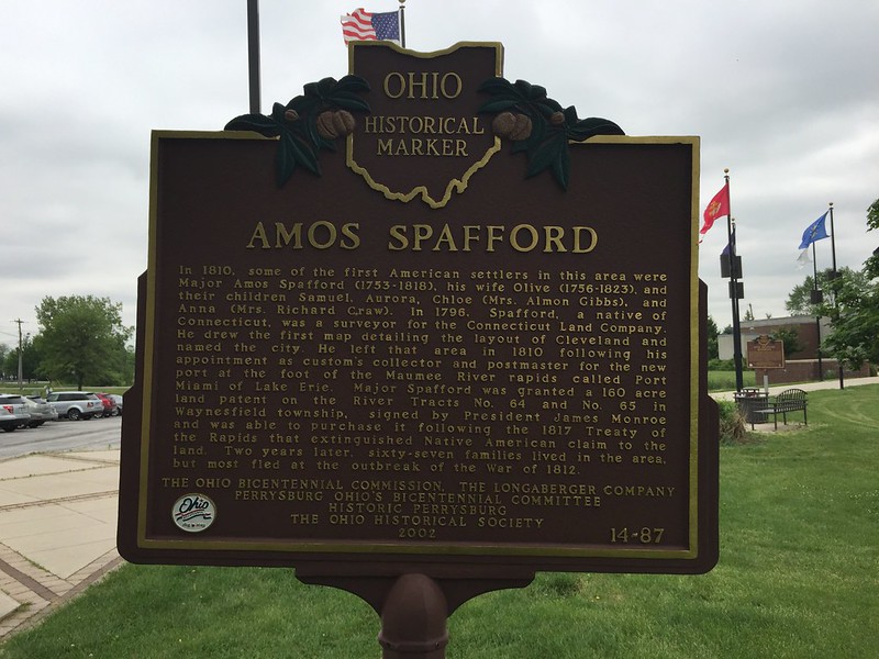
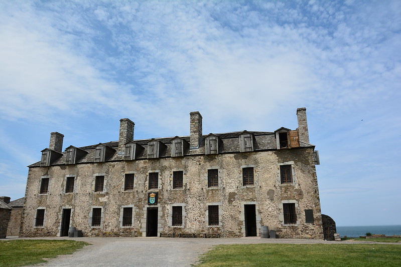
I’d been to Old Fort Niagara perhaps twice. Once a couple of my friends had come with us — I remember this because somewhere I have a closeup of our faces as we sat in the back seat of my dad’s van. Also among my photos there’s one of my dad and mom walking across a bridge or embankment in the middle distance. The enormous weight gain that had snuck up on him jutted out prominently, while a couple of yards behind him my mother struggled to keep her hair from blowing in the wind. It’s not a flattering photo, but I like it because it’s one of the few unposed photos I have of them together.

My dad may have taken me one more time, after my mother died and I had graduated from college. I can’t remember if we went to both Niagara Falls and Old Fort Niagara, or just Niagara Falls, but I recall eating lunch in a parking lot and feeling how odd and wrong it was to be on a little adventure without my mother.

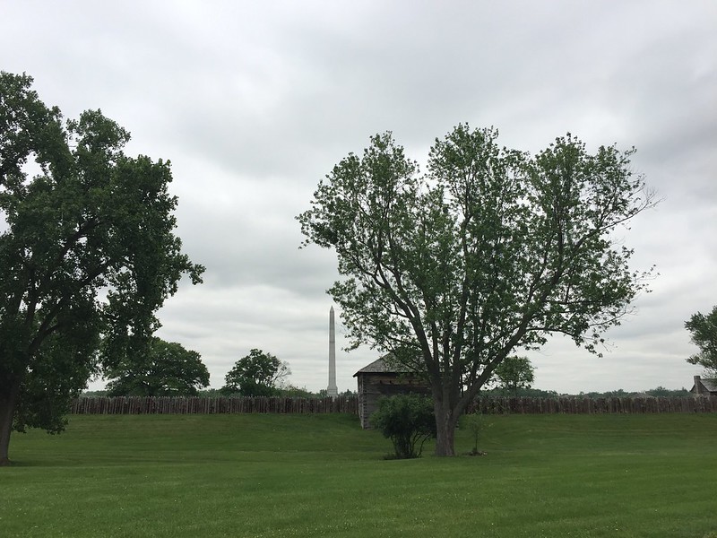
When I’d been to Old Fort Niagara before, I’d been struck by the number of college-age boys dressed in redcoats, firing muskets and cannons — funny to think that, like me, those kids have aged into their fifties. On this day, the fort wasn’t overrun by college-age redcoats, but by characters of various ages from several wars and conflicts, from pre-Revolutionary War to the Korean War and beyond — in tribute to Memorial Day. It was a little disconcerting to see GIs at the old fort.

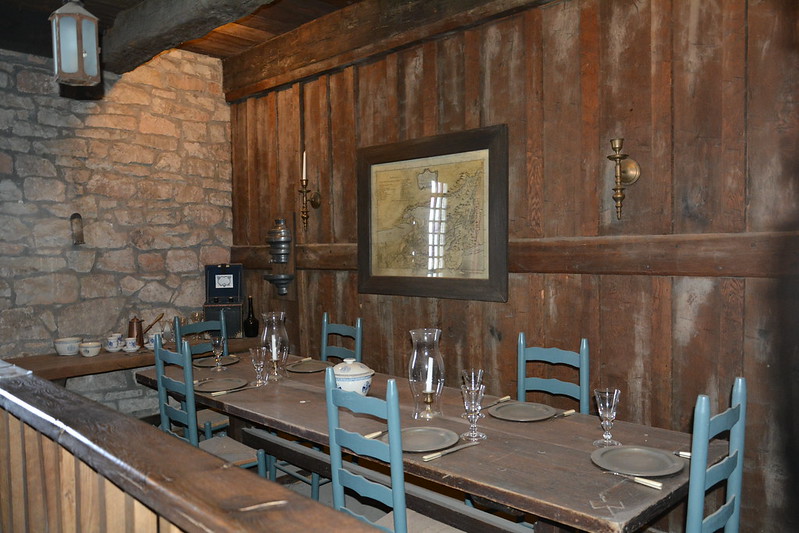
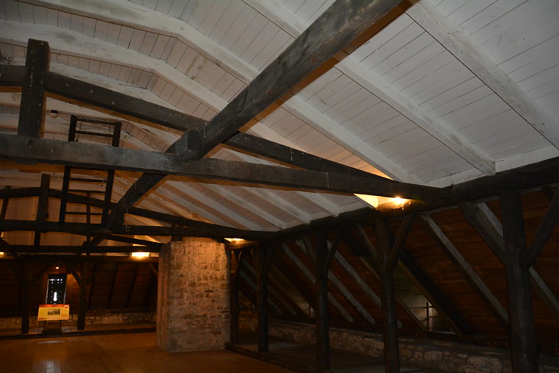
We listened to part of a long presentation about uniforms and the story of Betsy Doyle, who during the War of 1812 ran hot shot up the stairs of the fort’s French Castle. I struggled to get up the stairs even once without toting deadly hot shot.

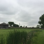
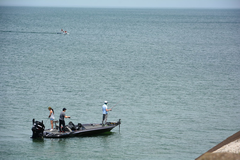
I’m sure I saw a lot more of the fort on this day than I had before, but I’ve never seen as much as I could. It was a beautiful day, too, with a slightly hazy look that I associate with this area, located across from Canada at the mouth of the Niagara River. It truly feels like a place out of time.

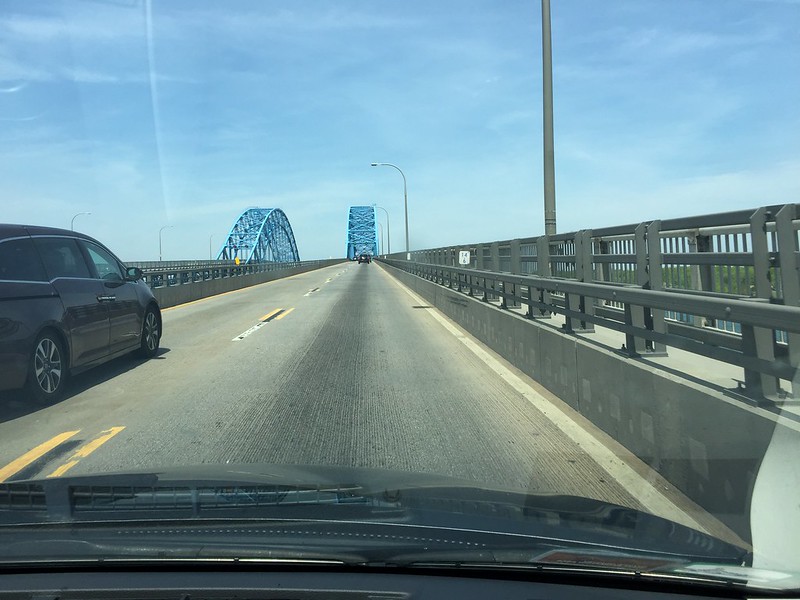
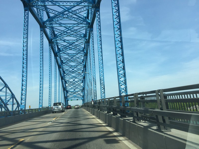
On the return trip, i took a photo of what I’d always thought was a wrecked barge jutting up from the Niagara River north of the Peace Bridge, with trees thrusting through the deck. Since then I’ve read it’s an old water intake station. There go all my assumptions and memories, as I remember my dad pointing it out to me.

On our last pass down Route 5, we made a final stop at Red Top Hots, although it wasn’t quite the same without BL freezing in the lake breeze. After stopping at the house to say goodbye to BL and family, we picked up a perfect souvenir of western New York — Weber’s horseradish mustard, which I don’t remember from my childhood at all.

Next we hurried to Chestnut Ridge Park to find the eternal (not really — it gets blown out frequently but can be relit) flame waterfall. Google Maps seemed determined to send J’s car down a footpath through dense woods, but I wasn’t convinced. As we meandered around a bit, seeing lots of high schoolers in the backs of pickup trucks (which surprised me), finally we asked a man walking his dog where to go. It turns out there’s a parking area for the trail off 277 that was easy to find, but in the meantime we’d lost an hour or an hour and a half of daylight by the time we arrived at the trailhead. I wish I’d remembered my way around Chestnut Ridge! We did get a brief glimpse of the toboggan run . . .

The trail to the falls isn’t too rough, although it’s steep in places, with rocks and logs in the way along the creek. By this time, fatigue had set in from several days of walking and standing, and I couldn’t make it past an uneven part of the trail near the water, even as young people leapt past me and others walked by without a care. As J. continued on, several people offered to help me, but I was physically and psychologically stuck, deterred by what may seem to most to be a tiny obstacle, but it was too much for me at that point in time. J. did see the falls, which he said were farther off than he thought based on what people were telling him. Although there wasn’t a lot of water, the flame was lit. I wish I’d seen it.

We left for Geneseo at about 8:15 p.m., traveling through East Aurora, Warsaw, and Perry on Route 20A, all of which J. liked. One deer crossed the road, and J. spotted a second. Along the way we passed dozens of wind turbines, just like in parts of Illinois on our way back from the Illinois River Road. Route 20A is more twisty than most roads in Illinois, and J. found himself hard pressed to keep out of the way of impatient locals, pulling over when possible to let them pass. At last, shortly before 10 p.m., we arrived at Temple Hill Bed & Breakfast, to be greeted by our friendly host, her friendly dog, and welcome rest after an exhausting but exhilarating few days.

Posted in Adventure, Blog | Tagged county park, Hamburg, historic fort, New York state park, photo, state park | Leave a reply

Metropolis, Illinois, and Paducah, Kentucky

words and images Posted on May 21, 2013 by dlschirfMarch 11, 2023
Shawnee National Forest/Cache River road trip: Day 4
May 21, 2013
Metropolis, Illinois
13 photos
Superman in Metropolis
Me as Supergirl
Fort Massac
J. C. Blair
Four flags over Fort Massac
Fort Massac State Park
Bridge to Paducah, Kentucky

After packing our gear and bidding farewell to the Outdoorsman cabin, we pulled out onto the road, only to find the lane blocked by a sheriff’s car that had come out of nowhere and cut us off in the blink of an eye. There he isn’t, there he is. J. said, “What? Am I in the wrong lane?” and started to pose the same question to the sheriff when he ambled over. He asked if we had been staying at Willowbrook Cabins. “I saw you pulling out and wanted to check,” he said affably. “I like to keep an eye on the place.”

Seeing the look on our faces and the bags piled on the bag seat, he assured us we hadn’t done anything wrong, returned to his car, and took off. The owner of Willowbrook Cabins can rest easy, knowing that the sheriff is Johnny on the spot when the unsuspecting tourists leave.

After eating breakfast in Elizabethtown at Ma and Pa’s restaurant and picking up the key to the Magnolia Cottage at the River Rose Inn, we returned to Golconda, where there is both a local grocery and pharmacy, as well as more river views. The weather had turned overcast and iffy, which made it a good day for a more urban adventure.

Thanks to Google Maps (accessible from Golconda), we ended up on Homberg Road, a winding country road with charm and character. It’s part of the Trail of Tears, down which the Cherokee were drive westward to Oklahoma, with thousands suffering and dying along the way. Although I’ve read about the Trail of Tears, until I saw the signs I’d had no idea (or had forgotten) that part of the trail passed through Illinois. There’s even a Trail of Tears State Park near the Mississippi. It’s a very long way around to get to Oklahoma.

A little way down Homberg Road, a big black dog ran out from a yard, planted himself in front of the car (stopped to avoid hitting him), and expressed intentions that didn’t seem welcoming. J. was afraid he’d stand on his hind legs and scratch the car, but he contented himself with circling in a menacing manner. Finally he ran back into his yard (perhaps someone had called him) and let us pass, although he didn’t seem happy about it.

Most of the drive on Homberg was partly sunny, which made it easier to spot a male indigo bunting flitting among the roadside brush. This is their favorite type of habitat, and over the next few days we found out that they’re not an uncommon sight in southernmost Illinois — although less common than the turkey and black vultures that seemed to wheel above us everywhere.

By the time we reached Metropolis around 3 p.m., the skies had clouded over with periods of drizzle. We entertained ourselves by posing with the giant Superman statue and cutouts in the center of town, then shopped for Superman T shirts, magnets, and other souvenirs. When we emerged, the skies had burst, which seemed like a good excuse to duck into Dippin Dots and celebrate our day’s lack of physical exertion by consuming lots of deliciously empty calories.

The weather wasn’t getting any less dark and wet, and Cairo was still a two-hour round trip. Again we compromised by agreeing to cross the Ohio to Paducah, Kentucky.

After a little discussion, we stopped at Fort Massac State Park, the oldest (1908) in Illinois. Located strategically on the Ohio, the site features a replica fort, including two barracks, three block houses, officers’ quarters, well, stockade, and fraise fence, as well as an outline of the 1757 French fort. I’d like to say how much I appreciated the history and the fort, but I was all too conscious of the rain beating on my borrowed poncho and of the mosquito hordes drilling into me. I can imagine how the common soldier felt on a warm, overcast summer’s day at Fort Massac. I still prefer Old Fort Niagara, where I heard mention of a dungeon.

It continued to pour as we crossed into Kentucky. At the exit, I noticed a Gander Mountain store. Still unhappy that, thanks to developing foot deformities I can no longer wear the great hiking shoes I’d worn only once or twice, I had J. pull into the mall. An hour or so later, we both emerged with waterproof hiking shoes, which we were going to need sooner than I expected.

Our last stop for the day was for a retro dinner at Parker’s Drive-In, where you can eat in your car as the rain pounds your car or in the large dining room.

And so back in the damp darkness to Elizabethtown and the Magnolia Cottage.

Posted in Adventure, Blog, Photography | Tagged historic fort, Illinois, Illinois state park, National Forest, photo, Shawnee, state park, travel | Leave a reply

Recent Posts

  • RANI incense cones
  • Backyard games
  • German Winter Nights by Johann Beer
  • Hungry squirrel and red-tailed hawk
  • Lodgings I have known: Arrowhead Lodge, Kabetogama, Minnesota

Top Posts & Pages

  • "I'd rather be slowly consumed by moss"
  • Everyday poetry: "Ode to Billie Joe"
  • Relics: Portable typewriter, Royal Sabre style
  • Maple Sugar Time at Chellberg Farm, 3/7/2020
  • Golconda, Burden Falls, Bell Smith Springs Recreation Area
  • Lodgings I have known: Willowbrook Cabins, Shawnee National Forest
  • Wopsononock Mountain, or Wopsy, in Blair County, Pennsylvania
  • Book review: The Collected Stories by Paul Theroux
  • Book review: The Way to Rainy Mountain
  • Book review: House Made of Dawn

Other realms

  • BookCrossing
  • Facebook
  • Goodreads
  • Instagram
  • LibraryThing
  • Twitter
  • YouTube

Good viewing

  • Art of John Taft
  • bensozia
  • Bill of the Birds (no longer updated)
  • BrontëBlog
  • Edge
  • Karen Winters Fine Art
  • Mental Floss
  • Musical Assumptions
  • National Geographic News
  • Orange Crate Art
  • Sexy Archaeology
  • The Creative Journey
  • The Introvert's Corner
  • The Pen Addict
  • The Raucous Royals
  • Thrilling Days of Yesteryear
  • Woodclinched
  • World-O-Crap

BOINC Stats

Copyright © 1996–2023 Diane Schirf. Photographs and writing mine unless noted.
↑