↓
 

words and images

🇺🇦✏️✒️📚📔🌜dreamer 🌕 thinker 🌕 aspirant📱📷🚴‍♀️🏕🍄🌻

Menu
  • Home
  • Articles
  • Book Reviews
  • Letters
  • Photography
  • Poems & Stories
  • About Diane Schirf
  • Site Map

Tag Archives: Minnesota

Post navigation

← Older posts

Lodgings I have known: Clearwater Lake Lodge

words and images Posted on February 13, 2020 by dlschirfMay 11, 2020

It’s high time I wrote about some of the places I’ve stayed — not the chains, but bed and breakfasts, inns, and other local places.

Steeped in history, August 5, 6, and 7, 2014

Like Rippon-Kinsella House in Springfield, Illinois, Clearwater Lake Lodge is listed on the National Register of Historic Places. Located off the Gunflint Trail west of Grand Marais, Minnesota, Clearwater Lake Lodge overlooks the lake and palisades, although I remember a healthy stand of conifers filtering the view. It’s also a great spot for getting outfitted for a Boundary Waters Canoe Area Wilderness adventure.

Arrival at Clearwater Lake Lodge
August 5, 2014
National Register of Historic Places

At Clearwater Lake Lodge, I thoroughly enjoyed: a lengthy thunderstorm that started after we had carried most of our things in, watching small shapes (likely bats) flit around in the inky darkness, the view of the lake through the trees from the back porch, the view of the lake from the imaginatively named Suite A, a brief canoe outing and the view of the distant palisades before black flies ate my ankles, the gift shop, and the comfortable main room.

With places to go and things to see, I didn’t have nearly enough time at the lodge.

At breakfast I found out one of the employees was a descendant of the original owners. I think she said she had never been in a canoe. I couldn’t imagine.

A stay at Clearwater Lake Lodge forces you to give up your constant attraction to the online world. Daytime’s slow satellite connection is limited (and a guest had inadvertently used up the monthly allotment on videos). In the wee hours, access was unlimited, but the cloud cover and/or the trees, which I loved, seemed to make it erratic. You can almost get away from it all and focus on the Gunflint Trail experience you can’t have anywhere else.

Below is part of the Clearwater Lake Lodge entry for the National Register of Historic Places, aka places I hate to leave . . .

The oldest surviving guesthouse on the Gunflint Trail, Clearwater Lodge is historically significant for its pioneering, and continuing, contribution to the Cook County tourist industry.

In 1893, the Cook County Board of Commissioners finished the last stretch of road linking Grand Marais to Gun Flint, a mining community about 45 miles north on the Canadian border. Although the completion of the “Gunflint Trail” was primarily a testimony to the political power of the county’s mining interests, the road was also a boon to homesteaders who settled the area during the early 1900s.2 Among these early residents were Charles (“Charlie”), and Petra Boostrom, who, in 1916, purchased 80 acres of land on the western shore of Clearwater Lake, just east of the Superior National Forest. There the Boostroms erected a small log cabin. Over the next ten years, Charlie earned a reputation as one of the area’s foremost trappers and hunters.

During the 1920s, an increasing number of tourists discovered the woods and lakes of Cook County, and Charlie found an increasing part of his livelihood as a guide for sport hvinting and fishing parties. To capitalize on the emerging tourist trade, he and Petra constructed Clearwater Lodge in 1925-1926. Completion of the building coincided with the construction of an automobile road connecting the new resort to the Gunflint Trail. Over the next two decades the Gunflint Trail developed into a major vacation spot, and Clearwater Lodge earned a statewide reputation for its hospitality. After the Boostroms retired from the tourist business in 1945, Clearwater Lodge went through several changes in ownership until, in 1964, it became the property of Jack (“Jocko”) Nelson and his wife Lee. The Nelsons renamed the resort “Jocko’s Clearwater Lodge.” Although Jack Nelson died in 1978, his widow continues to operate the lodge as a summer resort.

Untitled
Clearwater Lake
Clearwater Lake before the storm?
Weird storm lighting
Toward the Clearwater Lake Lodge gift shop
Entrance by gift shop
Clearwater Lake Lodge, Suite A
Cozy room
Palisades from canoe level on Clearwater Lake
Palisades from canoe eye level
Moon at Clearwater Lake
Moon over Minnesota
Morning view from Clearwater Lake Lodge porch
Morning on the back porch
Main room at Clearwater Lake Lodge
Main room
Main room at Clearwater Lake Lodge
Main room
Clearwater Lake Lodge
I’m a lumberjack, and I’m okay . . .
Leaving Clearwater Lake Lodge
Hated to leave . . .
Posted in Adventure, Blog | Tagged friend, Gunflint Trail, lodgings, Minnesota, National Register of Historic Places, photo, travel | 5 Replies

Pigeon River High Falls, Grand Portage State Park, Minnesota

words and images Posted on October 21, 2014 by dlschirfDecember 26, 2019

Until I get around to writing about this summer’s visit to Minnesota, here’s a compare and contrast of High Falls in Grand Portage, Minnesota, from one summer to the next — quite a difference in the volume of water.

July 2013:

Pigeon River High Falls, Minnesota

Like Niagara Falls, with Canada on the other side

August 2014:

Not looking as Niagara-like in August 2014

Not looking as Niagara-like in August 2014

And in miniature for fun:

Pigeon River High Falls, miniaturized

Pigeon River High Falls, miniaturized

Posted in Blog, Photography | Tagged Minnesota, Minnesota state park, photo, waterfall | Leave a reply

Day 11 in Minnesota: All good things

words and images Posted on August 11, 2014 by dlschirfMay 14, 2022
August 11, 2014: Baptism River Inn to Palisade Head to Northern Lights Roadhouse and Pub to Gooseberry Falls State Park to Duluth to Superior to Pattison State Park to Chippewa Falls
On which the rain continues, but lets up enough for a quick walk to Gooseberry Falls, and we see the sun set from Big Manitou Falls
Gooseberry Falls State Park, Pattison Park
22 photos
Baptism River Bed & Breakfast
Baptism River
Lake Superior
Lake Superior
Northern Lights Roadhouse (before June 2018 fire)
River at Gooseberry Falls
Gooseberry Falls
Gooseberry Falls
Gooseberry Falls in miniature
Gooseberry Falls
More miniaturized tree roots at Gooseberry Falls
Miniaturized tree roots at Gooseberry Falls
Miniaturized trees at Gooseberry Falls
Leaving Minnesota
Big Manitou area
Sunset at Big Manitou
Big Manitou Falls
Big Manitou Falls
Sunset at Big Manitou
Tunnel at Big Manitou
Pattison Park — Manitou Falls

Now the trip really was winding down under more gray skies with occasional rain. After taking some photos of the low but wild-looking Baptism River, we left Baptism River Inn and took a brief detour to Palisade Head, hoping for a slightly better view. Lemon Wolf Café isn’t open on Mondays, so we settled for Northern Lights Roadhouse and Pub, where we were seated on an enclosed porch overlooking the lake and the downpour for a relaxed, homely lunch.

Because of the rain, we thought about skipping Gooseberry Falls State Park, but I knew I’d have have regrets if we drove on by. We, along with many others, waited under the shelter of the visitor center porch as the rain came down, watching drenched visitor after drenched visitor return on the trail.

After a time the rain slowed and stopped, so we took off as fast as we could toward the falls. With the overcast sky, the lighting was poor and the colors washed out, but I continued to work on improving my waterfall photography techniques. We had been there for a while — maybe a half hour? — when we sensed the weather shifting again, so hightailed it back to the visitor center just as the clouds opened up again.

South of Gooseberry Falls State Park we came to the Silver Creek Cliff Tunnel, which was bored through the volcanic rock between 1991 and 1994. We stopped at the wayside to walk along the trail between the tunnel and the lakefront, but after a few feet the rain, which had slowed somewhat, picked up again, and I hurried back to the shelter of the car while J. opted to hang in and get drenched.

Further south, we passed through Two Harbors in search of a coffee shop, but if I remember right the one wanted to go to was closed. Further along we stopped at SuperOne to pick up containers for all our leftovers. At this point, it truly felt like the wilder parts of the Gunflint Trail and North Shore were well behind us — we were back in town.

Too, too soon we were in the city, Duluth, passing what appeared to be ritzy historic mansions, one of them a museum. We said goodbye to Highway 61, which merges into I-35 at 26th Avenue East. It was like a farewell to a beloved friend you may never see again.

It had become sunnier, and Duluth in full daylight is not nearly as eerie as it had been the first time I passed through in July 2013, at twilight on a misty night that made the city and hills appear as ephemeral as Brigadoon.

We pushed on to Superior, Wisconsin, and Red Mug Espresso, a half-underground coffee shop steeped in colorful art for sale and housed in a historic building. Their website cites one of Mike Royko’s favorite ideas:

Sociologist Ray Oldenburg talked about the importance of the “third place” — a community anchor, separate from home and work, where people feel welcome, socialize, and meet friends new and old.

(For Royko, his third place was a bar.)

“It’s a place to live your life,” the site adds. I would if only it were closer. As with so many places I’ve found on journeys both short and long, it was hard to leave this experience behind, but we still had plans for the remaining daylight.

One of these plans, a visit to Superior Entry Lighthouse, was thwarted by a combination of diminishing daylight time and the bumpy nature of Moccasin Mike Road, which isn’t that long. We couldn’t guess at what Wisconsin Point Road would be like on the narrow strip leading to the light, so we agreed to turn back on Moccasin Mike (I just wanted to say that name again) and head for our next out-of-the-way stop, Pattison State Park.

After driving down what seemed like endless country roads, we arrived at Pattison State Park, which is home to Wisconsin’s highest waterfall, Big Manitou Falls. You’d think it’d be easy to find a 165-foot-high waterfall, but it was surprisingly difficult — maybe because we were tired and easily confused by the directions some people we ran into gave us. The first spot we found seemed to be above the falls and didn’t offer a view. J. went one way while I went another. My way led to a platform on a cliff side overlooking the falls. To my left below, the falls roared. To my right, the sun was headed toward the horizon in a show of bright clouds and dark hills. The view on both sides helped make up for missing Superior Entry. Alas, we missed Little Manitou Falls, which are a few miles upstream.

With the sun setting, it was time to move on and get as far south in Wisconsin as we could. We made it — with effort — to Chippewa Falls, where we stopped at a chain hotel with no rooms. The very helpful desk attendant called two other chains — also no vacancies. She told me that’s not unusual for Chippewa Falls, which is a hotbed of business. The last place she called is, like the Bates Motel, somewhat off the major road. For that reason perhaps, they had available rooms. Avalon Hotel and Conference Center is a hybrid hotel-motel; many rooms have both inside rooms like a hotel and outside doors like a motel. Nervous guests can get a room with an inside door only. After a long day and the experience of last year, all that mattered to me was being able to crawl into a comfortable bed before the wee hours arrived and getting rested for the long day ahead.

Posted in Adventure, Blog, Photography | Tagged Minnesota, Minnesota state park, photo, waterfall, Wisconsin, Wisconsin state park | Leave a reply

Day 10 in Minnesota: Cascade River and Tettegouche State Parks

words and images Posted on August 10, 2014 by dlschirfMay 14, 2022
August 10, 2014: Baptism River Inn to Lutsen to Cascade River State Park to Tettegouche State Park to Palisade Head to Lemon Wolf Café
On which the weather turns a little dreary
Cascade River and Tettegouche State Parks
12 photos
Cascade River State Park
Cascade River State Park (miniaturized)
Tettegouche State Park
At Palisade Head

After breakfast courtesy of our hostess, we crossed the scary, narrow bridge toward the outside world and headed north to Cascade River State Park. On the way, we detoured at Lutsen, where Moondance Coffee House called. How can anyone go to a chain coffee shop when there are gems like Moondance in this world? (Okay, it’s a bit far for the average person.)

The cascades of the Cascade River are an easy, relatively short walk from the parking area (short if you don’t photograph every scrap of the fungus along the way). There are three cascades we could see. I watched some hardier people go up a trail that runs along the river, and we followed them partway. As with everywhere else in northern Minnesota, I’m sure we scratched only the surface of Cascade River State Park. This visit was a little bittersweet because this was the last time we’d visit one of the more northern parks on Highway 61.

By the time we arrived at the impressive Tettegouche State Park visitor center, the weather had turned cloudy and threatening. After spending some time shopping and relaxing at the visitor center, we decided to try to make it to Shovel Point, which is one of those “must see” places. By now, however, I was miserably fatigued and couldn’t get very far, the sky was dreary and uninteresting, and it was spitting enough rain every now and then to be a little uncomfortable without rain gear handy, so I didn’t get far and J. didn’t get much farther. We did get some okay photos, and we drove to Palisade Head for a panoramic if gray view of Lake Superior. I remembered Palisade Head from last year, to my surprise, because of the steep, twisty, narrow, partly one-lane drive up. It felt like returning to an old friend.

Our final stop before returning to Baptism River Inn was another old friend, Lemon Wolf Café in Beaver Bay. It seemed less crowded than last year, but the soup with wild rice was delicious, and so was everything else we ate — once again undoubtedly undoing any health benefits we would have gained from the day’s walking.

The sky was opaque with clouds, so now we were fairly certain we’d see no aurora borealis on this trip. I’d stand out in a downpour for that . . .

Posted in Adventure, Blog, Photography | Tagged friend, Minnesota, Minnesota state park, photo, waterfall | 2 Replies

Day 9 in Minnesota: Devil’s Kettle and Kadunce River

words and images Posted on August 9, 2014 by dlschirfJuly 17, 2021
August 9, 2014: Grand Marais to Judge C. R. Magney State Park to Kadunce River to Baptism River Inn
On which I spend a goodly amount of time seeking the devil or at least his kettle
Devil’s Kettle at Judge C. R. Magney State Park
15 photos
Grand Marais
Grand Marais
Colvill
Devil's Kettle trail
Devil's Kettle
Devil's Kettle trail
Devil's Kettle in miniature
Brule River
Brule River
Devil's Kettle
Fungus
Devil's Kettle trail
Trapped groundhog
Kadunce River at Lake Superior
Kadunce River flowing into Lake Superior

After some confusion about the length of stay at Shoreline Inn (J. thought it was two days), we relaxed on a deck overlooking the beach until the sun became too much, then set out for the next destination, with a brief detour to the Grand Marais Pharmacy — a traditional pharmacy housed in a log-style building.

Our destination was Judge C. R. Magney State Park, which we had missed last year and which I later discovered is home to a not-to-be-missed attraction — Devil’s Kettle. More than an attractive waterfall, Devil’s Kettle is where half of the Brule River, split by a rock formation, flows merrily on its obvious course to Lake Superior. On the other side of the rock, half of the Brule pours into the “kettle,” where it disappears forever, at least in the imagination. No one knows for sure where it reconnects with the Brule, if it does, or if it flows underground somehow to Superior. According to geologist John C. Green:

One [theory] is that, after dropping down the pothole, the river runs along a fault underground, or as a variant, that it enters an underground channel and comes out somewhere under Lake Superior. Both of these ideas have one valid aspect in common: they recognize that water must move downhill.

But the main problem is creating a channel or conduit large enough to conduct the impressive flow of half the Brule River! Faulting commonly has the effect of crushing and fracturing the rock along the fault plane. This could certainly increase the permeability of the rock — its capacity to transmit water — but the connected open spaces needed to drain half the river would be essentially impossible, especially for such a distance.

Furthermore, there is no geologic evidence for such a fault at the Devil’s Kettle. Large, continuous openings generally do not occur in rocks, except for caves in limestoneterranes. The nearest limestone is probably in southeastern Minnesota, so that doesn’t help… Maybe the Devil’s Kettle bottoms out fortuitously in a great lava tube that conducts the water to the Lake… Unfortunately for this idea, they are not the right kind of volcanic rocks.

Rhyolites, such as the great flow at this locality, never form lava tubes, which only develop in fluid basaltic lava. Even the basalts in this area may not be the “right kind”, being flood basalts that spread laterally as a sheet from fissures, not down the slopes of a volcano. No lava tubes have been found in the hundreds of basalt flows exposed along the North Shore.

Furthermore, the nearest basalt is so far below the river bed, and even if it did contain an empty lava tube (very unlikely after its long history of deep burial) the tube would have to be both oriented in the right direction (south) and blocked above this site so that it isn’t already full of debris. And there are no reports of trees or other floating debris suddenly appearing at one spot offshore in Lake Superior. The mystery persists.

How could I miss such an opportunity? This was a longer walk, my energy levels were subsiding, but we had read that there were a few strategically placed benches along the way. And I was highly motivated to push myself. We found the parking area and the signs and launched ourselves down the trail, crossing the Brule. J. quickly became sidetracked by the multitude of mushrooms in the park, so I went ahead. This is a well-marked, well-traveled path, but Judge C. R. Magney is largely untamed, and most of it is inaccessible. As this was the day’s only planned activity, I felt less pressured to hurry. Along the way, I came upon an overlook with a bench and a view of some waterfalls. Also on the way we stopped at a place where you can walk out on to the rocks by the river — a wild spot.

Later J. caught up with me, and we found there are a lot of stairs down (which means a lot of stairs up on the return). Further along, after we’d gotten separated again, I came to another set of steps and fell up the first high one, which made me even weaker with laughing in front of a couple who was sitting there. Half was the humor of how silly I must have looked; the other half was relief I didn’t crack my kneecap.

I wasn’t sure I was going to make it but I did reach Devil’s Kettle — keeping the promise to myself to see it was well worth discomfort on the way. We spent some time at one overlook, then moved on to a slightly lower one, all the while taking photos. Like the other waterfalls we’d seen this year, Devil’s Kettle was running lighter than it sometimes does — I’ve found a video in which a torrent surges over the rhyolite rock obstruction, almost obscuring the split in the Brule. Wherever the kettle half of the water goes, it must be able to accommodate a prodigious volume.

On the way out of the park we disturbed a groundhog, who ran to a drain for cover — and found himself trapped. I took photos and videos as he looked around, trying to figure a way out, but we soon left him in peace.

We stopped at the spot where the Kadunce River flows into Lake Superior, which again was calm. It’s fascinating to think about all that water winding its way for several miles through the woods, only to disperse itself into the breadth and depth of an inland sea, from where it will touch who-knows-how-many people. I looked upstream, which looks like it would be a beautiful walk. I’ve read since that from this spot you can walk over six Kadunce waterfalls in about a mile or so when the water is running low. I wish I had known that sooner — I might have planned a morning or afternoon around it.

Our next stop was at the Dairy Queen in Grand Marais, where we undid any health benefits we’d gotten from walking over the slightly uneven terrain and the steps down and up at Judge C. R. Magney State Park.

We headed south on 61 with few specific plans for the next couple of days and with a sense that our vacation was quickly coming to an end. We found the area we were looking for easily enough, but pulled up at a house that didn’t look like our destination. No doubt used to bewildered tourists, a woman came out and told us how to get to Baptism River Inn — we’d missed the turnoff in the dark, which isn’t surprising. It’s reached over a low, narrow bridge with minimalist if any guardrails. We arrived a little before 10 p.m., to find that hosts and guests were tucked in for the night — good idea.

Posted in Adventure, Blog, Photography | Tagged friend, Minnesota, Minnesota state park, photo, waterfall, wildlife | Leave a reply

Day 8 in Minnesota: Isle Royale National Park

words and images Posted on August 8, 2014 by dlschirfMay 3, 2020
August 8, 2014: Grand Portage to Isle Royale National Park to Grand Portage National Monument to Grand Marais
On which I don’t see a moose but do see mergansers and find out that “moose is a myth”
Isle Royale National Park
30 photos
Heading toward the Isle Royale ferry
Witch tree in rock
From the Isle Royale Ferry
Isle Royale ferry
Wreck of the America
Windigo at Isle Royale National Park
Isle Royale ferry
Isle Royale National Park
Fungus
Serious hiker — wish I had his stamina
Miniature world
Fungus
Miniature world
Sunning mergansers
Look — pretty things!
Isle Royale National Park
Resident of Isle Royale National Park
My first amphibious aircraft sighting
Windigo rangers
Rock of Ages light
Grand Portage Island
Beaver House in Grand Marais
Moon and gull in Grand Marais

We arrived bright and early for the boat trip to Isle Royale National Park and to our delight were called very early in the boarding process — we could get our choice of seats. The weather was warmer and sunnier than last year, so we didn’t notice the cold in the stern area. Being by now seasoned veterans of one previous trip, we knew where to look for the “witch tree,” the wreck of the America, and the Rock of Ages light (best photographed on the return trip, when the pilot navigates around the light slowly). The trip seemed shorter, maybe because we knew how long it would take and we weren’t shivering the whole way.

At Windigo, once again we spent time at the store and visitor center, but this time the flocks of butterflies around the shrubs near the dock were gone. I had been hoping to get some better photos of them this year. We met a guy who’d walked from the other end of the island, but it sounded like he hadn’t run into a moose on his week-long journey.

We headed for the campground, where we wandered around and checked out the primitive campsites (three-sided shelters with an opening of netting — very cozy). On the way, we passed some odd structures on slight hillside. According to the sign, they’re part of the park’s minimally invasive sewage system. I thought about the guy we’d just met and wondered if he was going to try out the short, expensive showers at Windigo’s nearby bathroom (several dollars for a few minutes).

J. found where a previous camper had left his mark, “Moose is a myth.” We didn’t see much wildlife, maybe because it was a few weeks later in the summer. I found only the remains of what may have been a rabbit, strangely unconsumed. On the way back, we passed mergansers sunning themselves on a rock.

At the dock, again we were called early in the boarding, so this time J. didn’t have to stand on the starboard side getting drenched with cold spray. We were in a good spot to get photos of the Rock of Ages light, which was perfectly illuminated in the afternoon sun.

After returning we had some time, so we went to the Grand Portage National Monument visitor center. The general area was mobbed as there was some kind of reenactment going on. The Monument overlooks Grand Portage Bay and Grand Portage Island, formerly known as Isle au Mouton and Pete’s Island. It’s a beautiful view in the late afternoon sun.

Our next stop was at Grand Marais and Shoreline Inn. Every herring gull along the North Shore seems to lurk among the buildings in Grand Marais, maybe because that’s where the tourists, and the tidbits that come with them, are. Perched along most of roof lines in sight, they cried and cried and cried during the evening, most likely settling down later so they could start up again in the morning.

Back near the Gunflint Trail, J. told me a co-worker had recommended the Gunflint Tavern, which was very busy. Halfway through dinner, though, I felt sick and woozy (unrelated to dinner), so left J. and walked back to Shoreline Inn, still guarded by gulls on the roof. The evening air helped, and the night view of the shore and the lake was lovely, a peaceful end to a full and filling day.

Posted in Adventure, Blog, Photography | Tagged friend, lighthouse, Michigan, Minnesota, National Monument, National Park, National Park Service, photo | Leave a reply

Day 7 in Minnesota: Leaving the Gunflint Trail, heading north

words and images Posted on August 7, 2014 by dlschirfMay 3, 2020
August 7, 2014: From Clearwater Lodge to Grand Marais and north to Grand Portage
On which I observe how full one can pack a canoe, find an out-of-the-way general store, photograph wildflowers, find a moose, eat at Naniboujou, and revisit Minnesota’s highest waterfall
Devil Track Wildflower Sanctuary, Pigeon River High Falls
20 photos
Main room at Clearwater Lake Lodge
Leaving Clearwater Lake Lodge
Clearwater Lake Lodge
Devil Track River
Devil Track Wildflower Sanctuary
Java Moose, Grand Marais
By Naniboujou Club Lodge
Grand Portage Lodge
Grand Portage State Park
Minnesota North Shore twilight

After breakfast I watched a couple pack a canoe and marveled at how much they managed to get into it. Clearly they were going a lot farther than the palisades. Finally they set out, with the female person in the back, although they didn’t get far. They must have decided to head back and switch places, but before they did that, the canoe started to spin. And spin. And spin. Just like an amusement park ride. Kevlar must be great for portages and for nausea. I wondered how experienced they were.

Reluctantly we left Clearwater Lodge with the idea of seeing a wildflower sanctuary J. had found on a list of attractions. Naturally, we had difficulty finding it, and were almost in Grand Marais before discovering we needed to backtrack, not to mention find facilities. A few miles off the Gunflint Trail, we discovered Devil Track General Store, with essentials scattered on half-bare shelves. I felt like I had stepped many years and many miles back in time, to a place like Mayberry after the interstate had bypassed it and it had been forgotten by the strange inhabitants of the stranger steel and glass towers that have creeped over more of the landscape of the modern world. Cue the Twilight Zone music.

We did find the Devil Track Wildflower Sanctuary, which is along the relatively short Devil Track River. The trail is grown over and close, and for some reason I opted not to go very far down it. Instead, I spent a good hour or so photographing flowers around the gravel parking area, where they grew abundantly. During this trip, I think I spent as much time photographing flowers as I did waterfalls, rivers, and lakes.

Next we set out for Grand Marais, where the marvelous Java Moose café awaited with good coffee, ice cream, WiFi, and a lovely view of Lake Superior. This is yet another place where I could have stayed forever, people and shore watching. Alas, after an hour or so, it was time to move on to our luncheon destination — Naniboujou Lodge and Restaurant, built in the 1920s as a club with a giant rock fireplace. There had been no room at the inn, so the plan was to have lunch there. At this time of day the dining room was sparsely populated, although a group did appear. Afterward, while J. perused the gift shop, I went behind the lodge and took photos of a particularly serene Lake Superior.

There had been room at Grand Portage Lodge and Casino, so that was our next destination. Last year, we’d driven there late at night in driving, blinding rain. Now it was a sunny late afternoon, perfect weather for a relaxing drive along a road that had seemed more terrifying a year earlier in the darkness and rain.

After checking in, we went to Grand Portage State Park, home to Minnesota’s highest waterfall (imaginatively named High Falls). The park belongs to the Grand Portage Band of Lake Superior Chippewa, and they lease it back for a nominal fee so all of us can enjoy this marvel. Last year High Falls had been such a torrent that even on the steps to the platform we were soaked by the spray and deafened by the roar. In comparison this evening’s High Falls was a mere trickle, with no spray and more of the underlying rock exposed. I noticed the lack of spray, but didn’t think much of it until I compared my 2013 and 2014 photos. Then I realized Cross River had also been running much more lightly this year than last, when it had been almost terrifyingly high as it rushed toward Highway 61.

After a couple of stops to admire Lake Superior, we returned to the Lodge and finally made it into the pool that we’d missed out on last year. Ahhh. Tomorrow was going to be an early morning.

Posted in Adventure, Blog, Photography | Tagged Gunflint Trail, Minnesota, Minnesota state park, waterfall | Leave a reply

Day 6 in Minnesota: End of Gunflint Trail

words and images Posted on August 6, 2014 by dlschirfMay 3, 2020
August 6, 2014: Clearwater Lodge to Moose Viewing Platform to Bearskin Lodge to Laurentian Divide Overlook to Chik-Wauk Museum to Trail’s End Café to Gunflint Trail Lodge and back
On which I do not view moose at the moose viewing platform but do enjoy a serious ice cream cookie, lift the load of a voyageur, and reach the end of the trail
Chik-Wauk Museum and Nature Center, Trail’s End Café
14 photos
Laurentian Divide Scenic Overlook/Birch Lake
Laurentian Divide Scenic Overlook
Near the Chik-Wauk Museum and Nature Center
Chik-Wauk Museum and Nature Center
Near the Chik-Wauk Museum and Nature Center
Chik-Wauk Museum and Nature Center
Near the Chik-Wauk Museum and Nature Center
Way of the Wilderness Outfitters/Trail's End Cafe
Palisades from canoe level on Clearwater Lake
Moon at Clearwater Lake

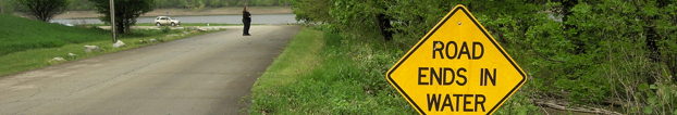
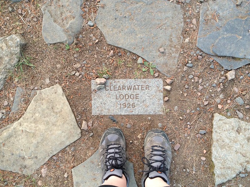
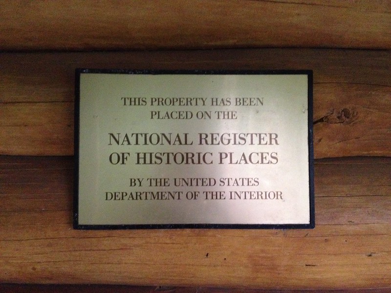
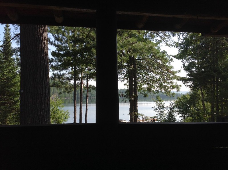
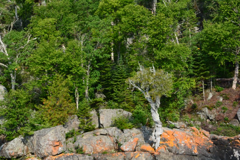
After a hearty breakfast prepared and served by the daughter of one of the original owners of Clearwater Lodge and deciding to delay a visit to Honeymoon Bluff until sunset (if time and my energy allowed), we backtracked toward Grand Marais to find the promised moose viewing platform. We couldn’t remember how close it was to the Grand Marais beginning of the trail, and, if I recall correctly, we stopped short of it and drove back and forth a few times without finding it again. Not only are Minnesota moose elusive, but so is the moose viewing platform. Finally, we spotted the sign we’d seen so clearly the night before.

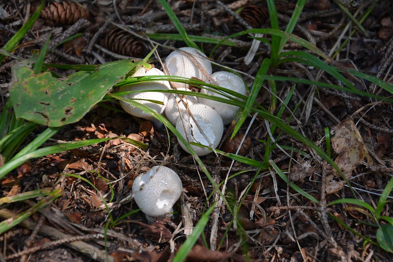
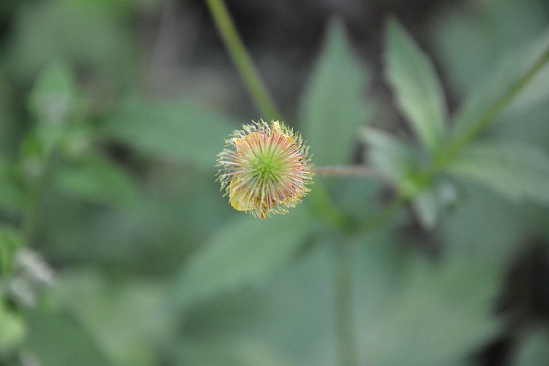
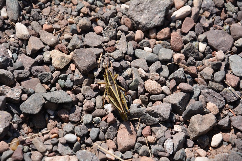
The trail was easy, and the mosquitoes were strangely intermittent — they weren’t always more abundant in the shady parts, as I would have expected. On the way we saw many wildflowers and mushrooms. Northern Minnesota is a macro photographer’s fantasy — for as long as you can tolerate standing still among the biting insects.

At last we made it to the moose viewing platform, which we shared with a family. Based on previous visits and what they’d been told, they didn’t expect to see any moose, but like us they seemed to have that spirit of, “Keep trying just in case!” By this time, it was past 11 a.m., and any moose in the area had probably finished breakfast hours earlier before any of us had woken up — that is, if there are any moose in the area. In Ely, we’d read that the Minnesota moose population has been decimated due to a surge in winter ticks.

Of course, I needed a visit to the facilities — any facilities. There are no rest stops on the Gunflint Trail. We found Bearskin Lodge and Resort, lured in by the promise of ice cream sandwiches. We found a pleasant owner and great gift shop in addition to the facilities. The ice cream sandwiches proved to be generous slabs of ice cream tucked between two giant chocolate chip cookies. Eating them gave us an excuse to hang out on the deck overlooking Bearskin Lake and watch the hummingbirds. Undoubtedly, in just a few moments we negated any health benefits provided by the morning’s moose viewing walk.

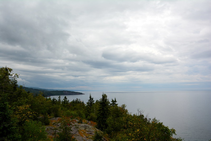
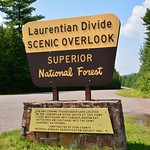
After tearing ourselves away from this comfortable spot, we stopped at a Laurentian Divide overlook, where J. recognized someone he’d seen earlier in the trip. It’s a small world . . .

As we headed west, we noticed acre after acre of scorched forest, with thousands of spiky, blackened skeletons of trees seeming to reach for the blue heavens. I learned later that 75,000 acres and numerous structures burned during what is called the Ham Lake Fire, which started when a camper started a paper and trash fire on a windy day that quickly got out of control. Doesn’t anyone listen to Smokey Bear? (Beyond the fire, the story is tragic, with the camper ultimately committing suicide.)

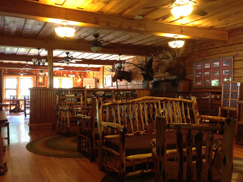
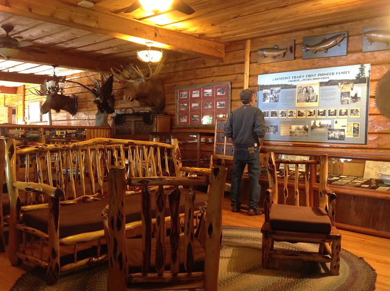
Close to the end of the trail is the Chik-Wauk Museum and Nature Center, which is focused on the history of the voyageurs. I managed to heft two voyageur packs using my back (after figuring out what was wrong about my first couple of attempts), but couldn’t have supported them for more than a nanosecond or carried them. Not surprisingly, many voyageurs lived short lives, and many are believed to have died from hernias. With the heavy loads, mosquitoes, long hours spent rowing and carrying everything over portages, and primitive conditions, this would not have been the life for me. It sounds more like hard labor punishment.

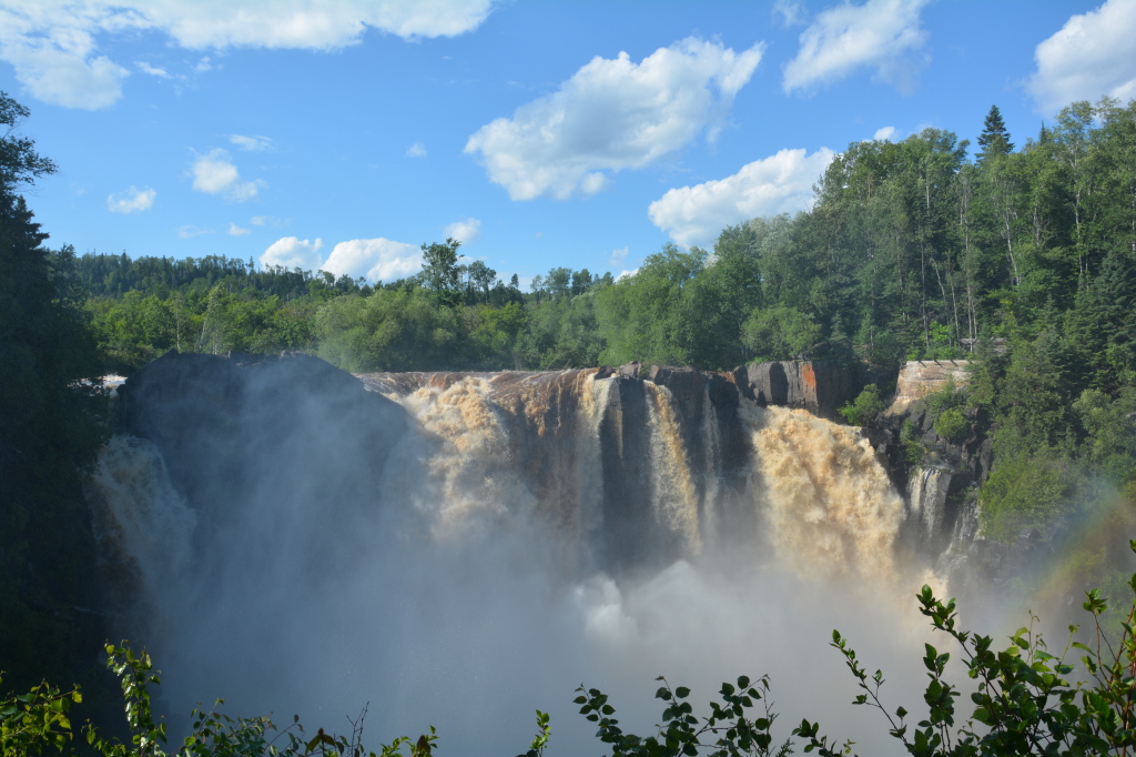
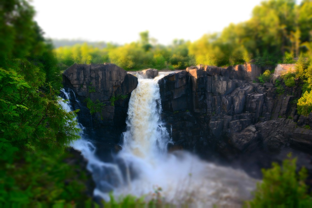
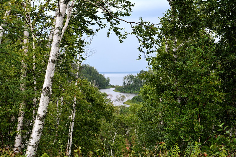
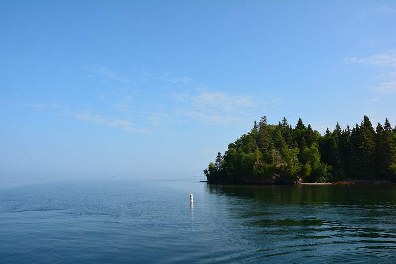
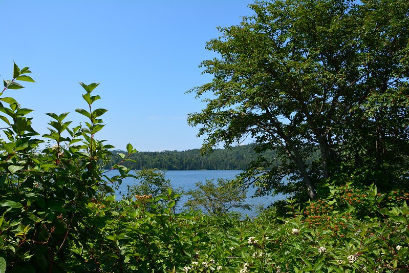
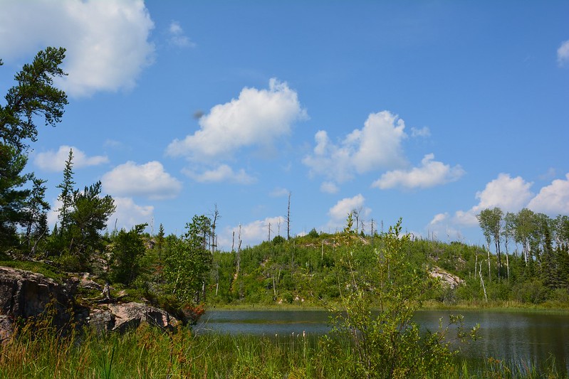
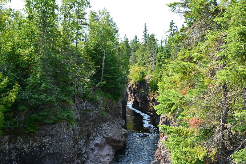
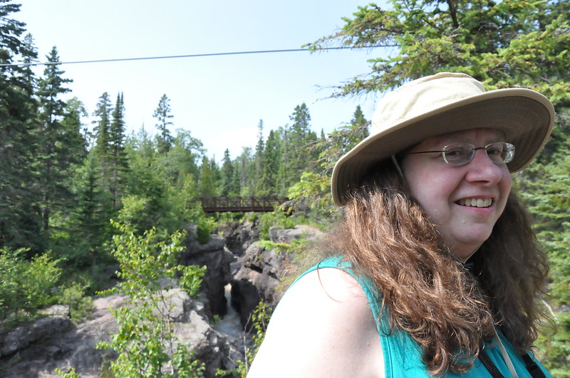
Behind the Chik-Wauk Museum I found a very short trail that lead to a little scenic overlook and a quick photo opportunity.

J. wanted to make sure he made it to the end of the Gunflint Trail, where we found Way of the Wilderness Canoe Outfitters and, more important, Trail’s End Café (by now we were both hungry). I expected to find the usual décor related to canoeing, kayaking, fishing, snowshoeing, etc. The last thing I expected to see was the array of Chicago sports memorabilia everywhere. We learned that the elderly owner (who returned with supplies before we left) had come here from Chicago decades earlier. He’d kept up with Chicago sports — there was as much or more memorabilia at Trail’s End as at a Chicago sports bar. For a moment, it felt like there was no escaping the city.

Having reached the end of the line, we backtracked and came upon a woman walking next to the road and looking into the trees. She said she’d spotted a baby black bear, but by the time we’d gotten situated there was nothing to see. We gave her a ride to the museum area. I never figured out where she was headed or how she was going to get there.

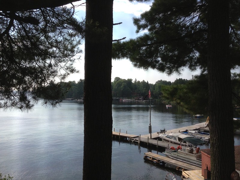
Eastward bound, once again I needed to use the facilities. This time, we stopped at Gunflint Lodge, which is a big, busy place at dinner and has wonderful views.

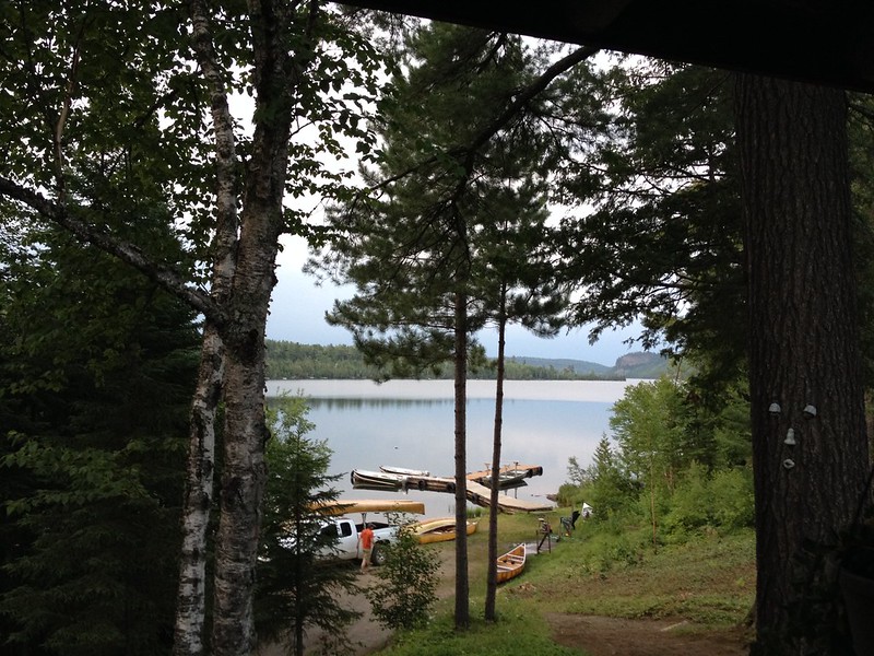
By this time, I was pretty sure I couldn’t handle the walk to Honeymoon Bluff, as much as I wanted to see it at sunset. J. proposed getting a canoe at Clearwater Lodge. I fought the idea for a long time, partly because it’s difficult and embarrassing for me to get into and out of a canoe, and partly because I can’t swim (and he’s not a strong swimmer). The more I thought about it, however, the sillier it seemed not to do the one thing that folks go to the Boundary Waters for, even if we did it in a very limited way (my idea was to go a hundred yards out at most). J. rented the canoe and got the permit (as though we were going that far!) after asking me which kind to rent — Kevlar or aluminum. “What’s the difference?” I don’t remember all he said, but I do recall that “Kevlar is more likely to spin.” I decided two novices in a canoe prone to spinning ≠ a good idea. Aluminum it was, and off we went.

I spent most of the time telling him it was time to turn around and go back (as I sat in the rocking canoe wondering how deep the lake was), while he ignored me and demonstrated his memory of how to maneuver the canoe, including how to reverse when I let him hit a snag. I think he wanted to go as far as the palisades across from Clearwater Lodge, but we had started after 7:30 p.m., so it was a little late in the day to go that far. As sunset drew closer, what made us agree to go back were the bites of the black flies, which felt like little razors extracting little bits of flesh in as painful a way as possible. Predictably, when we pulled up to the dock, I had to crawl/fall out in a predictably undignified manner. Yes, I would have made a fine voyageur, unable to lift, carry, swim, or withstand a few six-legged pests. At least I can row!

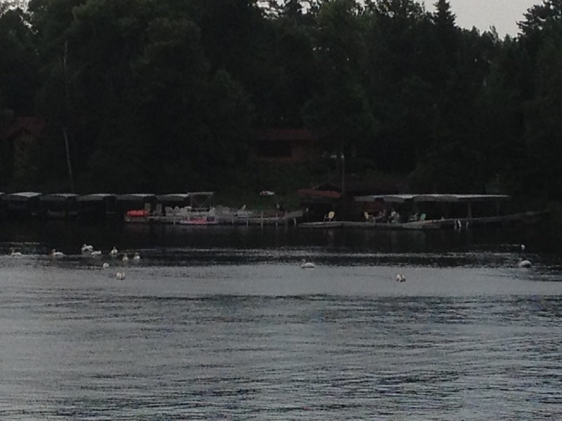
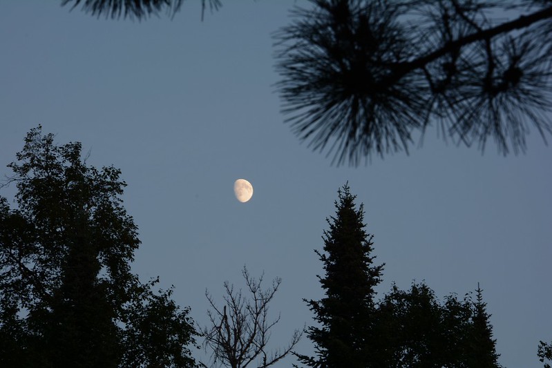
We sat on the back deck for a while, watching elusive shadows swoop unevenly back and forth, not making nearly enough of a dent in the resident mosquito population. Still, I cheered for their efforts.

Posted in Adventure, Blog, Photography | Tagged Gunflint Trail, Minnesota, photo | 2 Replies

Day 5 in Minnesota: Highway 61 and the Gunflint Trail

words and images Posted on August 5, 2014 by dlschirfJuly 4, 2020
August 5, 2014: Tofte to Cross River Falls to Schroeder to Temperance River State Park to Bluefin Bay to Cut Face Creek Rest Stop to Grand Marais to Gunflint Trail to Clearwater Lodge
On which I go from the thunder of waterfalls to the thunder of the sky on the Gunflint Trail
Temperance River State Park, Clearwater Lake Lodge
18 photos
Cross River Falls in Schroeder, Minnesota
Temperance River State Park
Gitchi-Gami State Trail sign
Temperance River State Park
Falling into the Temperance River
Temperance River State Park
From Bluefin Bay on Lake Superior
Wayside on Highway 61
Heading west on the Gunflint Trail
Arrival at Clearwater Lake Lodge
Clearwater Lake Lodge on National Register of Historic Places
Toward the Clearwater Lake Lodge gift shop
Clearwater Lake before/after the storm?

After a long soak in the spa, we stopped at the Cross River to take photos and walk down the steps on the eastern side. This was the first time I’d seen the Cross River in daylight — last year we’d stopped here twice at dusk. I’d realize later that it wasn’t only the sunlight that made it look different — this year the water was running at a fraction of last year’s volume. On the previous trip, the flood of water rushing under the road had seemed terrifying; now it was a serene scenic spot.

In the dark, Cross River had seemed a little desolate, but on this day we made quick visits to the Schroeder Baking Company and the Cross River Heritage Center, both within walking distance across and down the highway a bit.

Our next stop was Temperance River State Park, another first in daylight. On this quintessential summer day, teenagers were jumping feet first into the water, while the rest of us took the more-or-less easy walk to the gorge. Temperance River is gorgeous, although in the sunshine the waterfall visible from the first part of the trail shed some of its twilight wildness and mystery.

We spent most of a more relaxing day here, not in a hurry to get to the next stop. After walking part of the trail and taking many photos from many strategic vantage points along the gorge and of the abundant wildflowers, we set off in search of dinner, which wasn’t hard to find at Bluefin Grille at Bluefin Bay — although once we got there, it took a long time to navigate to the restaurant from the hotel parking lot.

Bluefin Bay is on the Superior shore, and our view overlooked a lone kayak, pulled up onto the beach. Within a half hour or so, however it was joined by more than a half dozen. It looked like a class led by a woman who got her kayak situated, then helped most of the rest get theirs up onto the now more crowded beach.

The hour was early — around 5 p.m. — the restaurant sparsely populated, and our server chatty, so we grilled her for her local knowledge. She said Highway 61 was being widened to put in much-needed culverts, which I had noticed in the daylight hours. It sounded like the folks with homes along the highway were in favor of the project, but the construction-related traffic jams were terrible, especially around Grand Marais. You could be stopped at a red light for a half hour. She mentioned one area where you can bypass the work by taking a side road that’s marked as though there may be no outlet or no reason to go down it. “Just ignore that,” she said.

She was very familiar with the Gunflint Trail and, given the time of day we were to drive down it, she told us we were likely to see moose and to be very careful to avoid hitting one. As we left Bluefin, I became certain we were going to run into a moose, or a moose was going to run into us, which set my stress hormones into action well ahead of time.

The traffic wasn’t horrendous, and I remember only making a stop at the Cut Face Creek rest area, which had a clear view of serene Superior in the early evening light.

After all that, the drive down the Gunflint Trail was uneventful, without a moose in sight. The closest we came was a sign, noted in memory, indicating a trail to a “Moose Viewing Area.” We would have liked to have seen one or a few moose — at a safe distance from the road, of course. Although cars with more confident drivers (probably local) zoomed past on occasion, it was clear we were headed away from town.

We overshot the turnoff onto Clearwater Road, which meant driving a mile or two extra to find a place to turn the car around. Clearwater Road is a gravelly, twisty road off the Trail, and it was well after 8 p.m. and getting dark when we arrived at Clearwater Lodge.

As we were unloading everything for a two-day stay (no quick task), I noticed it getting unusually dark. Big drops started to fall. We found all or most of the guests migrating from the common area to the back porch to watch a powerful thunderstorm accompanied by a downpour that seemed to get heavier by the minute. Soon the cooling temperature and the blowing rain drove most of the spectators back indoors, where they’d been chatting, reading, and playing games earlier. It was like life before the Internet distracted us from face-to-face interactions. Soon most dispersed to their rooms, while the storm continued to rage over the lake and environs until about 11 p.m. or so. The perfectly timed storm (because we’d gotten everything out of the car before it hit full force) was an amazing welcome to the Gunflint Trail and Clearwater Lodge.

Posted in Adventure, Blog, Photography | Tagged friend, Gunflint Trail, Minnesota, Minnesota state park, photo, state park | Leave a reply

Day 4 in Minnesota: A full day in Ely

words and images Posted on August 4, 2014 by dlschirfJuly 17, 2021
August 4, 2014: Ely to Tofte
On which we meet a snarling bear and a mellow wolf, learn about the “Root Beer Lady,” see a rock that’s older than dust, and find new waterfalls
North American Bear Center, International Wolf Center, Ely Pillow Rock, Kawishiwi Falls
12 photos
At Chocolate Moose in Ely, Minnesota
North American Bear Center
Shagwa Lake
International Wolf Center
About the Ely pillow rock
2.7-billion-year-old pillow rock in Ely, Minnesota
Kawishiwi Falls
Kawishiwi Falls

Our first stop in the morning was at Chocolate Moose (one of the few moose we spotted during the trip) for breakfast en plein air. Next, we were lured in by their neighbor, Piragis Outfitters, where we found cool stuff like bags and sporks. Who wouldn’t love a good Swedish-designed spork? I’m almost as dangerous at an outfitters as I am at a bookstore or office supply shop. If I camped or canoed or kayaked, I’d be destitute.

The next stop in Ely was the North American Bear Center, where we arrived in time to see the enrichment program at work and some of the relationships between the bears in play. I supplemented my Vince Shute photos with some of the center’s youngest bear treed by its largest, and of the largest bear snarling. She didn’t seem to be in a good mood on this beautiful August morning.

Toward the end of our visit, we ran into a woman who encouraged us to drive around Shagwa Lake, which is one of the many places I’d hang out at if I lived in Ely. Judging from the family we saw on its shores, it’s as good for wading and fishing as it is for photography.

J. stopped briefly at the Dorothy Molter Museum, a tribute to the “Root Beer Lady.” She’s said to be the last non-indigenous resident of the Boundary Waters Canoe Area Wilderness (BWCAW). Her homestead was dismantled in 1987, with two cabins restored in Ely. She made root beer and sold it to canoeists. I confess that at the time I didn’t find this as interesting as J. did, so I stayed in the car. I’m still haunted by all the stops made during last year’s trip, the long drives between destinations, and the resulting 1 or 2 a.m. arrivals. I have to get over that.

At the International Wolf Center, a lone wolf posed for photos, although I wasn’t quick enough to get a photo of him while he was moving.

Both the bear and the wolf centers offer a great experience, with lots of information for the interested adult and activities for children. While resting my feet at the Bear Center, I watched videos of Alaskan brown bears catching salmon and strutting off with their victims. I also posed with a late member of the elusive moose species and compared my size to the that of several North American bear species (at best, I’m the height of a juvenile or female black bear). At the Wolf Center, we walked through an exhibit of aurora borealis photos — the northern lights that in nearly three weeks of travel in 2013 and 2014 we were destined not to see even once.

After all this activity, we went to a café I’d found on Yelp!, the Front Porch, which is as comfortable as a café can get. It’s in a house with a lot of porch space in addition to roomy interiors. The food and coffee were good, and so was the cheesecake we bought for later. The Front Porch ranks high on my list of places I didn’t want to leave and that I wish were nearby. That’s even without having seen the live music offerings they have on some evenings.

After tearing ourselves away from the Front Porch, we began our hunt for the Ely pillow rock, which I’d spotted on a whimsical tourist map of Ely I’d picked up at Fortune Bay. From waymarking.com:

This historic 15’ rock outcrop is a wonderful example of Ely greenstone, a “rare ellipsoidal lava flow formed beneath primeval seas 2.7 billion years ago.” It is volcanic in origin and there are very few specimens like this in the world. It is easily accessible 24/7 and can be seen on the north side of Main Street in the northeast part of town.

Ellipsoidal lava is also known as “pillow laval” and is any lava characterized by pillow structure and presumed to have formed in a subaqueous environment.

When you have a chance to see a 2.7 billion-year-old lava rock in the Midwest, you can’t miss it. We almost did, however, because it was hard to find. A pair of cyclists tried to help, but I’m not sure they agreed on where to send us. After we drove around a while and ended up downtown again, one of my map apps finally gave me a clearer picture of where it should be on Main Street, which, despite its name, proved to be a gravel road.

When we finally got to what looked like the right spot, we didn’t see it at first because it was down the road a bit. This ancient piece of lava, formed when the area was underwater, is on the edge of a wooded area across from some typical houses. Most likely the residents who see it every day are over its charms, but I would find it amazing to pass such a relic of the past every day. I would feel more connected to the world that was than to the world that is.

During all this driving through Ely, we’d seen a custard place, Red Cabin Custard. It was a warm enough day for it, and stopping there gave J. a chance to get a Dorothy Molter root beer, while I had a PMS sundae (I recommend it whether you need it or not).

After packing up and checking out of Silver Rapids Lodge prematurely, we stopped at Kawishiwi Falls, which is a relatively easy short walk. The falls seem to be downstream from a dam, but that didn’t detract from their beauty in the early evening.

Leaving Ely behind, we set out at last on Highway 1, which was a long, lonely drive that seems to be used primarily by mining and logging vehicles. We saw very few cars, a few trucks, and no moose, although there may have been a white-tail or two. Even the towns seemed tiny and remote.

At least we reached Highway 61, the scenic road that runs along the western shore of Lake Superior. To our surprise, Highway 61 was under construction. Whether it was northern Illinois, southern Wisconsin, the Sauk City area, or now Highway 61, we couldn’t get away from construction. In this case, long stretches were gravel only, and some parts were down to one lane with long red lights to control traffic. Gone is my original memory of 61 as a misty, lightly traveled wonder (which it still is, in parts).

After bumping along for miles of torn-up, gravelly road, we arrived at the Americinn in Tofte, perhaps another sign of a growing tourist trade along the North Shore, to get ready for the next day.

Posted in Adventure, Blog, Photography | Tagged Minnesota, photo, travel, waterfall, wildlife | Leave a reply

Post navigation

← Older posts

Recent Posts

  • Future of artificial limbs (prosthetics)
  • Hodge, 2001 – 2013 (cat)
  • “Far more happier” (The Age of Wonder by Richard Holmes)
  • Pileated woodpecker pair at Sapsucker Woods
  • Eternal flame waterfall at Chestnut Ridge

Top Posts & Pages

  • Top 10 reasons Commander Riker walks with his head tilted
  • Book review: Zitkala-Sa: American Indian Stories, Legends, and Other Writings
  • Memories of South Shore Plaza, Hamburg, New York
  • Wopsononock Mountain, or Wopsy, in Blair County, Pennsylvania
  • Book review: Women in Love
  • Relics: The newsstand
  • Book review: Henry and June
  • Book Reviews
  • Sunset from Coffee Creek Park in Chesterton, Indiana
  • Horseshoe Curve National Historic Site, Tytoona Natural Area Cave Preserve

Archives

Other realms

  • BookCrossing
  • Facebook
  • Goodreads
  • Instagram
  • LibraryThing
  • Twitter
  • YouTube

Good viewing

  • Art of John Taft
  • bensozia
  • Bill of the Birds (no longer updated)
  • BrontëBlog
  • Edge
  • Karen Winters Fine Art
  • Mental Floss
  • Musical Assumptions
  • National Geographic News
  • Orange Crate Art
  • Sexy Archaeology
  • The Creative Journey
  • The Introvert's Corner
  • The Pen Addict
  • The Raucous Royals
  • Thrilling Days of Yesteryear
  • Woodclinched
  • World-O-Crap

BOINC Stats

Copyright © 1996–2023 Diane Schirf. Photographs and writing mine unless noted.
↑
 

Loading Comments...