↓
 

words and images

🇺🇦✏️✒️📚📔🌜dreamer 🌕 thinker 🌕 aspirant📱📷🚴‍♀️🏕🍄🌻

Menu
  • Home
  • Articles
  • Book Reviews
  • Letters
  • Photography
  • Poems & Stories
  • About Diane Schirf
  • Site Map

Tag Archives: Wisconsin state park

Smith Bros. Coffee and Port Washington

words and images Posted on September 5, 2021 by dlschirfSeptember 5, 2021
August 29, 2021

J found out Smith Bros. Coffee in Port Washington, Wisconsin, would be closed permanently after Labor Day weekend. On Sunday we took a quick trip to stop there and a few other places.

It was a good day for me to be in an air-conditioned car — the car thermometer read 97ºF at the Lake Forest Oasis, where the sky was sunny and the atmosphere heavy and oppressive with heat and humidity.

As we progressed northward I noticed enough dark clouds gathering to obscure the sun. Near Milwaukee the skies opened up, accompanied by some lightning and thunder. I’m not sure how long the bad spell lasted — maybe 20 minutes. By the end of it, the temperature had dipped to about 78ºF — that’s more like it.

I found a slightly different route into town that took us past Lion’s Den Gorge Nature Preserve. It’s now on my list.

Our first stop was Bernie’s Fine Meats, which is the source not only of deliciously addictive but unhealthful garlic summer sausage, but also many unhealthful European sweets. I spent well over $100 there. It’s showing in the waistline I no longer have.

Smith Bros. is across the street, part of the Duluth Trading store, which will expand into the Smith Bros. space when it closes. I ordered an iced coffee and sandwiches to go, and picked up coffee beans and an insulated travel mug. Of course I posed with the fisherman sculpture which was installed in 2020. It more or less replicates the sign on the roof, down to the fish on the man’s back, but without the man’s pipe. Our health-conscious times!

Reservations at Twisted Willow were not to be had, so we ordered food and drove around until it was ready to be picked up, about 40 minutes. We re-found the light station, but more important we found Port Washington has extensive lakefront parks. This was a good time to find them because sky was still dramatic from the on-and-off thunderstorms in the area. We decided to return with dinner and use one of the many picnic tables.

After we ate the salad portion of dinner in a strong breeze, during which another rainbow appeared, J took a brief detour toward Belgium and Harrington Beach State Park, home to one of my favorite views on County Road D — a single tree by the side of the road that leads to a stop sign and Lake Michigan. Fail to stop at your peril.

On the way back to the interstate I noticed the sky that had produced drama and rainbows earlier now gave a fire-breathing dragon cloud. What a great way to end a great day.

Posted in Adventure, Blog, Photography | Tagged friend, Lake Michigan, photo, travel, weather, Wisconsin, Wisconsin state park | Leave a reply

Google Maps most viewed photos

Every now and then I get an email updating me on my Google Maps photo statistics. As of today, these photos have 10,000+ views. The surprises? The chicken and the nondescript view of Lincoln Park Zoo’s south lagoon. That so many people are looking at Beaubien Woods. And that the photo of the Rainbow Bridge at Niagara Falls didn’t make the cut as of today. Not looking like it will for a long time.

Untitled
Amnicon Falls State Park, Wisconsin: 14,802 views
Untitled
Beaubien Woods, Illinois: 17,361views
Untitled
Garden of the Gods at Shawnee National Forest, Illinois: 18,008 views
Untitled
Rock of Ages off Isle Royale National Park, Michigan: 18,257 views
Warren Dunes State Park, Michigan: 18,341 views
Untitled
Tytoona Cave near Tyrone and Altoona, Pennsylvania: 18,938 views
Untitled
Chellberg Farm, Indiana Dunes National Park: 22,212 views
Untitled
Beaubien Woods, Illinois: 29,821 views
Lincoln Park Zoo, Illinois: 29,976 views
Untitled
Fountain of Time by Lorado Taft, Chicago, Illinois: 49,474 views
Untitled
Black Partridge Woods, Illinois: 49,719 views
Untitled
Black Partridge Woods, Illinois: 67,286 views

Finally, at six figures:

Untitled
Old Hickory, Coudersport, Pennsylvania: 105,725 views
Untitled
I received this right after I posted
December 1, 2020 by dlschirf Posted in Adventure, Blog, Photography Tagged Chicago, FPDCC, friend, Hyde Park, Lincoln Park Zoo, Michigan state park, National Forest, National Park Service, Pennsylvania, photo, Wisconsin state park 2 Replies

Belt of Venus, Wisconsin style

This is another Belt of Venus, this time taken in Wisconsin on Lake Michigan, November 28, 2015. Different from this one and this other one in Chicago.

Kohler_Andrae sunset
Belt of Venus, slightly disrupted?, on Lake Michigan in Wisconsin
May 4, 2020 by dlschirf Posted in Adventure, Blog, Photography Tagged Great Lakes, Lake Michigan, photo, sunset, Wisconsin, Wisconsin state park Reply

Day 11 in Minnesota: All good things

words and images Posted on August 11, 2014 by dlschirfMay 14, 2022
August 11, 2014: Baptism River Inn to Palisade Head to Northern Lights Roadhouse and Pub to Gooseberry Falls State Park to Duluth to Superior to Pattison State Park to Chippewa Falls
On which the rain continues, but lets up enough for a quick walk to Gooseberry Falls, and we see the sun set from Big Manitou Falls
Gooseberry Falls State Park, Pattison Park
22 photos
Baptism River Bed & Breakfast
Baptism River
Lake Superior
Lake Superior
Northern Lights Roadhouse (before June 2018 fire)
River at Gooseberry Falls
Gooseberry Falls
Gooseberry Falls
Gooseberry Falls in miniature
Gooseberry Falls
More miniaturized tree roots at Gooseberry Falls
Miniaturized tree roots at Gooseberry Falls
Miniaturized trees at Gooseberry Falls
Leaving Minnesota
Big Manitou area
Sunset at Big Manitou
Big Manitou Falls
Big Manitou Falls
Sunset at Big Manitou
Tunnel at Big Manitou
Pattison Park — Manitou Falls

Now the trip really was winding down under more gray skies with occasional rain. After taking some photos of the low but wild-looking Baptism River, we left Baptism River Inn and took a brief detour to Palisade Head, hoping for a slightly better view. Lemon Wolf Café isn’t open on Mondays, so we settled for Northern Lights Roadhouse and Pub, where we were seated on an enclosed porch overlooking the lake and the downpour for a relaxed, homely lunch.

Because of the rain, we thought about skipping Gooseberry Falls State Park, but I knew I’d have have regrets if we drove on by. We, along with many others, waited under the shelter of the visitor center porch as the rain came down, watching drenched visitor after drenched visitor return on the trail.

After a time the rain slowed and stopped, so we took off as fast as we could toward the falls. With the overcast sky, the lighting was poor and the colors washed out, but I continued to work on improving my waterfall photography techniques. We had been there for a while — maybe a half hour? — when we sensed the weather shifting again, so hightailed it back to the visitor center just as the clouds opened up again.

South of Gooseberry Falls State Park we came to the Silver Creek Cliff Tunnel, which was bored through the volcanic rock between 1991 and 1994. We stopped at the wayside to walk along the trail between the tunnel and the lakefront, but after a few feet the rain, which had slowed somewhat, picked up again, and I hurried back to the shelter of the car while J. opted to hang in and get drenched.

Further south, we passed through Two Harbors in search of a coffee shop, but if I remember right the one wanted to go to was closed. Further along we stopped at SuperOne to pick up containers for all our leftovers. At this point, it truly felt like the wilder parts of the Gunflint Trail and North Shore were well behind us — we were back in town.

Too, too soon we were in the city, Duluth, passing what appeared to be ritzy historic mansions, one of them a museum. We said goodbye to Highway 61, which merges into I-35 at 26th Avenue East. It was like a farewell to a beloved friend you may never see again.

It had become sunnier, and Duluth in full daylight is not nearly as eerie as it had been the first time I passed through in July 2013, at twilight on a misty night that made the city and hills appear as ephemeral as Brigadoon.

We pushed on to Superior, Wisconsin, and Red Mug Espresso, a half-underground coffee shop steeped in colorful art for sale and housed in a historic building. Their website cites one of Mike Royko’s favorite ideas:

Sociologist Ray Oldenburg talked about the importance of the “third place” — a community anchor, separate from home and work, where people feel welcome, socialize, and meet friends new and old.

(For Royko, his third place was a bar.)

“It’s a place to live your life,” the site adds. I would if only it were closer. As with so many places I’ve found on journeys both short and long, it was hard to leave this experience behind, but we still had plans for the remaining daylight.

One of these plans, a visit to Superior Entry Lighthouse, was thwarted by a combination of diminishing daylight time and the bumpy nature of Moccasin Mike Road, which isn’t that long. We couldn’t guess at what Wisconsin Point Road would be like on the narrow strip leading to the light, so we agreed to turn back on Moccasin Mike (I just wanted to say that name again) and head for our next out-of-the-way stop, Pattison State Park.

After driving down what seemed like endless country roads, we arrived at Pattison State Park, which is home to Wisconsin’s highest waterfall, Big Manitou Falls. You’d think it’d be easy to find a 165-foot-high waterfall, but it was surprisingly difficult — maybe because we were tired and easily confused by the directions some people we ran into gave us. The first spot we found seemed to be above the falls and didn’t offer a view. J. went one way while I went another. My way led to a platform on a cliff side overlooking the falls. To my left below, the falls roared. To my right, the sun was headed toward the horizon in a show of bright clouds and dark hills. The view on both sides helped make up for missing Superior Entry. Alas, we missed Little Manitou Falls, which are a few miles upstream.

With the sun setting, it was time to move on and get as far south in Wisconsin as we could. We made it — with effort — to Chippewa Falls, where we stopped at a chain hotel with no rooms. The very helpful desk attendant called two other chains — also no vacancies. She told me that’s not unusual for Chippewa Falls, which is a hotbed of business. The last place she called is, like the Bates Motel, somewhat off the major road. For that reason perhaps, they had available rooms. Avalon Hotel and Conference Center is a hybrid hotel-motel; many rooms have both inside rooms like a hotel and outside doors like a motel. Nervous guests can get a room with an inside door only. After a long day and the experience of last year, all that mattered to me was being able to crawl into a comfortable bed before the wee hours arrived and getting rested for the long day ahead.

Posted in Adventure, Blog, Photography | Tagged Minnesota, Minnesota state park, photo, waterfall, Wisconsin, Wisconsin state park | Leave a reply

Day 1: On the road to Minnesota through Illinois and Wisconsin

words and images Posted on July 31, 2014 by dlschirfJuly 26, 2022
July 31, 2014: Chicago to Sauk City
On which preparations are made and the journey begun
Mill Bluff and Amnicon Falls State Parks, Wisconsin
10 photos
Blue Spoon Cafe
Blue Spoon Cafe
Mill Bluff State Park
Amnicon Falls State Park

The sequel to last summer’s Lake Superior trip began July 31, when J. helped me take Petunia to the Hyde Park Animal Hospital, followed by a quick dinner at Plein Air Café. Finally, we stowed all my stuff in the car and set out, with the goal of reaching Cedarberry Inn in Sauk City.

This isn’t as easy as you’d think. This summer, as last, the Jane Addams Expressway is under construction, which meant for J. driving at night at reduced speed through dozens of miles of construction barrels and barriers. Although I wasn’t driving, I could sense how stressful it was, with no end in sight. I don’t know how people commute through this nightmare every day. Of course, we’d be taking the same route back — something to look forward to! After reaching Wisconsin, we ran into pockets of construction. Even after leaving I90/94 for Sauk City, we faced construction. At least when we got to Minnesota, off the interstates, we thought, we’d face no more construction mazes.

Finally, we arrived at Cedarberry, where the next morning you bet I immersed myself in the warm jets of the whirlpool. So far I had not felt the sharp pangs caused by sitting confined in a car for long periods.

August 1, 2014: Prairie du Sac to Mill Bluff State Park to Amnicon Falls to Fortune Bay Resort & Casino in Tower, Minnesota
On which I discover sea stacks in Wisconsin

The reason for driving out of the way to Sauk City was to visit Blue Spoon Café in Prairie du Sac. Started by the Culver family of “Butter Burger” fame, Blue Spoon is nestled between one of Prairie du Sac’s main streets and the Wisconsin River. Sitting on the patio overlooking disused, abruptly ending train tracks and the river, I felt relaxed and peaceful in a way I’m not sure that I ever have. Only the need to press on and get to Tower, Minnesota, at a reasonable hour weighed on me.

J. noted some state parks along the way that he thought would make great stops, but I’m doomed to be the nay-saying killjoy. When we spotted a series of stone stacks along I90/94, however, I agreed this was worth investigating, however briefly. This proved to be Mill Bluff State Park, and the bluffs are what you might call sea stacks, formed underwater. Mill Bluff State Park is part of the Ice Age National Scientific Reserve in the Driftless Area.

Even though this park is in the driftless area, the area the glaciers missed, the geologic features are partially the result of the last (or Wisconsin) stage of glaciation. During this glacial advance, the Wisconsin River was plugged near Wisconsin Dells. The river spread out to form glacial Lake Wisconsin, covering most of what today are Adams, Juneau and other adjacent counties, including the Mill Bluff area. During this time, some of the mesa and buttes stood as islands in the glacial lake, while others were submerged. Wave action hastened erosion of the sides of the rock forms.

The unique flat-topped, cliff-sided rock structures are capped by layers of somewhat more resistant sandstone; and weathering tends to break the rock off in vertical fragments. There are remnants of the Dresbach Group, Upper Cambrian sandstone. The heights of the bluffs range from 80 feet to over 200 feet. The mesa and buttes are isolated “outliers” of the continuous limestone-capped escarpments south of the park.

We drove around a bit, talked to an elderly staffer, drove some more, then found the trail that lead to the top of Mill Bluff, up about 223 steps crafted by the CCC during the 1930s. We have a lot to thank the CCC for, 70-plus years later.

I wish I’d known more about the geology of the area as I stood on top of Mill Bluff, but even to the ignorant like me, the view is spectacular. It takes a little imagination to see the park without I90/94 dividing it.

After Mill Bluff State Park, we did have one scheduled stop — Amnicon Falls State Park, not far from Duluth. After a brief detour down a residential gravel road, we found the park we’d been to before at about the same time of day but two weeks later in the summer, with earlier nightfall. A staffer told J. about a photo contest and to look for Snake Pit Falls near the park’s namesake falls.

Amnicon Falls is indeed a photogenic spot, complete with rustic footbridge. The view of Snake Pit Falls in the growing gloom was a delightful bonus, although I’m resigned to never seeing this park in sunlight or even daylight.

The original plan had been to stop at K&B Café and BBQ in Eveleth, Minnesota, at the recommendation of J.’s co-worker. By the time we hit Eveleth, however, it was past closing time. We did stop at a rest area, where we learned about the Laurentian Divide. How did teachers make earth science sound so dull?

At last, perhaps around 11:30 p.m. or so, we arrived at Fortune Bay, a huge resort and casino complex on Lake Vermilion owned by the Bois Forte Band of the Lake Superior Chippewa. A little worse off for the 223 steps at Mill Bluff State Park, I welcomed the comparatively early night.

Posted in Adventure, Blog, Photography | Tagged Minnesota, photo, state park, travel, waterfall, Wisconsin, Wisconsin state park | Leave a reply

Days 9 and 10 (Wisconsin): Apostle Islands National Lakeshore (no photos), home

words and images Posted on July 21, 2013 by dlschirfMay 3, 2020

July 20, 2013: Bayfield to Devil’s Head Resort

At last, after our thwarted attempt on Monday the 15th we were able see the Apostle Islands clearly, although I couldn’t get any good photos. Afterward, we checked out the Apostle Islands National Lakeshore headquarters in Bayfield, and ate a late lunch at Greunkle’s.

Finally, and reluctantly we left beautiful Bayfield behind, saddened by the knowledge that vacation was over and that in a day and a half, Lake Superior, Kabetogama, Rainy Lake, Crane Lake, and all of their historic, cultural, architectural, and wildlife treasures would also be behind us. We made a few stops, including at an out-of-the-way fishing hole and at a castle-like building in the middle of nowhere (J. took a photo of it). At Rice Lake, we ate at Lehmann’s Supper Club.

We soon faced an unexpected problem — there didn’t seem to be many places to stay in northern Wisconsin, and a big event at Wisconsin Dells meant every lodging was booked. Even an operator from hotels.com couldn’t help. By now both of us were very tired and desperate for rest.

At last, I found a place with a room — Devil’s Head Resort. The problem was that it was more than an hour and a half away. As we got closer, we ran into another problem — unbeknownst to us at first, the GPS decided to take us through Devil’s Lake State Park instead of on the regular roads. Poor J. was trying to stay awake while driving on the park’s hilly, sharping winding, snaky road, while I was trying to stay awake to keep him awake. In hindsight, it was terrifying.

Despite poor coverage, I managed to get the resort’s desk attendant long enough to get better directions. At last we arrived — after 3 a.m. Never did a cinderblock-walled room look so welcoming and comfortable.

July 21, 2013: Devil’s Head Resort to Prairie du Sac to home

After a better rest than I expected, we went to Blue Spoon Café in Prairie du Sac, a little out of the way but worth it for a good breakfast on the tiered back patio overlooking the Wisconsin River. A railroad track lies between the river and the buildings, a little above river level. It reminds me of the dreams I used to have that I’m at home and that a train runs behind the trailer, curving around Dad’s garden and Virgil’s ash tree before heading west to an unknown destination. Sometimes it derails, sometimes it never ends, and sometimes it takes me with it.

We spotted a Harley Davidson dealer, so J. stopped to get something for his brother while I got a free bandana.

At about this time rain came, and I don’t remember that it quit. For long stretches, it was pretty bad. Closer to Illinois we ran into an almost unreal amount of road construction, which, with the rain, meant a slow, tiring return — just in time for the work week starting Monday, when Lake Superior and all the other lakes and the waterfalls receded into the realm of a dream.

Posted in Adventure, Blog | Tagged National Lakeshore, National Park Service, Wisconsin, Wisconsin state park | Leave a reply

Day 4: Apostle Islands to Madeline Island to Amnicon Falls to Kabetogama

words and images Posted on July 15, 2013 by dlschirfJune 11, 2020

July 15, 2013: Apostle Islands National Lakeshore to Madeline Island to Amnicon Falls State Park to Kabetogama

The Bayfield Inn offers whirlpool suites. Is it necessary to say that as soon as I woke up from the long drive and late night, I inserted myself into warm, soothing jets for as long as I could, which wasn’t long enough?

Bayfield, Wisconsin
Charming Bayfield, Wisconsin is the home of John of the famous John and Schoep photo

Today’s objective was a cruise around the mysteriously named Apostle Islands. Our genial captain told us quite a bit about the unpredictability of Lake Superior weather, and it was soon clear that current conditions were conducive for a thick pea soup fog. After we had learned a great deal about the islands we could barely see through a few breaks in the fog, we headed back to shore with the option to get a refund or choose another day. Fortunately our plan had us staying in Bayfield Saturday before heading home, so we signed up for that morning’s tour.

With the afternoon in front of us, we lined up for the ferry to Madeline Island. Maneuvering the car around the narrow space by the pilot house made J. nervous, but the man guiding him said, “Trust me.” All, including the car, made it unscathed. Even better, the morning’s fog had cleared, and the sun had emerged. I looked happy enough!

IMG_5623
On the ferry to Madeline Island

On Madeline Island we ate outdoors at The Pub at The Inn on Madeline Island, which has a wonderful view of the lake and mainland. The only fly in the ointment were the flies, which weren’t repelled by the natural repellent J. had bought when exchanging the cruise tickets. Even so, you can’t beat a good bar lunch on the lake.

Afterward, we drove around, eventually heading out of town and checking out the houses and properties. I imagine, but don’t know, that most people leave the island for the winter — which was hard to picture on a sunny summer day.

We found ourselves at Big Bay State Park, where we fought off mosquitoes while gazing across the lake. A kayaking class floated by. On one of the Pictured Rocks cruises, someone had told us that sea kayaks are recommended for navigating Lake Superior and its unpredictable weather, and that it’s a very bad idea to go out alone. We’d seen a few brave souls on their own.

Madeline Island
Life on Lake Superior — colorful kayaks
Madeline Island
Madeline Island mushrooms

Our last stop on Madeline was at Grampa Tony’s, where so many teenagers were working that I started to look for Richie Cunningham.

Our next goal was Kabetogama for two days, but we detoured to Amnicon Falls State Park until it was too dark to take photos.

Amnicon Falls State Park, Wisconsin

The never-ending road took us through Duluth, which, in the growing twilight, appeared surreal. As at Porcupine Mountains, there was something unearthly about the muted light.

On this long drive as on others, we were terrified of hitting deer. On one of these night drives, someone ahead of us flashed their lights. We found a mini-herd parked in the center of the road. They didn’t budge even as the car passed slowly within a couple of feet of them. They know who rules the night. After that incident we jokingly hoped for “deer buddies” ahead of us in remote areas who could warn us of deer near or on the road.

The rest of the night reminded me of entering Shawnee National Forest. In the dark, it felt like we were surrounded by forest and fields, with signs of habitation and commerce seemingly scarce. When I needed a bathroom break, it took some time to find a rough, almost deserted bar that was still open.

After an interminable time in the darkness (unbroken, alas, by the aurora borealis), we found the Sandy Point Lodge area, but with spotty to no cell phone coverage it was difficult to navigate. Finally we arrived, exhausted — but it was closer to 1 a.m. than midnight, there was no light, the door was locked, and no one answered the phone. We learned a valuable lesson — call ahead to make arrangements.

Although coverage was weak, I was able to check Yelp and make a few calls. At last a sleepy-sounding woman answered and said we could stay at her place, Arrowhead Lodge and Resort. Delirious with joy that I wasn’t going to have to sleep in the car, I told her we’d be right over. “No hurry,” she said. “I have to get dressed.” We found Arrowhead and brought in as little as we could, following her up a narrow staircase. By then it was after 3 a.m. That was a long day, and then some.

Posted in Adventure, Blog, Photography | Tagged friend, Lake Superior, Minnesota, National Lakeshore, photo, state park, travel, Wisconsin, Wisconsin state park | 2 Replies

Blue Spoon Cafe, Natural Bridge and Aztalan State Parks, Wisconsin

words and images Posted on October 10, 2011 by dlschirfSeptember 23, 2020
More adventures in America’s Dairyland, October 8, 2011
Blue Spoon Cafe, Natural Bridge and Aztalan State Parks
17 photos
  • Wisconsin River from Blue Spoon Cafe
  • Railroad tracks behind Blue Spoon Cafe
  • Blue Spoon Cafe
  • Wisconsin River from Blue Spoon Cafe
  • Blue Spoon Cafe
  • Air-conditioned movie theater!
  • Natural Bridge State Park, Wisconsin
  • PA081896
  • Natural Bridge State Park, Wisconsin
  • IMG_1331
  • IMG_1332
  • Aztalan State Park
  • Aztalan State Park, Wisconsin
  • Aztalan State Park, Wisconsin
  • Aztalan State Park, Wisconsin
  • Aztalan State Park, Wisconsin
  • PA081927

During our first trip to the Baraboo area of Wisconsin, J. bought a $35 state park permit that expires at the end of the year, so use it he must. That’s why we ended up on I94 to Wisconsin again, this time centered on the Prairie du Sac/Sauk City area.

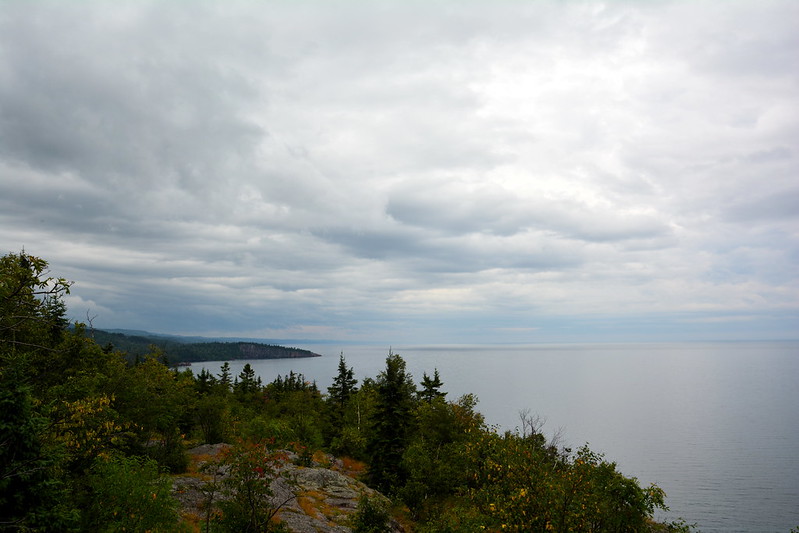
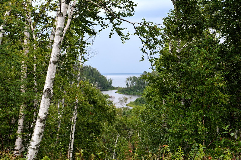
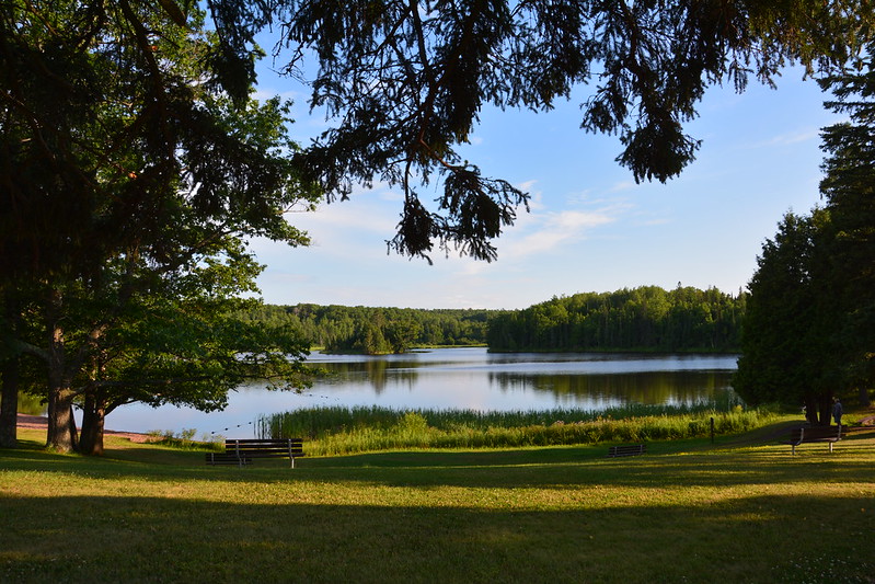
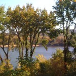
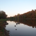
Thanks to Yelp for iPhone, on Saturday morning we landed at the Blue Spoon Creamery Café, where you order and get a number, and your meal is delivered to your table. While J. stood in the short line, I sought the outdoor seating that I’d read about — Blue Spoon has three terraces overlooking the Wisconsin River, and I found a perfect spot on the middle terrace, with lovely views of the river and the railroad tracks.

Railroad tracks?

Railroad tracks run between the lowest terrace and the river, but, judging from the height of the weeds between the rails and the nonchalance of those who strolled by occasionally, they seem to be abandoned — a perfect Rails-to-Trails Conservancy project. Somehow the rails added to the scene’s interest. I wondered when a train last rumbled behind all those buildings on Prairie du Sac’s main street.

After lingering for a long time over breakfast and coffee — who wouldn’t in such a perfect spot and in such perfect weather? — and getting coffee beans to go, we stopped at a tiny farmers market on a lot between two buildings across the way. Because of its size, the offerings were slim but surprisingly varied, from produce and cereals to jewelry and a locally roasted coffee. Which meant more coffee. I have enough to start a small business.

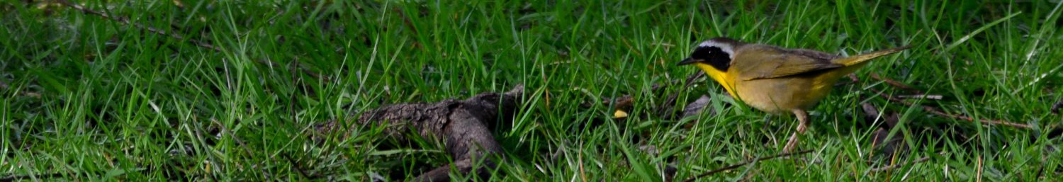
The next stop was next door at the J. S. Tripp Memorial Museum. The Tripp has a large collection of preserved birds, donated years ago by taxidermist Ed Ochsner. It’s probably the closest I’ll get to a golden eagle, which looked like it could have carried off whole villages. It’s mostly feathers, but they make its head look almost as large as a human’s. The saddest pieces were the tiny spotted deer twins and baby ducks.

The museum features a working Royal typewriter with round keys. The proprietor told us the kids try to type on it like they would on a laptop and are surprised by the force and effort it takes to punch the keys. His view is that manual typewriters required so much movement that carpal tunnel didn’t become an issue for those pioneer typists — it’s the small, repetitive motions that cause or exacerbate CTS.

Near the typewriter is a proof press(se) with wood type, along with samples of newspapers partly in English, partly in German. In addition to photos, furnishings, clothing, knickknacks, and the like, the museum, like others of its kind, features Civil War arms and regalia. These exhibits make me think that, if there isn’t one already, there should be a database of history museum and historical societies’ holdings — not just, say, those of the Smithsonian and other large institutions. It sounds like a formidable undertaking, but with Internet communications, digital cameras, and database and other technology, along with agreed-upon standards and willing volunteers, it could be done. It probably comes down to time, money, and value. A formidable undertaking indeed.

As we were getting ready to leave, our new acquaintance pointed out a winery across the river, halfway up the hillside — another reason to consider returning.

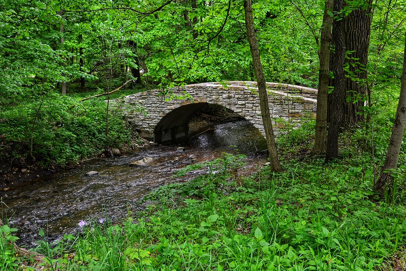
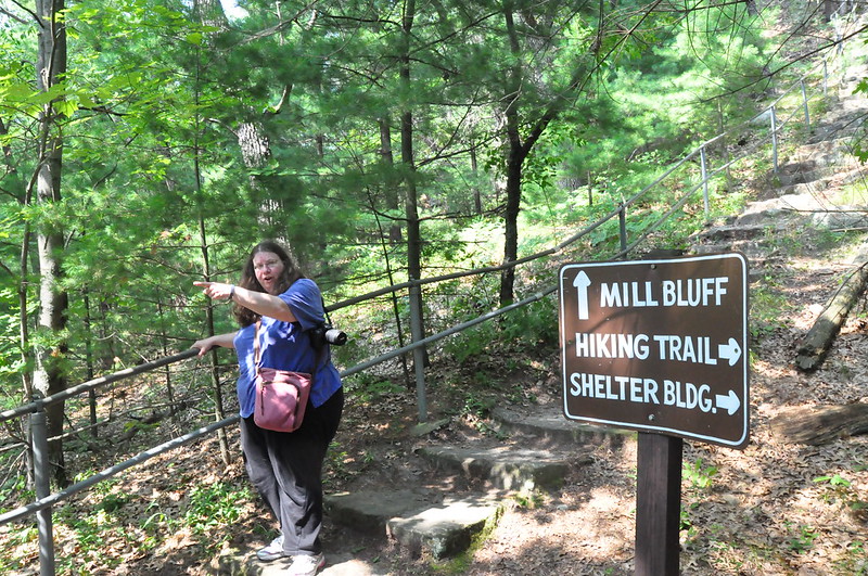
Finally we left for the next destination, Natural Bridge State Park, getting lost a few times along the way. We did pass a few cows here and there, but not as many as I might have expected in America’s Dairyland. I’ve seen more in New York and Pennsylvania, albeit in spring and summer.

At Natural Bridge State Park, we saw a middle-aged couple returning from the trail and asked them how far to the bridge. The man answered in time, not distance, saying it was about five minutes away and telling us that they’d learned there’s a cure for everything in plants (signs along the trails indicate how Native Americans used various plants medicinally). His tone was at the advanced end of skeptical. He must not know where aspirin and quinine come from.

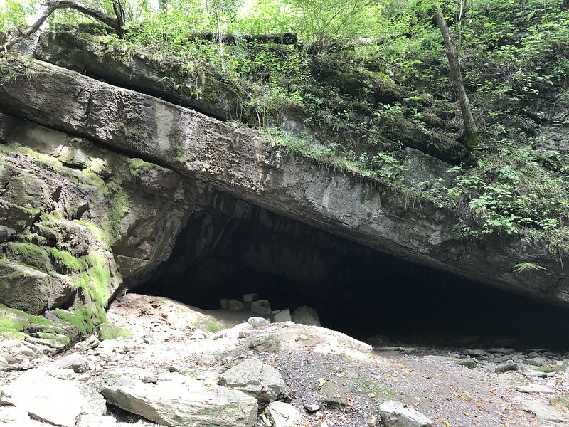
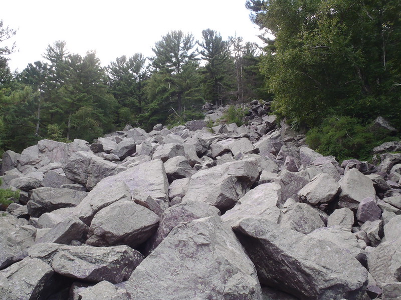
An hour plus later of slowly climbing up a long, steep, eroded trail and stairs to an overlook and taking many photos, we were skeptical of his five-minute estimation. After a while, we ran into people evidently on the return trip who told us the bridge wasn’t much farther. I was at a point where I wondered if I could get back down the steeper, narrower parts of the trail, or if I was going to have to be carried or, more likely, airlifted out. Not that this is an especially difficult trail for most people, who strolled past us on their way out, but my knees and ankles don’t appreciate the physics of even slightly steep descents, especially when the trail is narrow, tilted, or eroded unevenly. I was very glad to have worn hiking shoes and to have brought a trekking pole — I needed both.

At last we arrived at the natural bridge at about the same time as a couple coming from the opposite direction. From these people and others, we learned that the trail forms a loop and that we must have taken the longer way around. When I mentioned that my knees don’t like steeper descents, the male half commiserated with me — that’s why they’d taken the shorter, easier way.

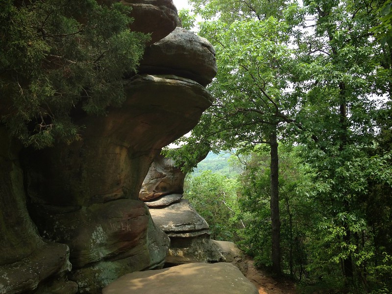
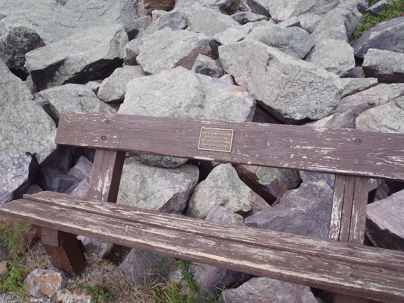
The bridge, the largest in Wisconsin, was lovely and impressive in the afternoon sun, but it saddened me to see the silly graffiti carved into it. We’re not talking Shakespearean sonnets, just juvenile “Rick rules” and “Jordan and Jillie” type graffiti — nothing anyone wants to see now, let alone 500 or 5,000 years in the future. I’m sure this has been going on for countless generations.

After a prolonged photo session, we continued down the trail, which descended in several places, although not as sharply. After about 10 minutes or so, we could see and hear signs of the parking lot through the trees. We really had taken the long, hard way — and I’m glad we did, and that I did without complaint. I proved something to myself.

A middle-aged and an elderly woman approached us and asked a few questions. I firmly told them to veer right. I was thinking that if they went left, they would end going a really long way around another loop the trail had led to. J. was beside himself and after they left (veering right) insisted I was wrong. I realized we were talking about different splits and that he was correct — they had gone the wrong way. So I hustled after them, surprised by how far they’d already gone up the wrong trail. They were already thinking of turning back or perhaps had — I’m not sure — and I felt guilty as I watched the older woman gingerly pick her way down. I stayed in front of her so at least I could steady her if she couldn’t make it. I tried to explain my error and apologized profusely. The younger woman said they were starting to wonder and she didn’t blame me — she thought there should have been directions. We had found a sign — as we were returning. All’s well that ends well, and neither I nor the older woman had to be rescued!

Next on the list was Aztalan State Park, an hour and a half away — that is, if you know where you’re going. There were long stretches during which the cellular network disappeared, which made the various map apps useless. We did pass some points of interest, including what appeared to be a church in the middle of nowhere. According to a sign, which J. noticed in passing (twice), it was a church museum. I’m not sure it was open. It’s one of those roadside oddities that might pull you in if you have time and and an interest in the unusual.

I did break J.’s heart by insisting we bypass Rustic Road (Lane?), which might have worked as a route, and might not have. I’m convinced he’s a sucker for marketing and was hoping to find something especially picturesque on a road called “Rustic.” I thought we’d see more frame houses and tidy yards. While the rolling hills aren’t quite the equivalent of Pennsylvania’s Central Alleghenies, overall the look is similar, only neater and more affluent.

As we were passing through a small town that I thought (hoped) had to be close to Aztalan, somehow J. spotted a coffee shop called the Daily Grind. How his radar picks up coffee shops while he’s driving I’ll never know, nor do I want to know. We stopped there, ordered drinks, and crossed the threshold into the connected pottery shop.

AFter a few more miles and false turns. we arrived at Aztalan around 5 o’clock, an hour later than I’d expected. At this time, we could experience this historic site with its restored Mississippian mounds in the waning daylight. First, J. couldn’t resist spinning a wheel to power playback of an educational recording about the site, while I cranked an old-fashioned pump connected to a drinking fountain. I wasn’t thirsty, but was fascinated to witness the result of my labor come out of the fountain and the excess disappear into a drain in the earth. The water had a taste, as water close to the source often does.

It’s not something I think about often, but there is something marvelous about working and seeing the effort tangibly rewarded. As so little is left that requires labor — even the simple task of dish washing for most is delegated to a machine — I wondered if that’s part of why gardening, scrapbooking, crocheting, and other manual arts have surged in popularity in the online age. It’s physically and spiritually satisfying to create something by hand — or to tease water out of the ground. As a novelty, it felt great. If I had to do it for drinking, cooking, cleaning, and bath water every day in every kind of weather, I wouldn’t be so enamored.

We ascended a couple of the mounds, which overlook a strangely featureless landscape. It’s not flat like much of Illinois, but nothing stands out, except the mounds and palisades, and the lines of trees. Only a few visitors were about when we arrived, and the dog walker and kite flyer disappeared before sunset. Not seriously, I wondered if the local sprouts used the mounds for sledding, and J. said, “Until hand reaches out from within the mound . . .”

As the sky grew darker, the colors became less distinct, and the scene more somber. It seemed a good time to leave the mounds and their histories in peace, undisturbed.

More misdirections and an urgent stop or two at gas stations, and we were in Lake Geneva, where we had reservations at the Baker House. The fine weather continued into the evening, and people seemed to be wandering about in search of a party. At the Baker House, the atmosphere was almost busy, loud, and crazy enough for the Great Gatsby. J. was disappointed not to get a table in one of the elegantly appointed rooms, but the enclosed porch, while close to the musicians, was almost calm.

After a little walk near the lake, finally we headed homeward. Although it should have been a two-hour drive here, it took more like three to four, including a half hour nap in the parking lot of a doggy day-care center. A full, full, rewarding, and exhausting day.

Posted in Adventure, Blog | Tagged friend, nature, photo, travel, Wisconsin, Wisconsin state park | Leave a reply

Day at Wisconsin Dells

words and images Posted on August 21, 2011 by dlschirfJanuary 28, 2023

Right after a 40-hour work week and 8-hour work day, there’s nothing like a 4-hour (plus) car trip to rejuvenate the wearied mind and senses. At the end of countless miles of mesmerizing orange-and-white barrels and tags along I90 lie Baraboo, Devil’s Lake State Park, and Wisconsin Dells. The distance, about 200 miles, is nearly the same as from my old home in Hamburg, New York, to my extended family in the Altoona, Pennsylvania area. Forty years ago, with breaks for a meal and to collect mountain spring water before it became too polluted to drink, the Altoona trip took an interminable five hours. I remember well my back seat plaint of “Are we there yet?” and resisted the strong temptation to resurrect it, especially as Google Maps helpfully tracked the apparent slowness of our progress north and west, and my sciatic nerve sent searing pain down my right leg to make sure I knew it wasn’t happy.

International Crane Foundation

After a short but intense rest and a soak in a whirlpool, I was ready for the first destination — the International Crane Foundation. I knew about the ICF from my work as a docent at Lincoln Park Zoo, but somehow I’d forgotten about it. Right now, the main road leading to the ICF is closed for repairs, so we went in via County Road A. Even while getting out of the car, I noticed a number of eerie calls that aren’t in the usual repertoire of the wildlife and domestic stock typical of farm country. As we wandered and listened to some of their vocalizations, I realized how effective they could be if used in an alien invasion film.

Many of the cranes were in the middles of their enclosures, alert but not concerned about their human admirers. The Siberian crane pair, however, was at the very back, where we couldn’t get a good look at them. After a few minutes, though, they’d had a good look at us and didn’t like what they saw. First the male, followed by the female, approached us stiffly and threateningly, every posture, movement, and sound expressing displeasure. The woman in the visitors center had told us cranes are territorial and aggressive and had asked us not to intrude on their space with so much as a camera lens. We didn’t have to. We got the full show by standing quietly and behaving. After they came to the fence and put on their threat show, they remained wary but had lost the intensity of their interest.

Siberian cranes at the International Crane Foundation

The showcase habitat features the endangered whooping crane, whose plight I recall from childhood when only a handful remained. On one side of a pavilion, you can relax in the shade and watch a 20-minute video about them and the use of ultralights to train young birds in the ways of migration. On the other, a roomy seating area overlooks a wetlands where a pair was foraging in the water. While there is no obvious barrier, a guide said there’s a drop-off  that the cranes know about.

Unlike their Siberian cousins, the whooping cranes seemed unconcerned about either us or the group on the official tour that had caught up with, then bypassed us. At first hidden behind the grasses and reeds, they waded out into the open water, approaching the seating area at times, then wandering back behind the grasses, all very nonchalantly.

P8201650
The best photo I’ll ever get of a whooping crane
at International Crane Foundation, Baraboo, Wisconsin

I lost track of how many of the 15 crane species we saw, although it was most of them. The crane enclosures are distributed along trails bordered by a messy array of wildflowers (or weeds, if you prefer your flowers bred, hybridized, and given a cute name followed by a registration mark). Bees, butterflies, and others couldn’t get enough of what I think is gayfeather. They remind me of how much I would love to have a butterfly garden.

It was almost one o’clock when we left. The day had dawned cloudy and rainy, but by the time we’d arrived at ICF, the rain had stopped, the clouds had cleared, and the sun had made its appearance. In less than an hour, the day had transformed itself from disappointing and unpromising to perfect.

Perfect weather for a Duck. An Original Wisconsin Duck.

Original Wisconsin Duck adventure

Call me sheltered, but I’d never heard of Ducks as either amphibious military machines or tourist attraction, but they’re part of the draw to Wisconsin Dells. I didn’t have much time to read about them and didn’t know what to expect.

On the way to the Original Wisconsin Ducks, I pointed out a young man sitting on a chair next to the highway, seemingly doing nothing more than getting a tan in an especially noisy, barren spot. I wondered that he couldn’t find something better to do and a better place to do it. It turns out he was working. More about that in a bit.

Also by the roadside, we noticed signs indicating one-way Duck trail — and soon spotted an actual Duck lumbering down the trail and stopping to wait to cross the highway. That was my first glance of a Duck and how they operate. It wasn’t long before we found its home base.

Each Duck seats 20. When one fills up and drives off, another takes its place. We were near the head of the line when an empty Duck arrived. The few people ahead of us conservatively sat in the middle seats, perhaps afraid of getting wet, but I pushed J. to the front right-hand seat. From here we could see the Duck’s dashboard, with exposed crossed wiring. The war industry had no time or use for aesthetics or niceties. We could also see a control for bilge water. That, the life vests overhead, and the overall shape of the Duck were the only indications from inside (on board?) of the vehicle’s amphibious nature.

Time to board! I’d told J. driving (piloting?) a Duck could be the perfect retirement career for him, but it looked like fairly hard work to manipulate all of the mechanics while trying to elicit laughter for a series of corny jokes. We learned later that Duck drivers are college students who undergo six weeks of training. No Duck for J.

Into the dells we went, including Fern Dell, where the already pleasant temperature dropped several degrees. The combination of rocks and trapped moisture on which the ferns thrive acts like a giant air conditioner. With the play of the sun and shadow, the rocks, the lush green of the trees and ferns, and the brisk air, I thought I was in heaven — except, of course, for the roar of the Duck’s engine, which kept me grounded. So to speak.

With a splash and spray that made me happy I’d steered J. to the front seat, the Duck entered the Wisconsin River with its amazing sandstone bluffs. With the woods, water, and bluffs, I could be happy living here, I thought, even as bigger, faster boats jetted by and set the Duck to rocking.

Wisconsin Dells from a Duck
Wisconsin Dells from a Duck on the Wisconsin River

Between corny jokes, our driver/helmsman pointed out where in 2008 heavy rains had raised the level of Lake Delton, causing it to rise and break through a weak spot and to empty into the river, taking several houses with it. I remembered seeing video and the concern about what was to be done and whether the area could recover. Lake Delton refilled quickly and on this calm day little resembling the raging torrent of rushing, roiling water in the video. The bank opposite the breach shows how high the river rose when all that lake water suddenly poured into it; the earth looks like it was hit with force and churned quite high above our heads. For the observers, it must have been both a frightening and an awesome experience (in the true sense of that overused expression).

After a leisurely cruise on the river, the Duck clambered over a sand bar into Dell Creek. Next we entered Lake Delton, which was full of vacationers, tourists, and locals. The dire predictions didn’t come true, and people like us continue to pour in and pay to enjoy the river, the lake, and the dells. I often wonder about the many situations that seem bad in the present, but worked out okay or even well in the long term. For all the gloom and doom I grew up, many things today are better or at least no worse. For example, the Great Lakes may be threatened by zebra mussel and Asian carp, but they’re cleaner than they were when I was a child wading among clumps of slimy algae at Hamburg Beach. And, we’re making the effort to save species like the whooping crane rather than let them follow their cousins the dodo and the passenger pigeon into oblivion.

Back on land, the driver stopped twice to talk to young men sitting along the Duck trail. The first proved to be the idle fellow I’d pointed out from the highway. Our driver asked  him about his Barbie doll order and other fetishes and told us to wish the other guy a happy birthday. He said they earn $20 an hour for sitting around. My guess is that they’re Duck spotters, paid to coordinate the movements of the many Ducks on land. Where were these cool summer jobs thirty years ago in western New York?

On the return trip, the Duck passes through a couple of narrow gorges, Red Bird and Black Hawk, with only four inches leeway on either side. I was tempted to reach over and try to touch the rock. We also stopped to admire a few deer dining just off the trail. “They’re so lifelike, aren’t they?” our driver said. One even drooled happily. It was then someone noticed the deer had companions — up to a half dozen wild turkeys. I said something about the convenience. Our driver peered thoughtfully and said, “It’s amazing what they can do with electronics.”

Near the end of the tour, he stopped the Duck to pass out booklets and postcard packets, explaining that Duck drivers are students (sorry, J.) and that through a program they earn the money from the booklets and postcards we tourists buy from them (guilt trip!) for $2 apiece. What a deal! J. had his wallet out immediately. Someone asked where he was going to college; he answered, “Boo U.” Someone scoffed at the name, so he told us that it’s the nickname for Baraboo University — I guess the scoffer hasn’t heard of cutesy college nicknames! Someone asked a tough question: “What are you studying?” judging by his embarrassed reaction. He confessed that he hadn’t actually started college; he had just graduated from high school. As we were about to exit, I couldn’t resist asking him if he even has a driver’s license. “Yes,” he informed me, probably praying I wouldn’t pinch his cheek. “I have a commercial license.” Well, at 18 he’s at least two up on me — I’ve driven neither car nor Duck!

Original Wisconsin Ducks driver
I hope he didn’t drive/pilot with his eyes closed!

The Cheeze Factory

Our next planned destination was Devil’s Lake State Park, but as we drove through the area admiring the updated, upscale 1950s motel chic, we decided it might be a good idea to refuel. Along the main strip, the choices seemed to be limited to chains and greasy spoons. Then I spotted The Cheeze Factory, a cute house strangled by a jungle of flowers. I didn’t have a chance to look it up on Yelp or anywhere else and didn’t know what to expect. I didn’t expect an Austrian host or a vegetarian menu. It couldn’t have been more perfect. J. ordered barbecue tofu and a chocolate Coke (there’s a soda fountain), while I settled on red, white, and blue ravioli — the “blue” being bleu cheese. We ordered two cheese sandwiches (recommended by Rachel Ray) to go and topped off our mid-afternoon snack with generous slabs of princess cake — oh, the lemon butter cream frosting!

Devil’s Lake State Park

Stuffed, we made it to Devil’s Lake State Park, although it took a while to figure out where to go and where to park. I’m fairly certain we’re not ready to ascend to some of the park’s upper trails. Instead, we took the easy Tumbling Rocks Trail between the lake and a hillside covered with boulders of lavender-and-lichen Wisconsin quartzite. On the path J. spotted a millipede just like the one he’d found at Starved Rock, this time getting some photos of the little guy, whose feet clung to my hand like Velcro. Tickle tickle. Around us, even in the growing dusk under building clouds, among the picnickers, the scene took on an almost alien beauty. All I can say is that folks in this part of Wisconsin have a lot of lovely outdoor choices. I’d stay in only in the worst of weather.

Talus slope of Baraboo quartzite
Talus slope of Baraboo or purple quartzite at Devil’s Lake State Park
Seating on the Tumbled Rocks Trail at Devil's Lake State Park
Seating on the Tumbled Rocks Trail at Devil’s Lake State Park
Devil's Lake State Park
Devil’s Lake State Park

And so we set out on the long drive home, with a rainbow to guide us for about 20 to 30 minutes. In Janesville we picked up subs at a Stop n Go and dined al fresco in a pavilion under the stars at the Janesville visitors center.

And so home after a long, wonderful, and memorable day, from cranes to Ducks.

Posted in Adventure, Blog, Photography | Tagged friend, photo, state park, travel, wildlife, Wisconsin, Wisconsin state park | Leave a reply

Wisconsin: Ducks, cranes, and devils

words and images Posted on August 20, 2011 by dlschirfMay 21, 2020

Gallery

Posted in Adventure, Blog | Tagged nature, photo, state park, wildlife, Wisconsin, Wisconsin state park | Leave a reply

Recent Posts

  • Future of artificial limbs (prosthetics)
  • Hodge, 2001 – 2013 (cat)
  • “Far more happier” (The Age of Wonder by Richard Holmes)
  • Pileated woodpecker pair at Sapsucker Woods
  • Eternal flame waterfall at Chestnut Ridge

Top Posts & Pages

  • Top 10 reasons Commander Riker walks with his head tilted
  • Book review: Zitkala-Sa: American Indian Stories, Legends, and Other Writings
  • Memories of South Shore Plaza, Hamburg, New York
  • Wopsononock Mountain, or Wopsy, in Blair County, Pennsylvania
  • Book review: Women in Love
  • Relics: The newsstand
  • Book review: Henry and June
  • Book Reviews
  • Sunset from Coffee Creek Park in Chesterton, Indiana
  • Horseshoe Curve National Historic Site, Tytoona Natural Area Cave Preserve

Archives

Other realms

  • BookCrossing
  • Facebook
  • Goodreads
  • Instagram
  • LibraryThing
  • Twitter
  • YouTube

Good viewing

  • Art of John Taft
  • bensozia
  • Bill of the Birds (no longer updated)
  • BrontëBlog
  • Edge
  • Karen Winters Fine Art
  • Mental Floss
  • Musical Assumptions
  • National Geographic News
  • Orange Crate Art
  • Sexy Archaeology
  • The Creative Journey
  • The Introvert's Corner
  • The Pen Addict
  • The Raucous Royals
  • Thrilling Days of Yesteryear
  • Woodclinched
  • World-O-Crap

BOINC Stats

Copyright © 1996–2023 Diane Schirf. Photographs and writing mine unless noted.
↑
 

Loading Comments...